Complete Guide to Buniyar Temple

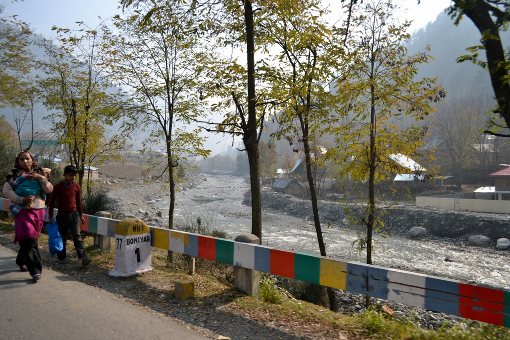
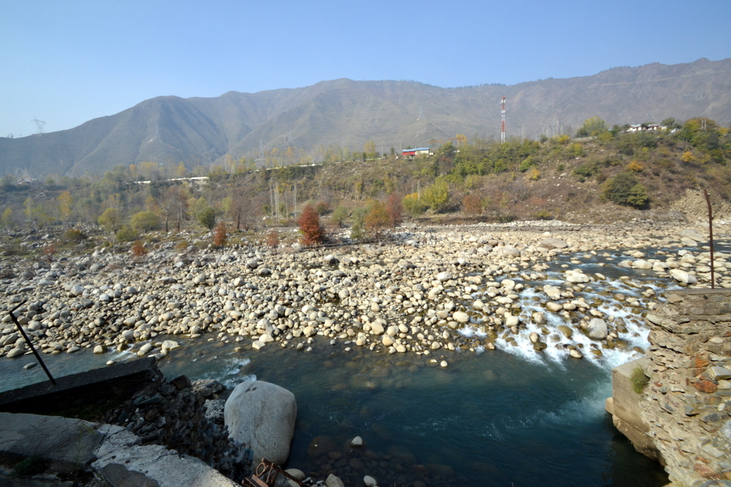
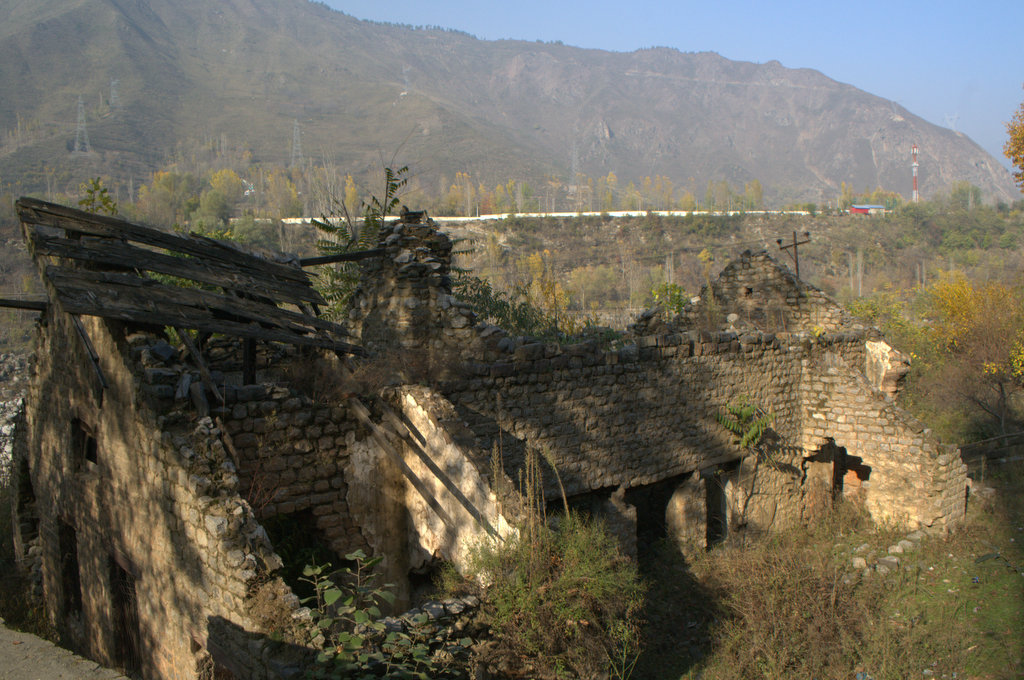
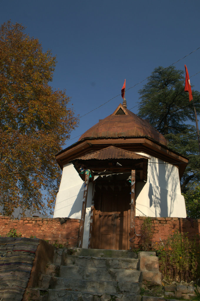
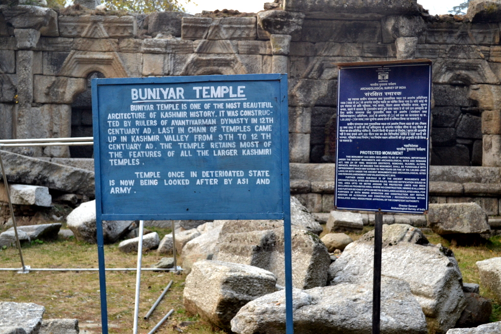
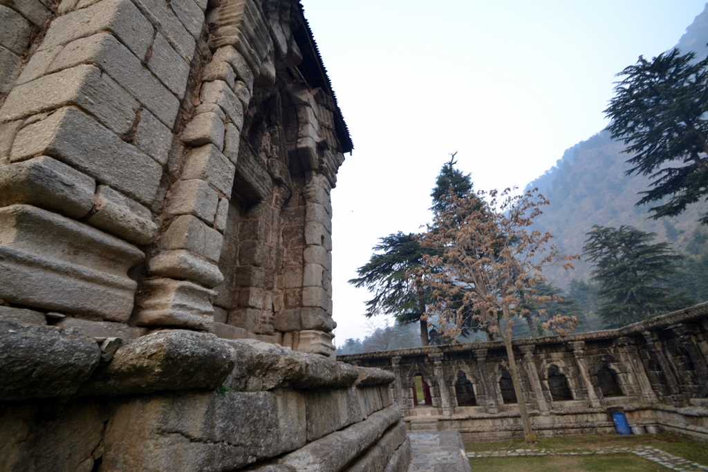
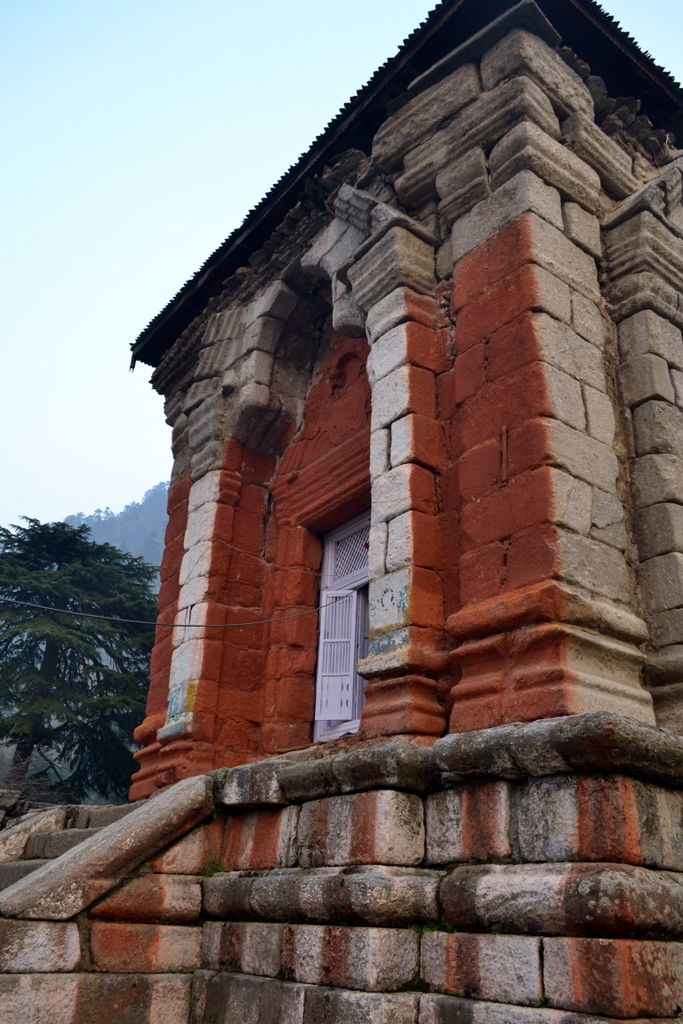
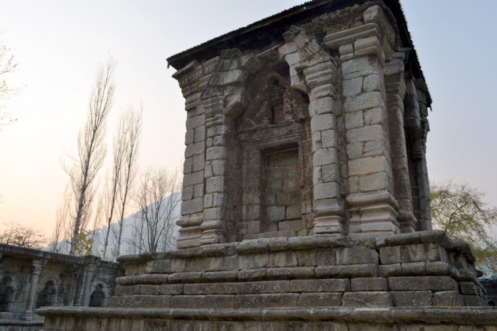
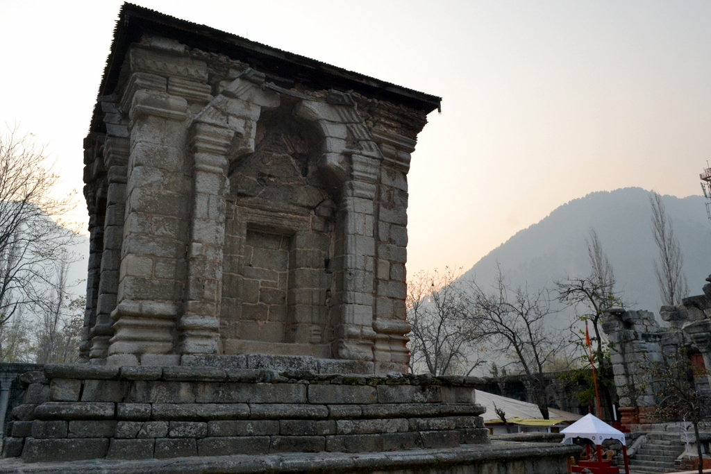
Buniyar Temple, about two miles above Rampur,  situated along the Baramula-Uri road on the bank of the Vitasta, is often described as the “best preserved” specimen of Kashmiri architecture. Although unlike most Kashmiri temples which are made of limestone, this one (beside the one at Wangat) is made of granite.

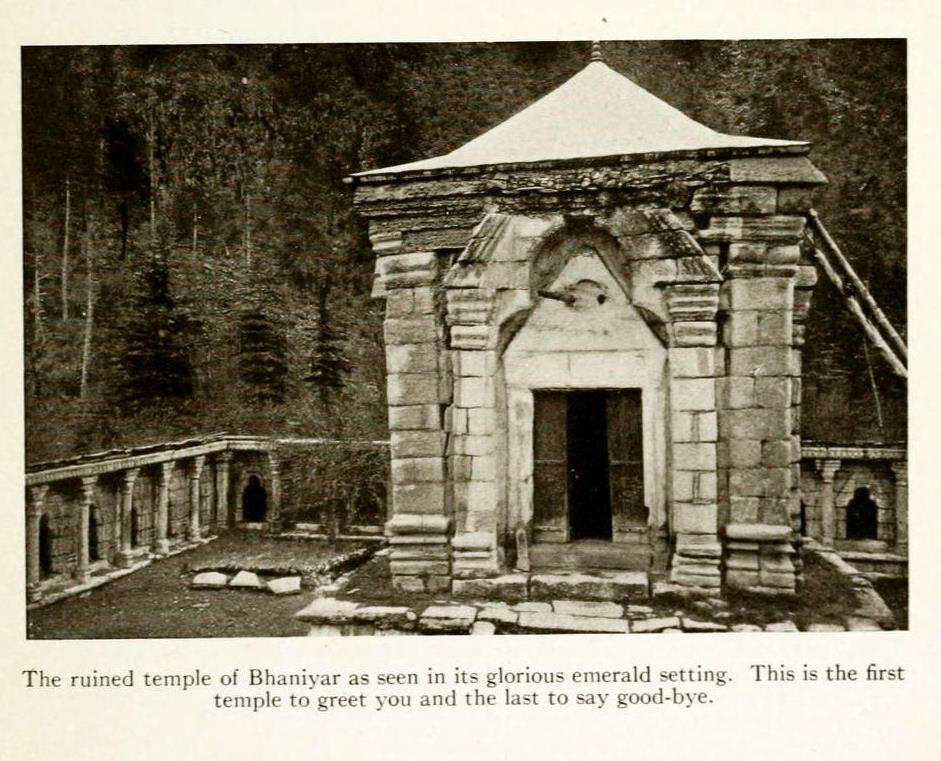
This is the story of the temple at Bhaniyar/Buniar/Bhavaniyar/Bunair/Boniar/Boniyar/Buniyar.


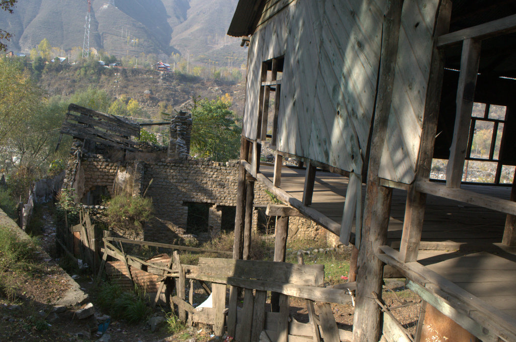
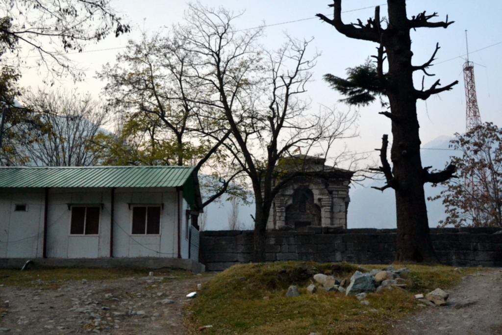
On my way back from Uri, I decided to check the ancient temple whose roof is visible from the road. A military man walked me from the main road, past the security gate and into the military camp which now surrounds the temple. On way to the temple, the man, someone from mainlands, claimed the temple was build by ‘Pandavas’. When I told him that I am ethnically Kashmiri Pandit, the man happily said that it all belongs to me. 
In 1868, when Henry Hardy Cole arrived at the temple along with photographer John Burke for his ‘Archaeological Survey of India report, ‘Illustrations of Ancient Buildings in Kashmir’ (1869), a local Hindu Fakir who lived in the temple told him that the temple was build by ‘Pandus’. 
The temple had recently been excavated on the orders of Maharaja Ranbir Singh. Before that, the temple had been claimed by mountain and the trees, which might explain why it survived vandalisation and remained untouched for a long time.
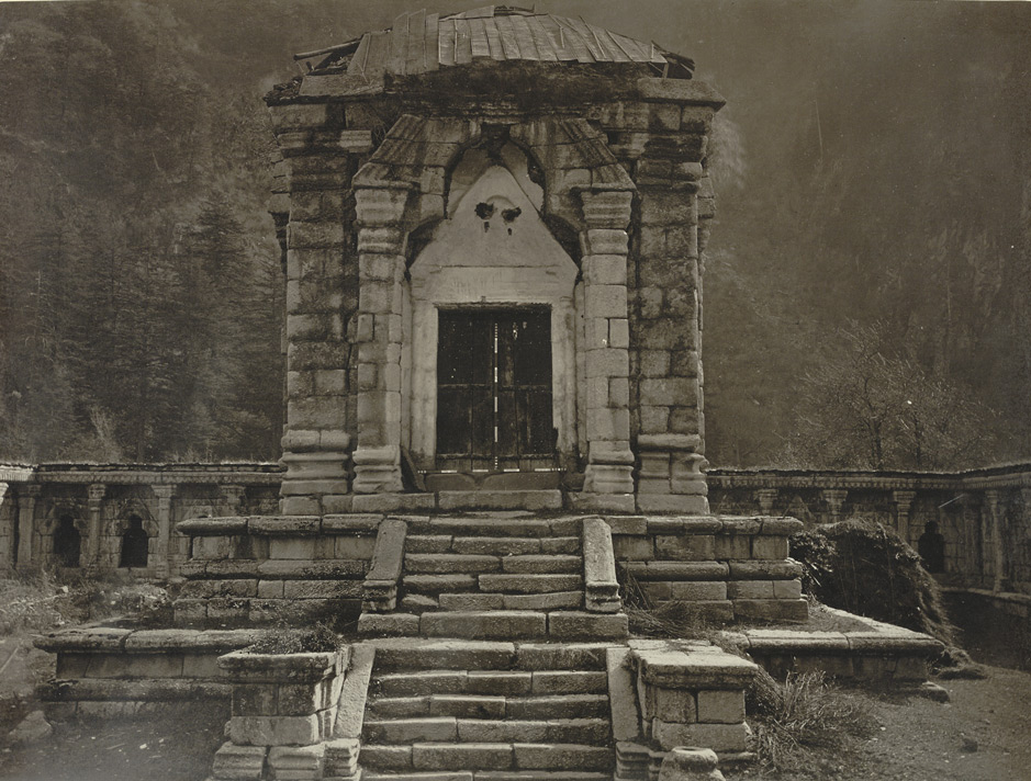
Burke’s Photograph
[via British Museum]

The ruins of this temple had earlier been noticed by Karl Alexander A. Hügel  (1835) and G.T. Vigne (1837). Hügel mistakenly described it as a well preserved Buddhist temple, while Vigne called it a Hindu ruin on the road. 

An attempt to study the temple was first made by Alexander Cunningham in November 1847. He noticed that the Pandits called the place ‘Bhawaniyar’. And assumed it to be a ‘Bhawani’ temple. Cunningham couldn’t examine the temple properly as it was half-buried under snow at the time. Using a telescope he tried to see beyond the thick foliage if the inner wall of the temple had a colonnade.

First proper detailed note of the temple came in 1865 when that summer W.G. Cowie visited the temple that had been recently excavated revealing 13 sq.ft. interior), walls supported on a basement of 4 ft.sq, a cloistered quadrangle measuring 145’x120′. The findings were given in ‘Notes on Some of the Temples of Kashmir’  (Journal of the Asiatic Society of Bengal > Volume XXXV, Issue II, 1867). Te local Pandits told him that the temple was built by one Bonadutt, hence the name of the place. The brother of this man had built a temple at Venapora beyond Sopor. About the granite used in the temple he wrote:

“The material of which the buildings are constructed, is a pale, coarse granite, of which there seems to be no quarry within reach on the left bank of the Jhelum. This circumstance is remarkable, considering the enormous size and weight of some of the stones employed. Mr. Drew, a geologist in the service of H, H. the Maharajah, thinks that the blocks of granite must have been carried down some of the valleys on the opposite side into the river bed, whence they were brought for the construction of the temple.”

He also suggests that the central temple was probably surrounded by water (just like Cunningham had suggested for Martand) as he found two old wells also near the temple. He also noticed that near upper base of the temple, is the spout of a channel which carried off the washings of the image. He wrote it looked like a snake or some similar animal.

Later some addition notes were added by James Fergusson in around 1876. He noticed that the colonnade was Gandhara inspired. 

Final clear description about the temple was given by R.C. Kak in Ancient Monuments in Kashmir (1933):


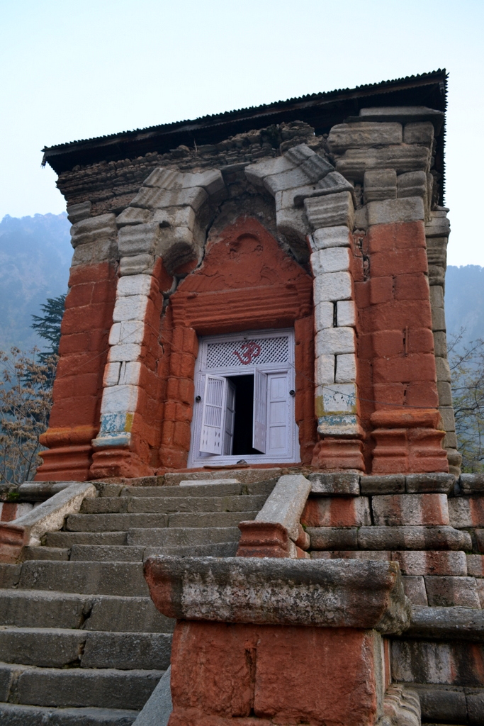
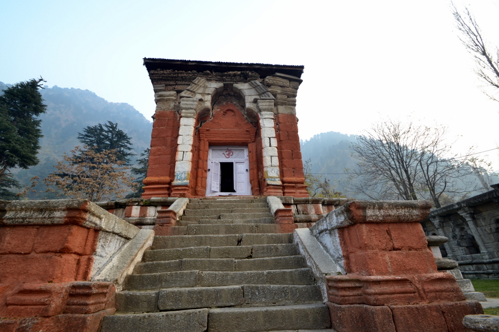
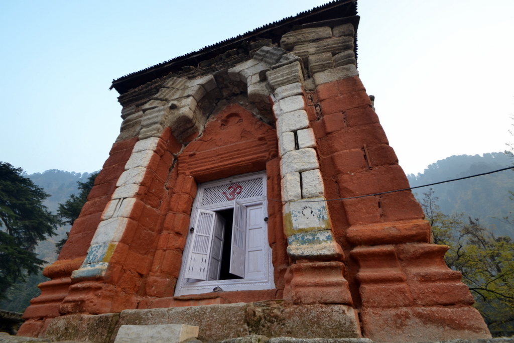
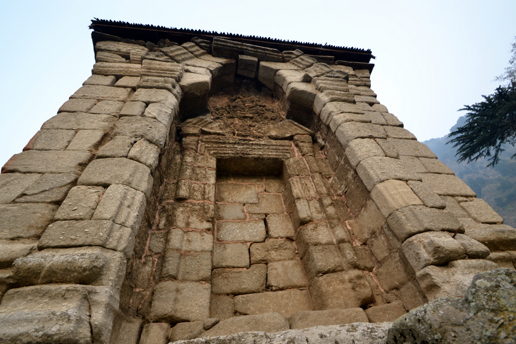
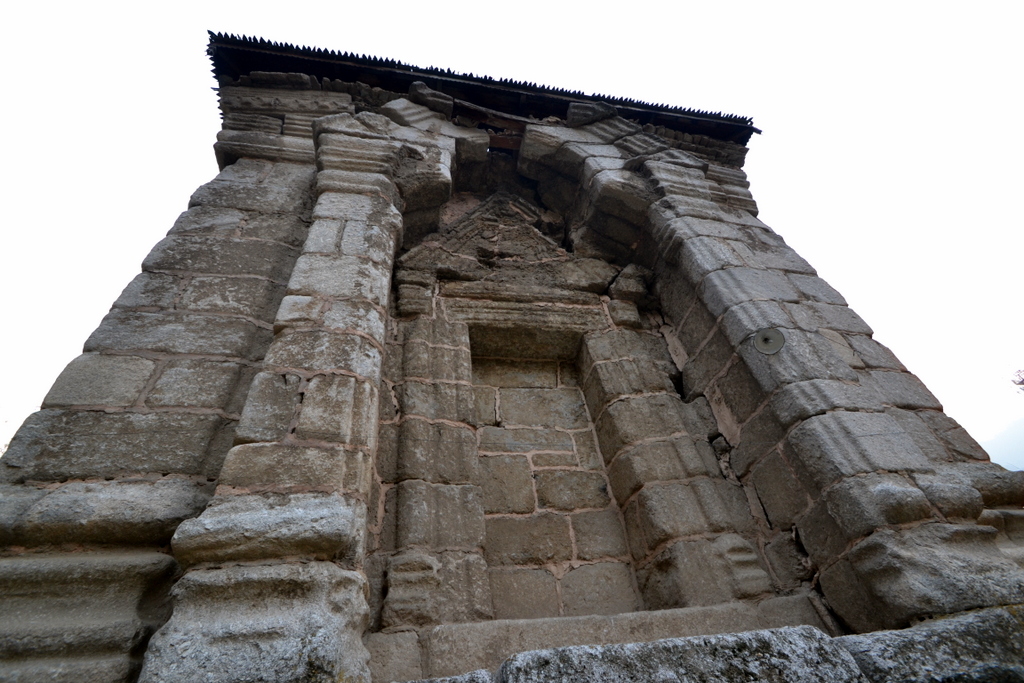
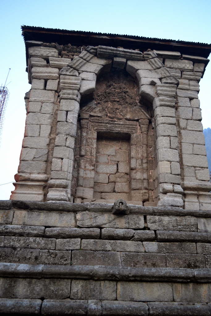
The gateway is a double-chambered structure faced on each open side by a trefoil arch surmounted by a steep pediment. The lintels of the closed arches are supported on pairs of columns which were originally fluted, though the weather has now left no trace of flutes. They have a double capital, the upper one being voluted on all four sides. The walls are externally surmounted by a cornice of kirti- mukhas, alternating with miniature trefoiled niches. Upon this rests the first course of the pyramidal roof. 

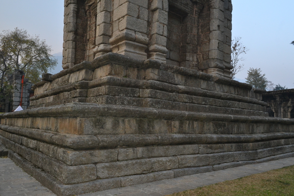
The flights of steps-on the eastern and western sides respectively afford entrance to and exit from the entrance chamber. The one on the roadside is buried underground, but the inner stair has been excavated. It consists of seven steps flanked by sloping rails and upright side walls. Between this stair and the temple is a small stone platform which formed the lowermost course of the stepped base of a column (most probably a Garudadhvaja). 

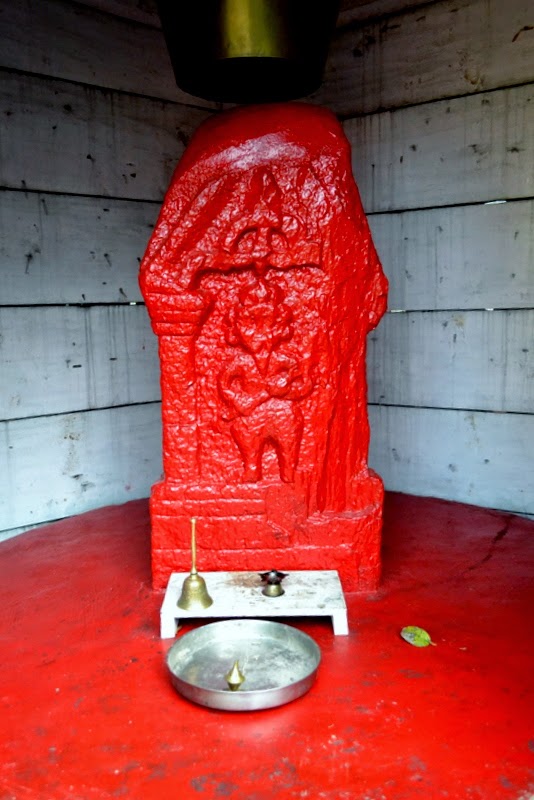
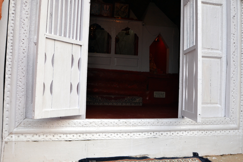
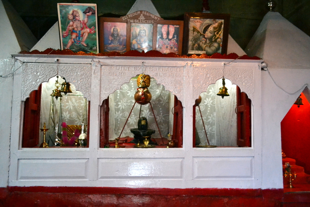
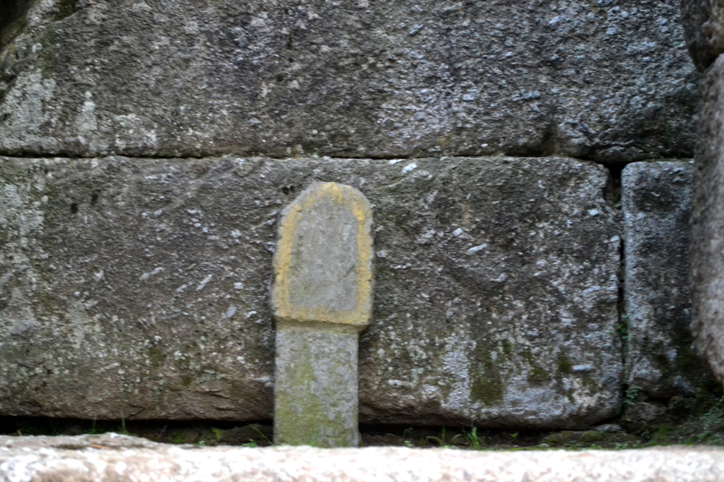
The priest in charge of the temple has now placed in it a small stele of very crude workmanship and late date, which he has painted with vermilion. Another similar stele, still standing in the position in which it was found, is seen in front of the temple stair.
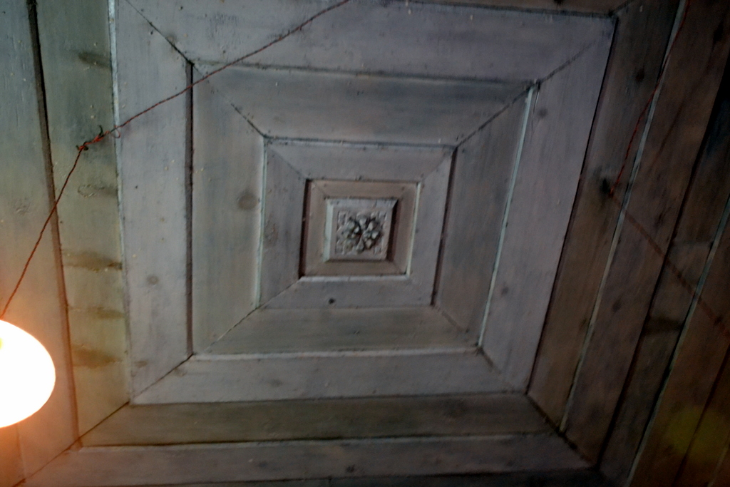
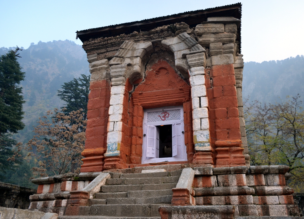
The temple itself stands on a double base, which is in every respect similar to other structures of its kind in Kashmir. A lofty trefoil arch, standing upon advanced pilasters and enclosing a rectangular entrance originally surmounted by an ornamental trefoil and steep pediment, gives access to the sanctum. The jambs of the entrance are adorned with half-engaged columns. The interior is a square of 14 feet. The pedestal of the image is placed on a broad platform. The original image, which seems to have been of Vishnu, is now replaced by small Siva-lingas originally brought from the bed of the river Narbada. The walls are covered with a coat of modern whitewash. The string course from which the ceiling springs is still visible, but the ceiling itself which Bishop Cowie saw in 1865 and described as domical, has since either fallen down or been removed. It was, no doubt, similar to the ceilings of the larger temples at Wangath.

Externally the only decorations are the trefoils of the recesses, their pediments, and the cornice of kirtimukhas and miniature trefoils from which the roof sprang.
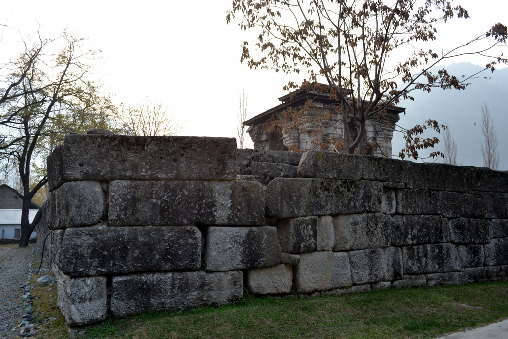
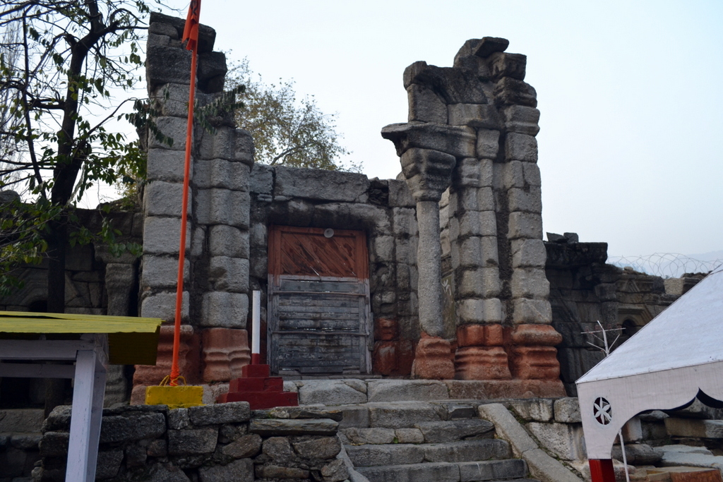
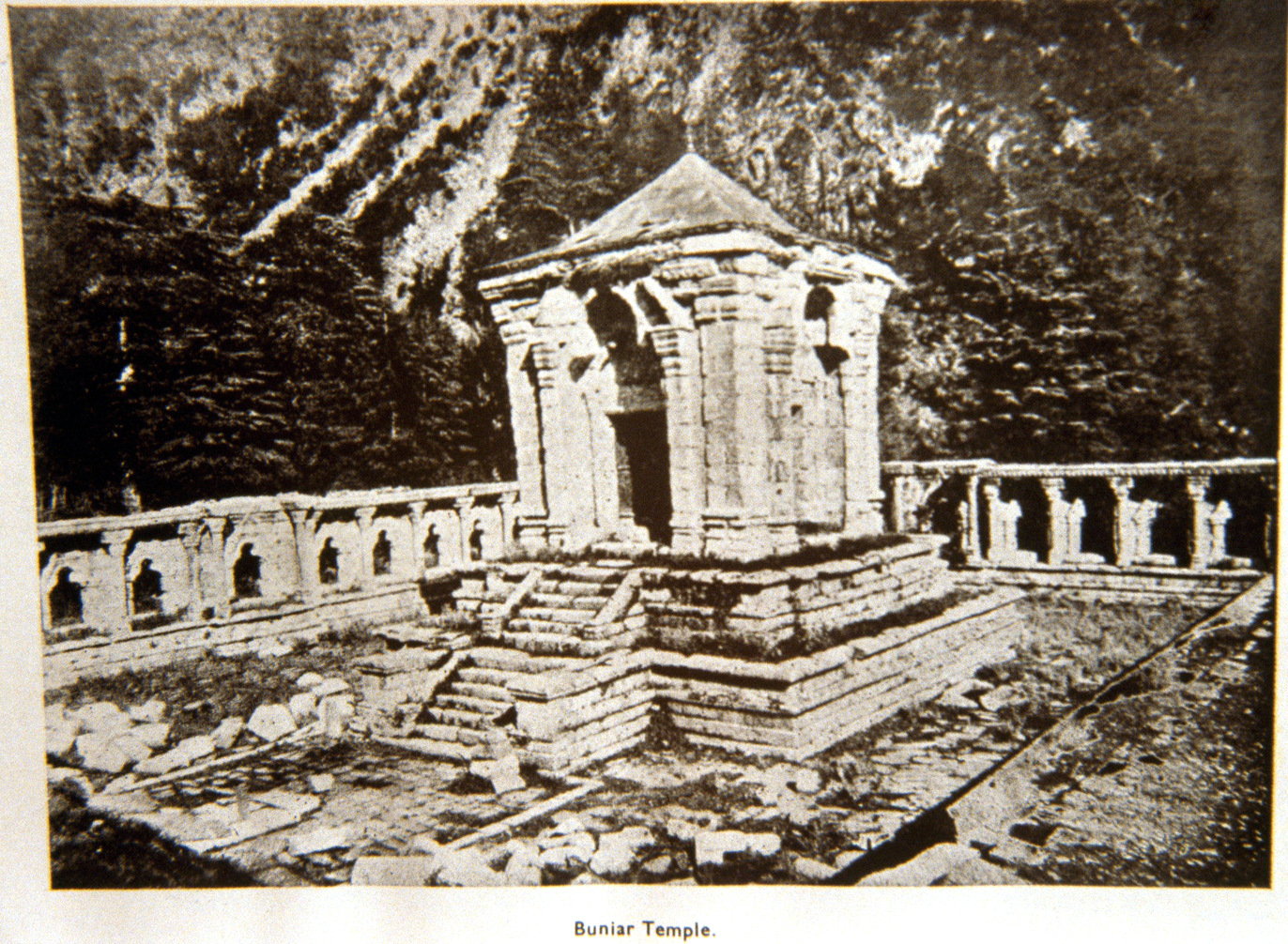
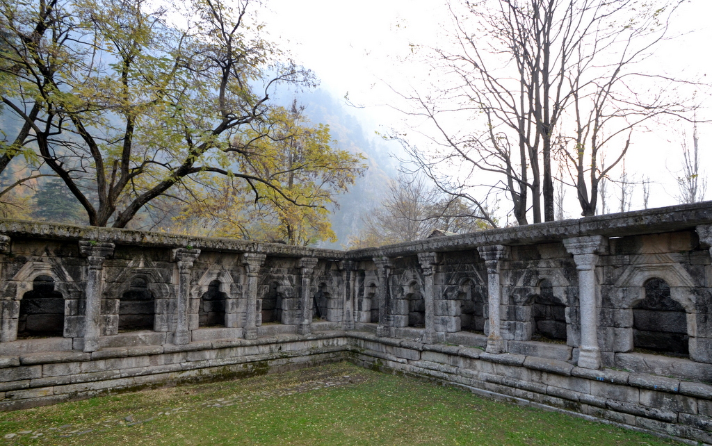
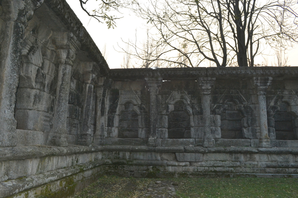
The quadrangle measures 145′ by 119 1/2′, and consists of fifty- three cells and the gateway. They are rectangular, 7′ long by 4′ broad. Each cell has a single trefoiled entrance enclosed in a high- pitched pediment resting on half-engaged columns. These ranges of cells are preceded by a noble colonnade which stands on a base similar to that of the temple. A transverse beam connects the capitals of the columns with the roof of the cells. Over these beams rises the entablature, only one course of which, namely the frieze of miniature trefoils, is extant.

In the centre of each range of cells, except, perhaps, the one in which the gateway stands, is an apartment of larger dimensions preceded by a pair of taller columns which are advanced about 4′ from the rest of the peristyle.

The top course of the cells is also decorated in the same way as the frieze above.
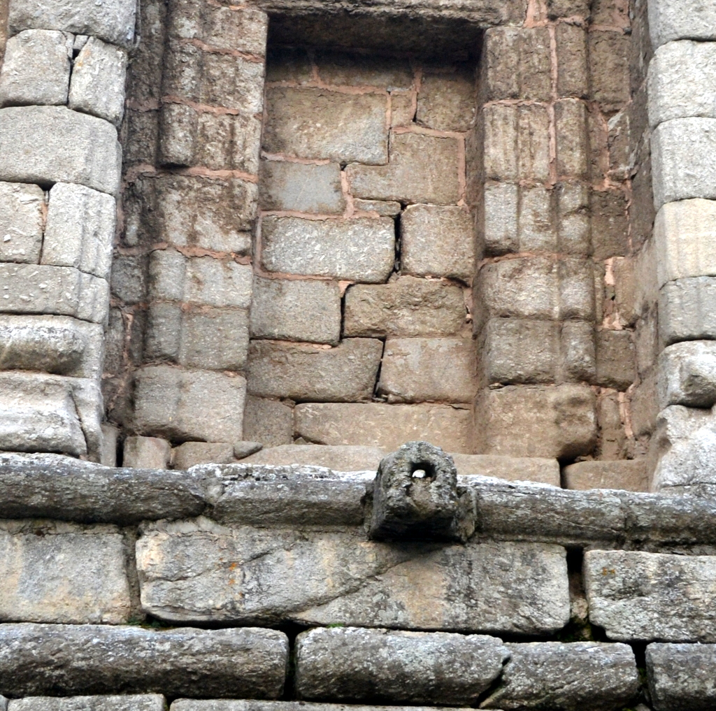
On the south side, projecting from the cornice of the upper base of the temple, is the spout of the channel which carried off the washings of the image. It seems to have been shaped originally into a makara, or crocodile’s head. Immediately below it is a huge water trough carved out of a single block of stone.

The rain-water in the courtyard is carried off by a drain which runs under the south-eastern corner of the peristyle. 

In cell No. 11 of the north range, beginning the reckoning from the corner nearest the gateway, is the side entrance, which was then, as now, closed with a wooden door. The monotony of the external face of the western wall is partially relieved by rows of small square projections. In its two corners are two cells opening outwards.
Immediately outside the side-door mentioned above is a square structure built of plain blocks of stone. The middle portion of each of its four walls has fallen down, and the gaps have been filled in with small chips of stone built in mud. It is difficult to surmise what was its original purpose.

The temple is now often described as Vishnu temple dating back to 8th-12 century A.D. 
In 1947 war, some Dogra soldiers were holed up in the temple and attacked by the raiders. The place is now a military camp with the temple getting reshaped by aesthetics of military men. 
-0-


Photograph from ‘Our summer in the vale of Kashmir’ (1915) by Frederick Ward Denys.

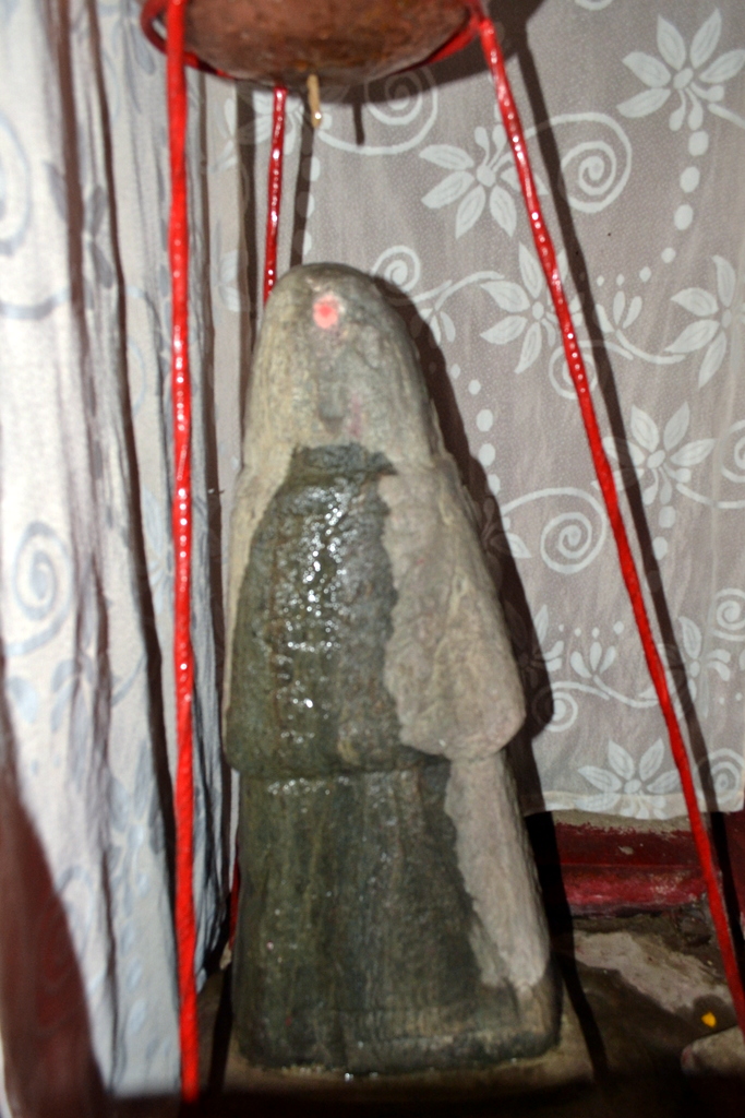
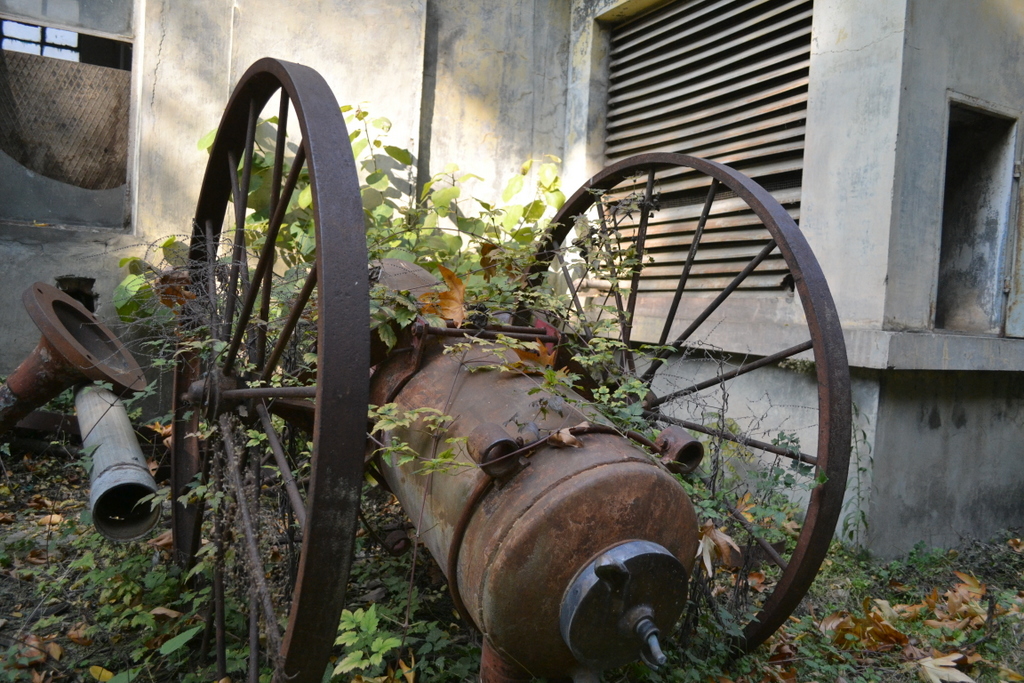
This is now worshipped as Shiv Ling

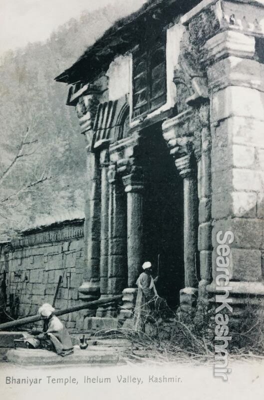
A postcard from 1920s. 

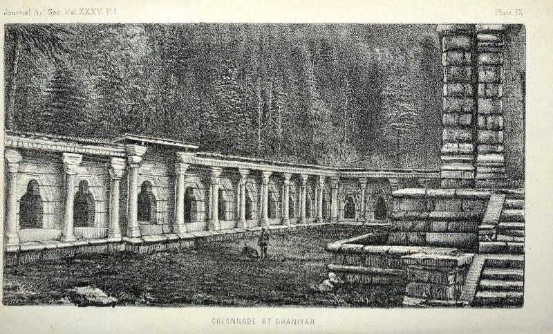
Sketch of Colonnade from
‘Notes on some of the temples of Kashmir, W.G. Cowie, 1865

The walls of the colonnade now have crude murals  of Hindu deities.

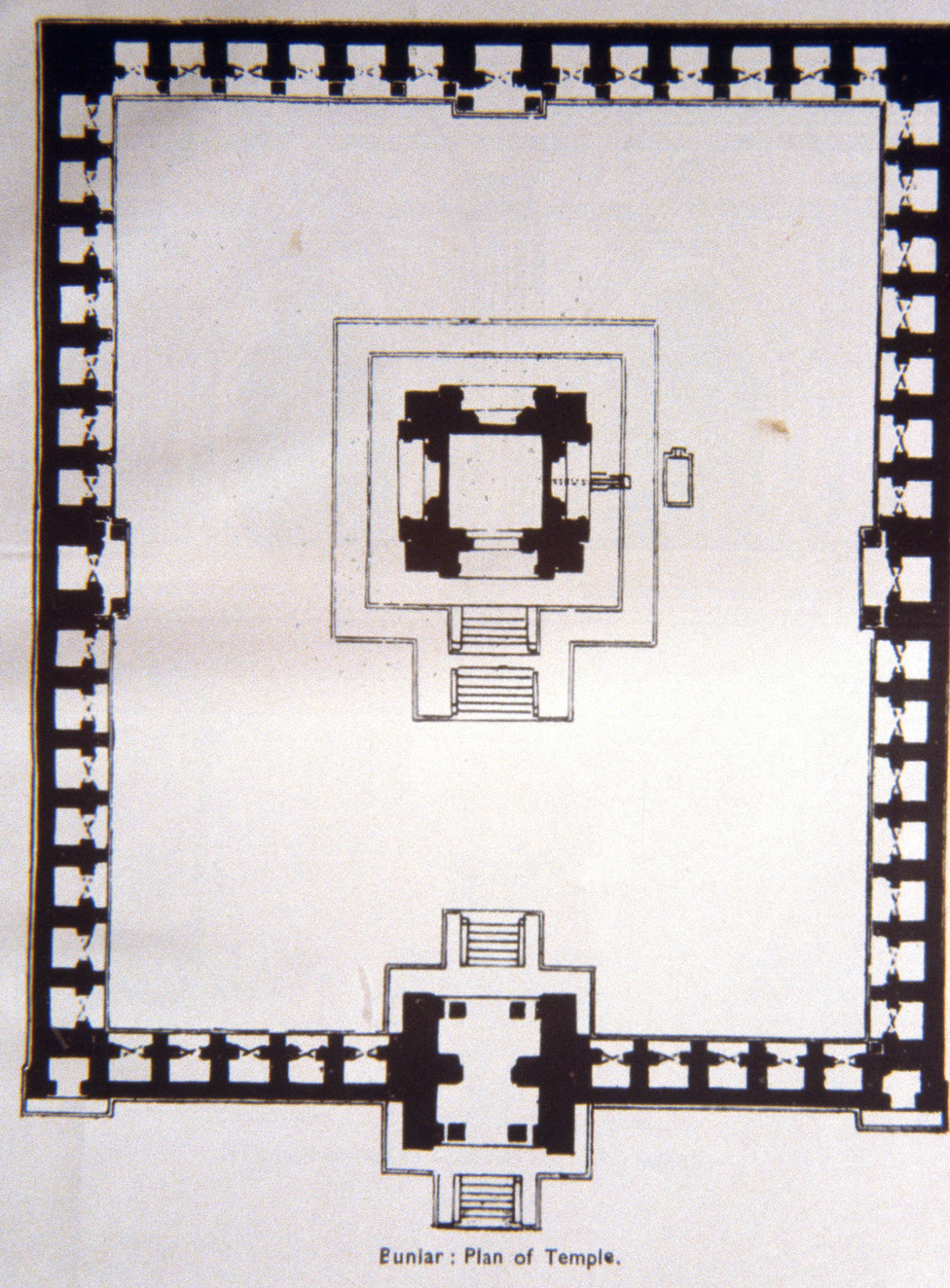
Ground Plan of Buniar Temple

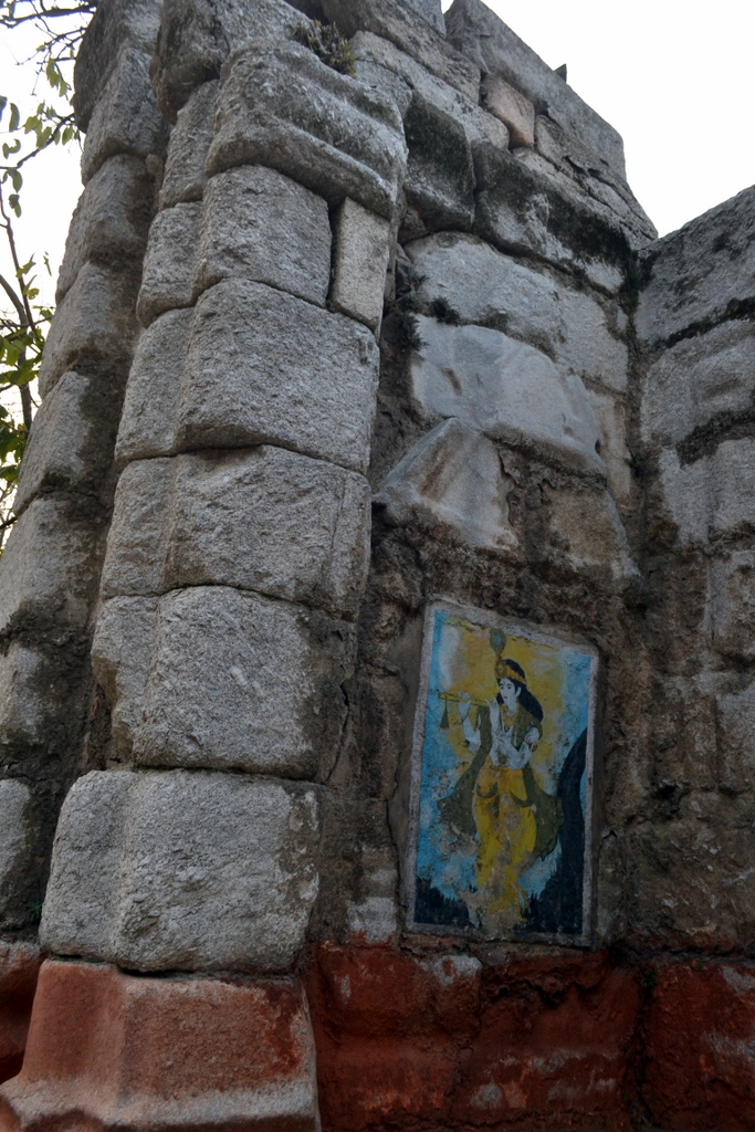
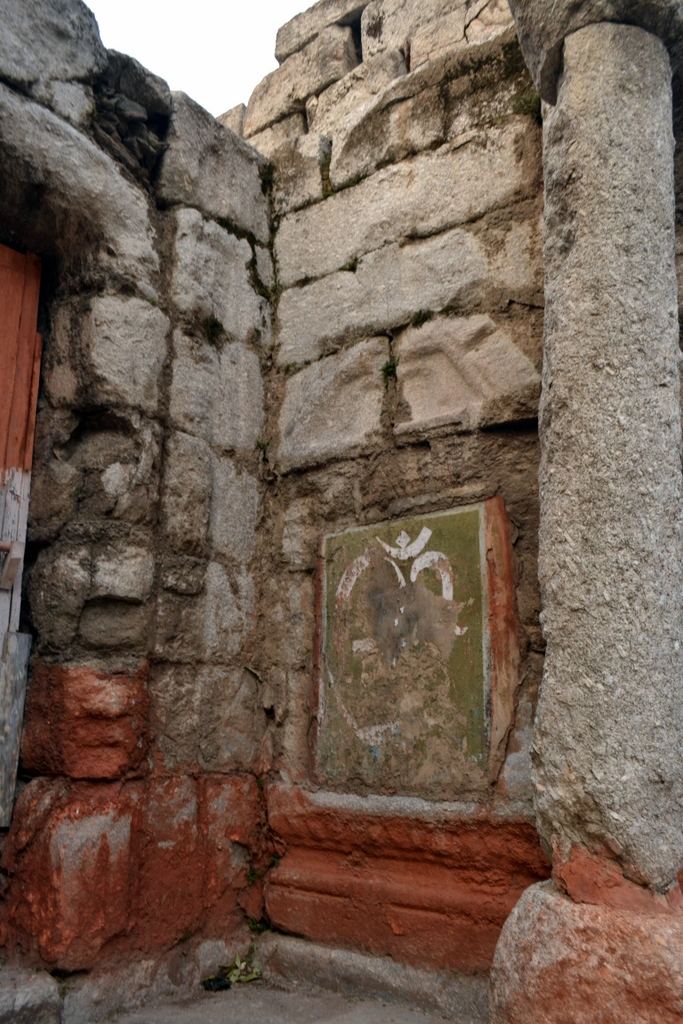
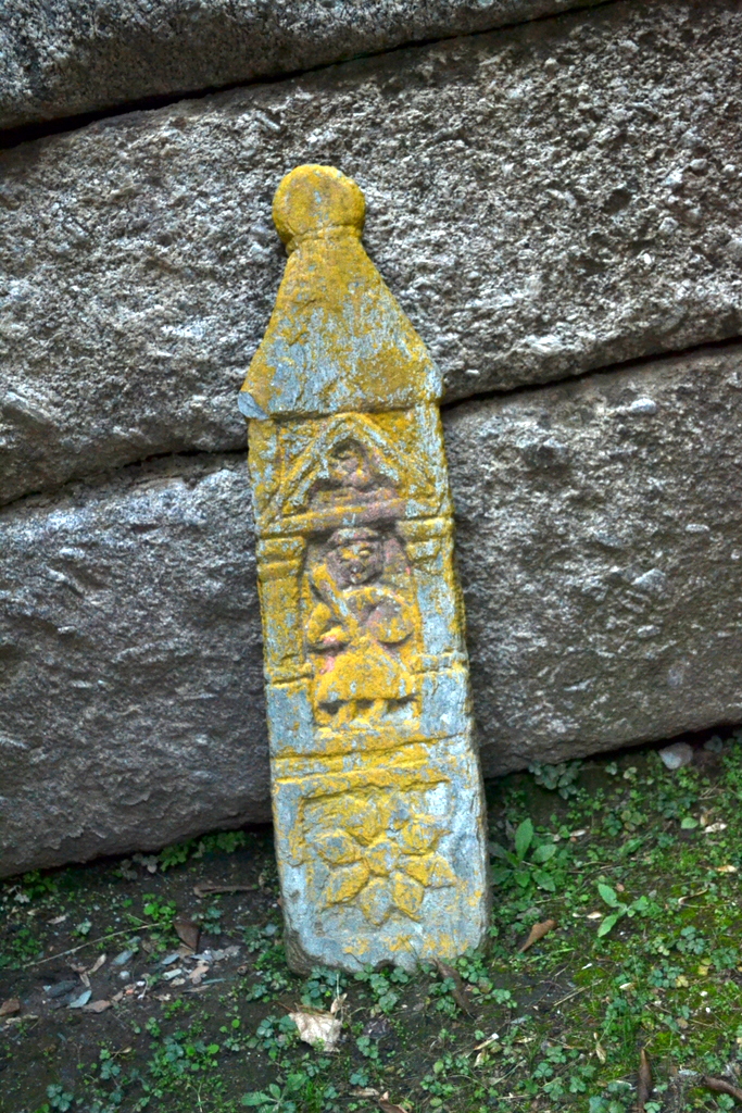
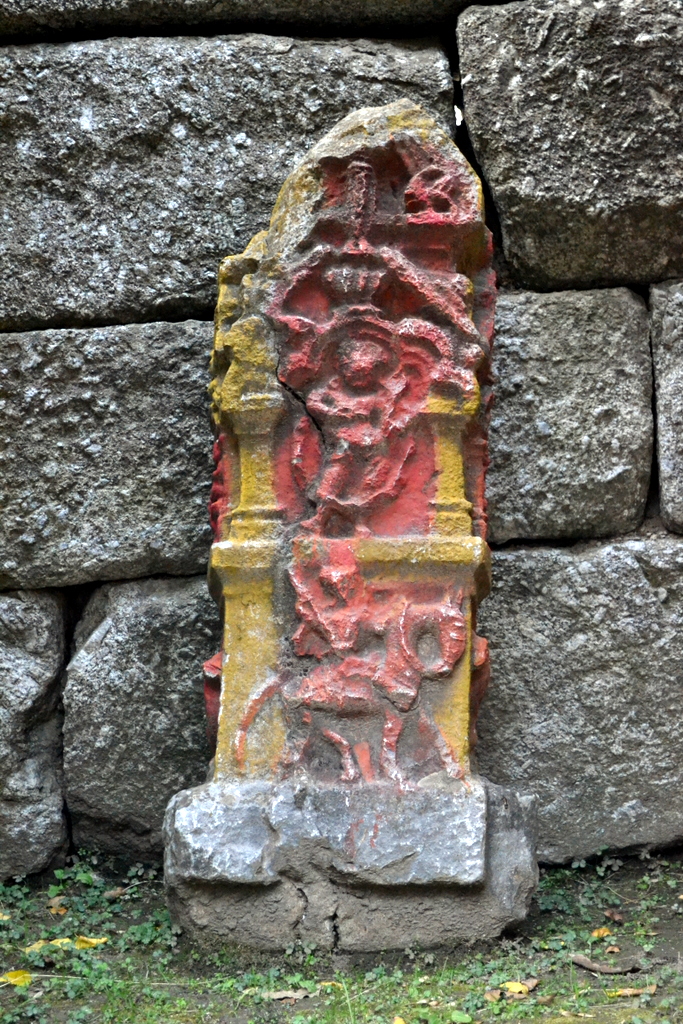
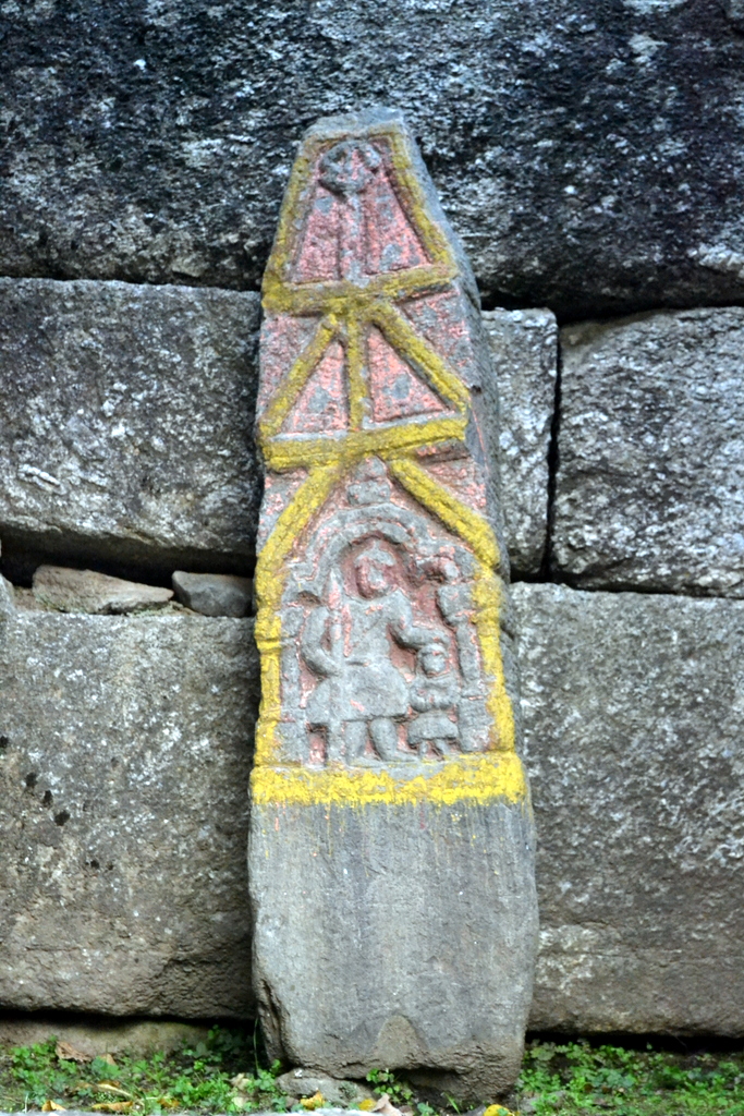
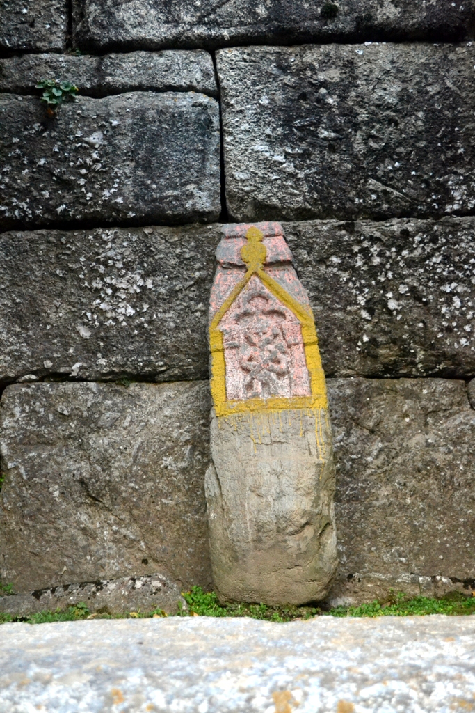
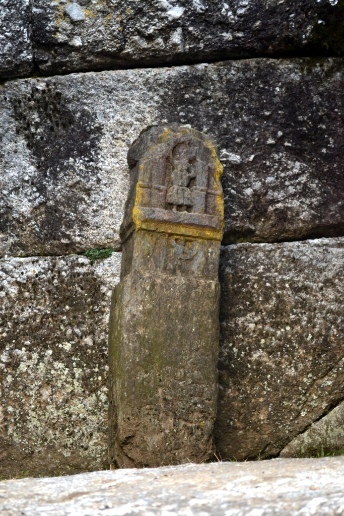
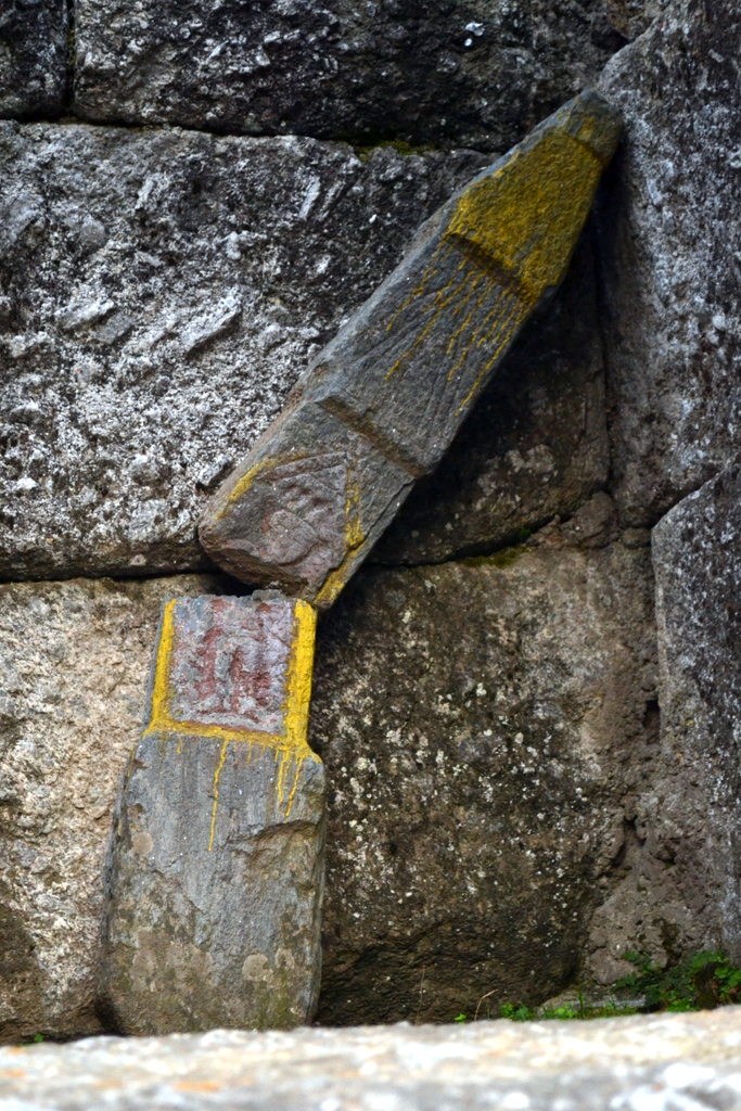
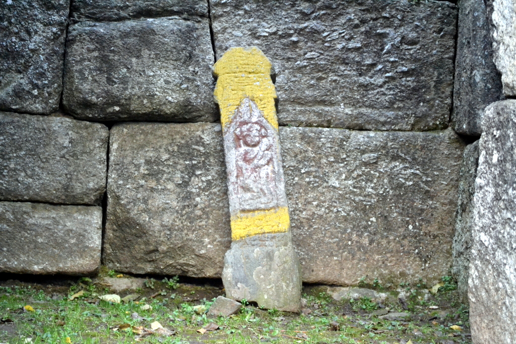
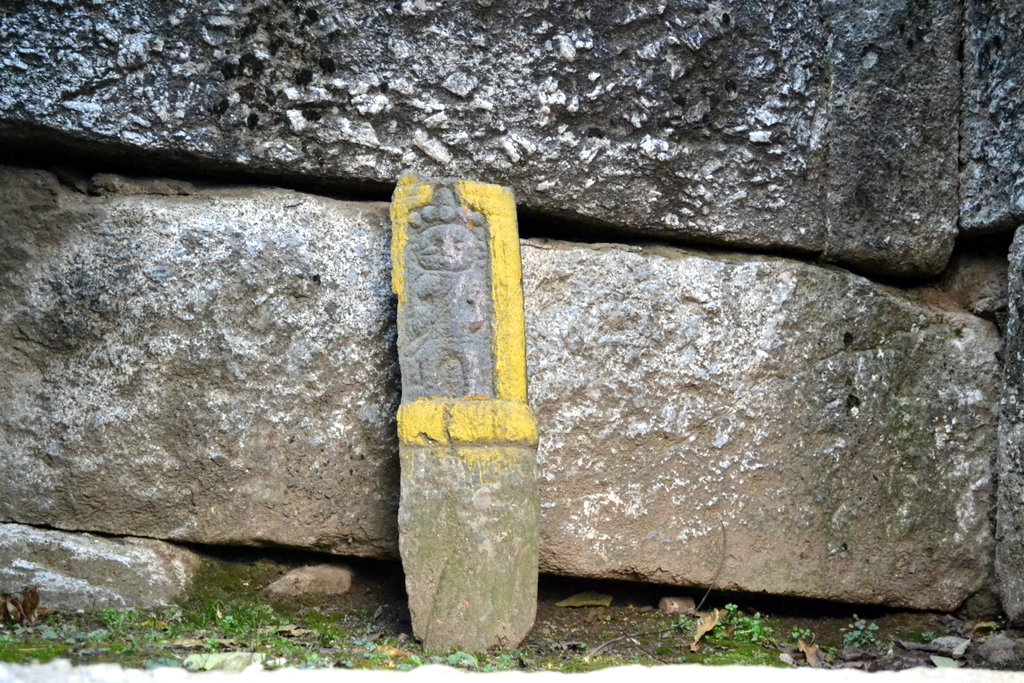
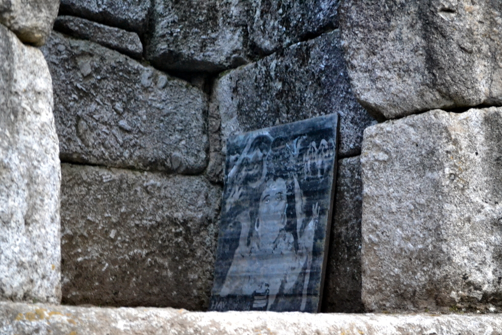
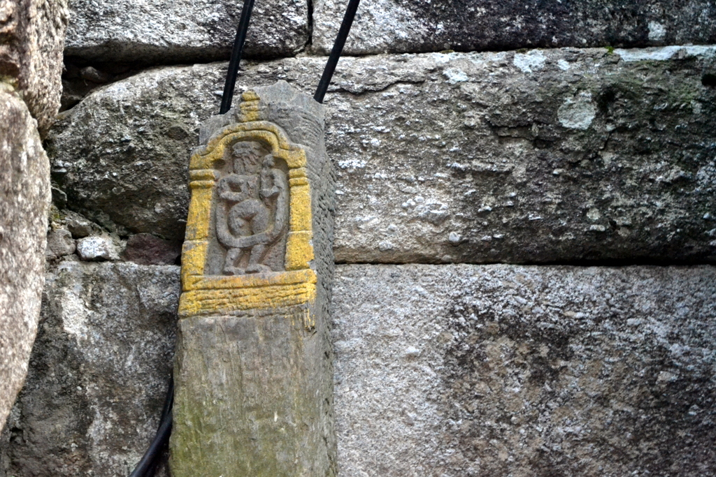
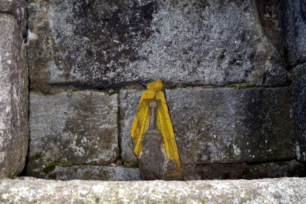
Inside the colonnade are now placed these interesting ancient sculptured stones (again crudely painted over). [Some of them are Hero stones or Sati Stones]

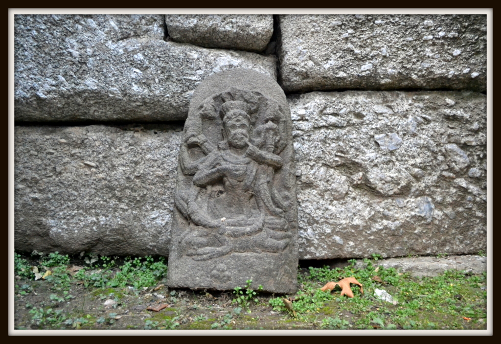
The above image is the only one I could clearly identify. This is Chamunda, yogini of death, destruction and decay.
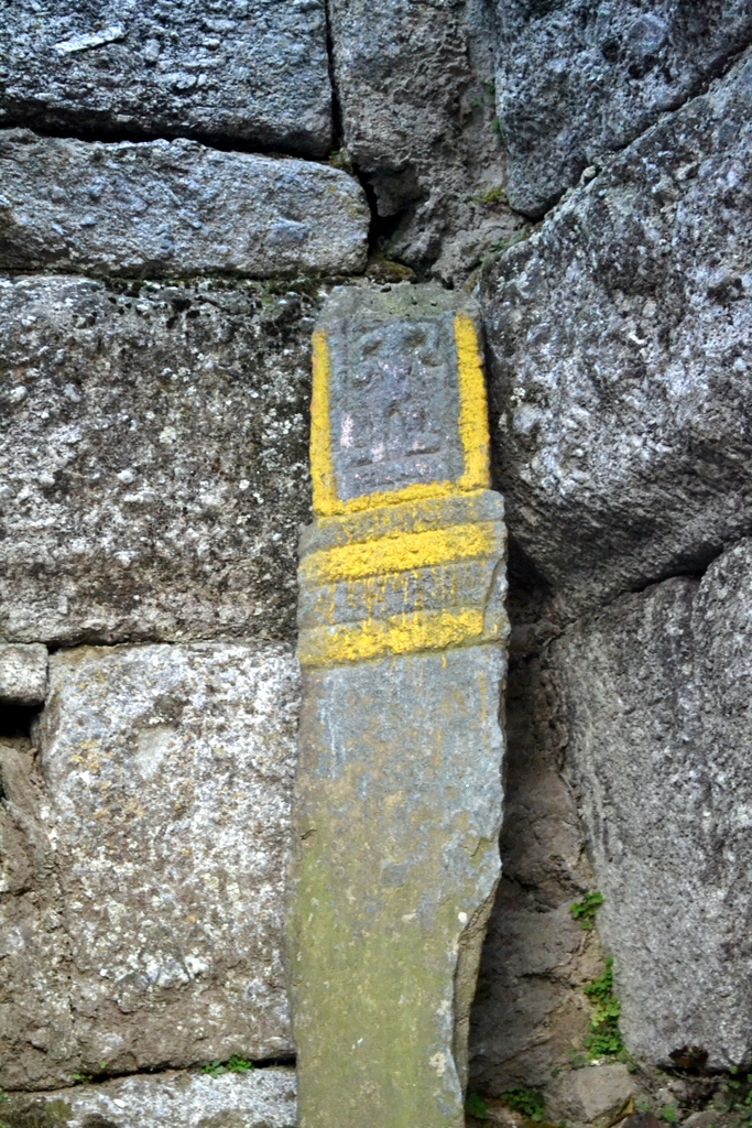
The snake/crocodile


-0-

In Light of Mohra


About 46 miles down Jhelum river from Srinagar, just past Baramulla town, the topography changes drastically, hence the nature of river also changes. The mountains become edgier and the river becomes rougher. The valley of Kashmir falls rapidly, it slopes down. At places, water desperately seeks place to escape. At places, it physically cuts through them using routes violently carved out by it over ages. The beauty of all this seems a cold naked fact to the eye. The Jhelum river within 100 miles has an average fall of 50 feet per miles, with a minimum flow of around 3,000 cubic feet per minute. Ancient eyes of Kashmiris must have witnessed these cold facts and given rise to the story of Varah and the draining of Satisar, giving rise to the mythical origins of the valley.

Just 46 miles down Jhelum, the influence of Kashmiri culture drops, Kashmiri ethnicity gets overtaken by Gojri and language changes to Urdu. It seems a place so unlike Srinagar. The river looks unfamiliar.

Just past the ancient pilgrimage spot of Buniyar, it is here at Rampore in Uri area of Baramulla (the ancient Varaha Moh), a human endeavour about hundred years ago shaped the present semblance of Kashmir. A river was tamed to produce the life force of modern human life: electricity.


After the devastating flood of 1903, in 1904, skills of Canada born Major Alain de Lotbinière of Royal Engineers, after having successfully harnessed Cauvery Falls in Madras for electricity to be used for Kolar gold-fields in Mysore, were sought by Maharaja of Kashmir Pratab Singh for taming Jhelum river.

The idea was to produce electricity using the wild power of the river, and then use that electricity to dredge the river, to control it further.

Lotbinière came up with an extensive plan that made brilliant use of local topology and resources to produce one of the great marvels of engineering for its time. 

The details of the plan are given by Francis Younghusband, Resident of Kashmir for three years starting 1906,  in his book ‘Kashmir’ (1911):

[Lotbinière] therefore came to the work in Kashmir in September 1904 fully primed with the knowledge of all the latest developments of electrical science, and at once conceived the idea of harnessing, not any of the minor rivers of Kashmir, but the river Jhelum itself, and selected a spot a few miles above Rampur where he might entrap some of the water, lead it along the mountain-side at practically a uniform level, till he could drop it through pipes on to turbines—very much in the same manner as a mill-stream is led along and then dropped on to a water-wheel—and so by setting in motion various machines generate electrical energy.
The theory of the electric installation is then very simple. The valley falls rapidly. At the part selected it falls about 400 feet in 6½ miles. Some of the water is taken out and kept at about the same level so that at the end of the 6½ miles it has a fall of 401 feet. Consequently when it is dropped those 400 feet it falls with immense force and velocity. By most ingenious machinery this force is turned into electrical energy, and then transmitted by wires to wherever wanted—it is hoped even to the plains of the Punjab, to Rawal Pindi at least.
[…]
Water for the present project has been taken out a couple of miles above Rampur at a most charming spot, where the river comes foaming down over innumerable boulders, and the banks are overshadowed by the same graceful deodar trees which clothe the mountain-sides. Here very strong and solid masonry headworks and regulating sluices have been built under the lee of some friendly boulders; and elaborate precautions have been taken to protect these headworks from the impact of the thousands of logs which are annually floated down the river by the Forest Department to be caught and sold in the plains below.
From these headworks what is called a flume has been constructed in which the water will run along the mountain-side to the forebay or tank immediately above the generating station. This flume, answering to the channel which conducts the water to a flour-mill, is to the eye absolutely level, but it has in reality the very small drop of 1·05 feet in 1000 feet—just sufficient to make the water run easily along it. Its length is about 6½ miles; and the main difficulty in the whole project was found in constructing it. A road or even a railway when it comes to an obstacle can very likely, by a change in the gradient, rise over it or under it. But this flume had to go straight at any obstacle in its way, for it obviously could not rise, and if it were lowered it could not rise again, and so much horse-power would have been lost at the far end. The flume, in fact, once it was started off had to take things as it found them and make the best of them. The first obstacle was a great spur of boulder conglomerate. This had to be cut down into to a depth of forty feet. An arched masonry passage had then to be made, and the whole covered over again. Five torrents were negotiated by passing them clean over the flume. Over six other torrents the flume—here made of wood—had to be carried on strong iron bridges. And six tunnels were made through projecting rocky spurs. Only one-third of the 6½ miles’ length of flume could be built of masonry, and the remainder had necessarily to be built of timber. This portion had an internal section of 8-1/3 feet by 8½ feet, and was constructed of tongued and grooved, machine-planed, deodar planking 2¾ inches thick, supported on cross frames 3½ feet apart.
[…]
On emerging from the flume the water enters the brick-lined tank or reservoir called the forebay, where it settles for a moment before descending the great iron pipe which conducts it on to the machinery in the power-house below. In this forebay there are, of course, sluice gates to regulate the flow, and shut it off altogether at one or all the pipes. And there is also a spill channel for the water to flow away to waste when it is not wanted.
Then four hundred feet below we come to the power-house, with all the most modern electrical plant transported from America, and much of it from the farthest western coast of America, across the Atlantic and the Indian Oceans, right across India, and then for 150 miles by road over a range 6000 feet high. The water-power made available by the flume is capable of generating 20,000 horse-power; but as that amount of power is not at present required, electrical machinery to develop not more than 5000 h.-p. has as yet been put in, though space and all arrangements have been provided in the power-house for machinery to develop 15,000 h.-p. more whenever that is required. The machinery is by the General Electric Co. of New York, and the generators supplied are of the three-phase 25-cycle type. The water-wheels upon which the water from the forebay, led down the pipes and contracted through a nozzle, impinges with such tremendous velocity that a hatchet could not cut the spout, are made of specially toughened steel, and are so cunningly designed that the utmost effect is obtained from the fall of the water, and that immediately the water has done its work it is allowed to pass away at once through a waste channel back again into the river without further impeding the machinery. These wheels were supplied by Abner Doble of San Francisco. They are sent revolving with immense rapidity—five hundred revolutions per minute, or eight every second—and they cause to revolve the electrical generators which are placed on the same axis, and thereby electric energy is generated. By a series of very ingenious machines this electric energy is regulated and conducted to the transmission wires which are at present carried through Baramula to Srinagar, and which will transmit the power at the extremely high voltage of 60,000 volts from the generating station to the spot where the power is required.

The construction operations were under charge of Mr. A.C. Jewett, a citizen of California and a former employee of General Electric. He later went on to be the chief engineer for the Amir of Afghanistan in a water-power project near Kabul. [ ‘Special Consular Reports. Vol. 72, 1915]
Flumes running along the hills
The plant was commissioned in 1905 and fully operation by 1907

The water from Jhelum was diverted about 8 miles higher up into a canal, running partly on the surface but mostly in a wooden tube or flume, 8 feet square, which ran along hillside.

The fall at the power house was about 430 feet. The result of the effort was about 5000 horse-power which was used for dredging the bed of the Jhelum River and neighbouring marshes, and thus preventing floods (something that was later stopped in around 1917 [Kashmir Ecology and Environment: New Concerns and Strategies by Saligram Bhatt]), and for reclaiming some 60,000 acres of cultivable land. Between 1908 and 1912 about 6100 acres of land was reclaimed from Wular Lake. The electric power was also be used for heating the water basins in the silk factory and turning the reeling machinery, as well as for lighting Srinagar making it the second city in the sub-continent to be electrified. There were also plans for providing electricity to industrial operations in Rawalpindi, Murree and Abbottabad. Also, to the proposed Srinagar-Abbottabad railway line.

Thus the whole of Kashmir was getting reshaped by taming of the river at Mohra.
Given the strategic location of Mohra power project (about 85 Kilometer from Srinagar), the plant was sabotaged on 22nd October 1947 by Paskitan backed Tribals in a bit to overtake Kashmir. The valley plunged into darkness. However, when the dust settled, the plant remained operational. Mohra was was the only source of power supply in Kashmir Valley till the year 1955. It was heavily damaged later in the flood of July 1959 from which it never recovered.
A new power plant was set up in Mohra in 1962 using foreign collaboration but because of Nehruvian era policy, avoiding American help and instead relying on Hungary. The Plant was at a different location upstream and remained operational till 1992 but now only serves as the spot for transmission grid.
On crossing into Rampore after passing an Army check-post, the first power plant we see along the river is the New Mohra Power Plant commissioned in 1962.

The river cutting into the plant.

The machinery came from Hungarian firm Ganz

Memory of Hungarian Electrical Engineer Lajos Kaps who died on 22nd November 1962 due to electric shock. The lore has it that he had a nail in his shoe and the incident happened during the inauguration.

Control room for transmission

Remnants of the power plant.

The river from the New Mohra Power Plant. The river is great for fishing at some of the nearby spots.

The men who control electricity
The place was once famous for wildlife. Wild cat sightings are still common.
Further down the river, we come to the place where stood the old actual Mohra Power Plant.

None of the old machinery can be seen. However, some later additions can be seen laying around. Here, a piece from British Company Winget.

The men who used to work in the old powerhouse. They hope that the place will be converted into some sort of heritage. For ages, the powerhouse was the only source of employment for locals.

These men remembered that the land for power plant was purchased by the Maharaja from local inhabitants.

Biscuit tin roofed temple next to the old post office of Mohra. Biscuit tin roof for temple was in vogue in Kashmir in early 20th century.


The two local men who showed me the spot across the road from where water was dropped onto the turbine. They also mentioned a reservoir up the hills. We didn’t have time for that. 

-0-
16th November, 2014
When I visited the place, the place was getting ready for local elections. I was accompanied by Michael Thomas who had come all the way from England to look for a piece of his family history. His grandfather had worked at Mohra in 1908.  Over at Pipal Press, he writes:

“In 1899 my grandfather left the Potteries in England as an inventor/electrical engineer and joined Balmer Lawrie in Calcutta. They had just started an Electrical Division and secured contracts ‘up country’. Family records show that William Hodgkinson worked in Kashmir on a hydroelectric power station and his first son (my uncle) was born in Gulmarg in March 1909. “

-0-
There was a terrorist attack in the region a few weeks later. Among the dead was a Kashmiri Pandit Police officer.
-0-
After the trip, on reaching Jammu, I showed the photographs to a grand-aunt. She remembered her father, a man named J.L. Dhar, used to work at Mohra, probably in 1930s. She remembered something and laughed.
She remembered that the plant had to be shut once because a 21 Kilogram fish had got stuck in one of the funnels. “Imagine the distance travelled by the fish!”
-0-

camp in Uri

Inside the army camp on entering Uri

Remains of 1947 war.

Female and Male
Markhor

Remains of the era when this area for famous among hunters.

Varah at Baramulla

-0-

Facebook
YouTube
Instagram
RSS