Complete Guide to Sugandhesa Temple, Pattan

Kalhana tells us that King Avantivarman (AD 855 – 883 AD), the first king of the Utpala dynasty had a foul mouthed son who didn’t have taste for high poetry. He tells us S’amkaravarman (Shankaravarman, A.D. 883-902), son and successor of Avantivarman founded a new town called S’ankarapurapattana and built two temples at the place dedicated to Shiva. The new king named one of the temples after his wife Sugandha as Sugandhesa. After early death of her two boy kings, Sugandha too got to rule Kashmir from 904 to 906 A.D. 


Kalhana mentions that just like a bad poet steals material from other poets, a bad King, plunders other cities. S’amkaravarman plundered the nearby Buddhist site of Parihaspora to build his new town. The stone of the temple came after the ruin of Parihaspora, that happened just around 150 years after it was founded by Lalitaditya (697-734 A.D). According to Pandit Kalhana, it was the evil deeds of the King that lead people to forget the real name of this town and instead have them call it simply as Pattan [Stein, ‘the town’. Cunningham, pandits wrote it as ‘Paathan’, ‘the path’ as it falls on the important route to Varahmula]. Kalhana mentions that the fame of the town rested not on the temples but “what gave fame to that town was only what is still to be found at Pattana, — manufacture of woollen cloths, trade in cattle, and the like.”
In 1847, the two temples at Pattan were identified by Alexander Cunningham (1814-93) as the ones mentioned in Rajatarangini. Based on the fact that one of the temples was smaller and less decorate that the other, he marked it as Sugandhesa temple.
-0-
16th November, 2014
At a distance of about 25 kilomoters from Srinagar, this is the first major historical monument that one runs into while on way to Baramulla on national highway NH1-A. 

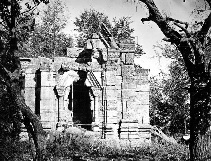
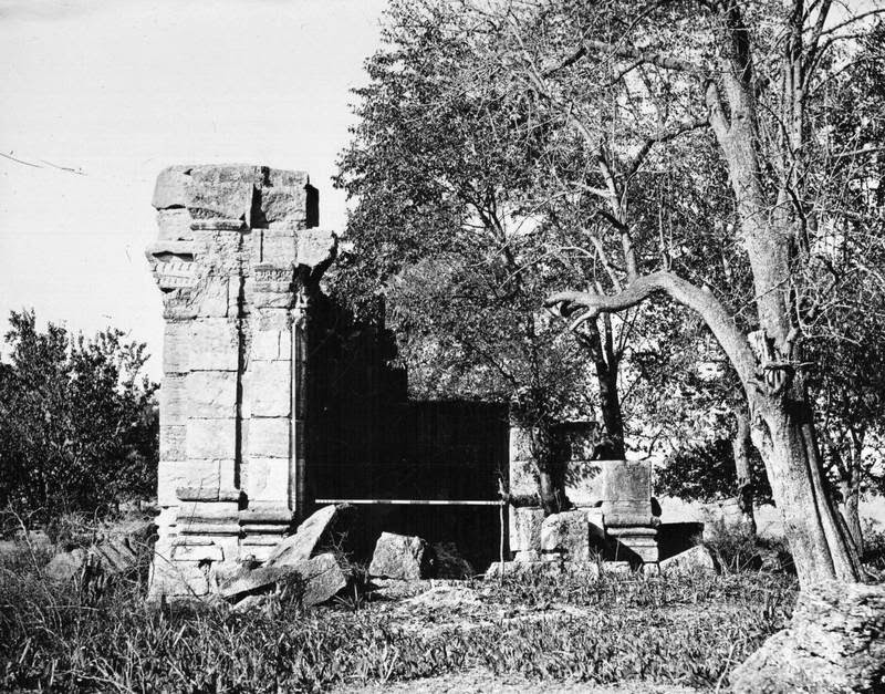
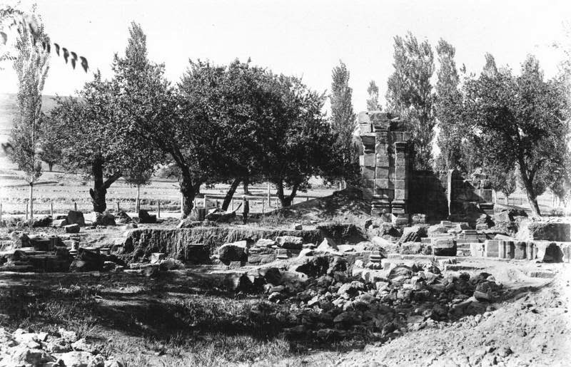
Sugandhesa Temple, 1868.
Photograph by John Burke for Henry Hardy Cole’s Archaeological Survey of India report, ‘Illustrations of Ancient Buildings in Kashmir’ (1869).
Ram Chandra Kak in his ‘Ancient Monuments of Kashmir’ (1933) provides the basic description of the structure:

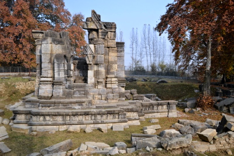
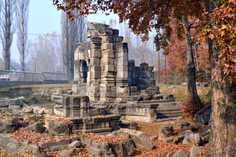
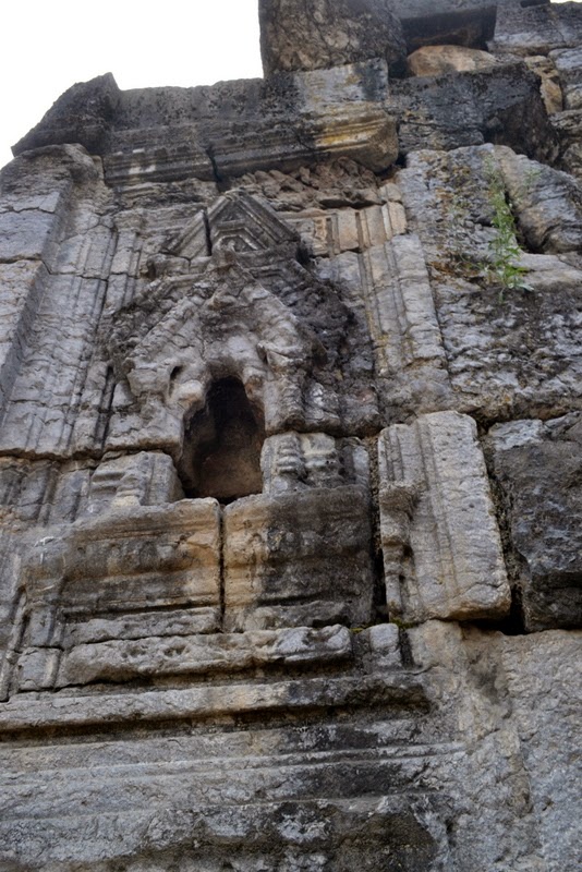
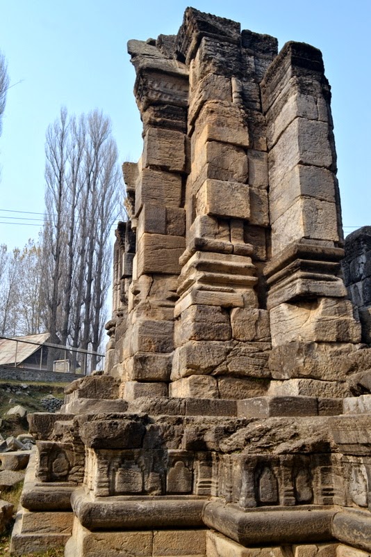
The shrine is 12′ 7″ square and has, as usual, a portico in front. It is open on one side only, and has trefoiled niches externally on the other sides. These niches contained images. The temple stands on a double base, but it seems probable from the flank walls of the lower stair and the frieze of the lower base, in which the panels intended for sculpture decoration have been merely blocked out, but not carved, that the temple was never completed.
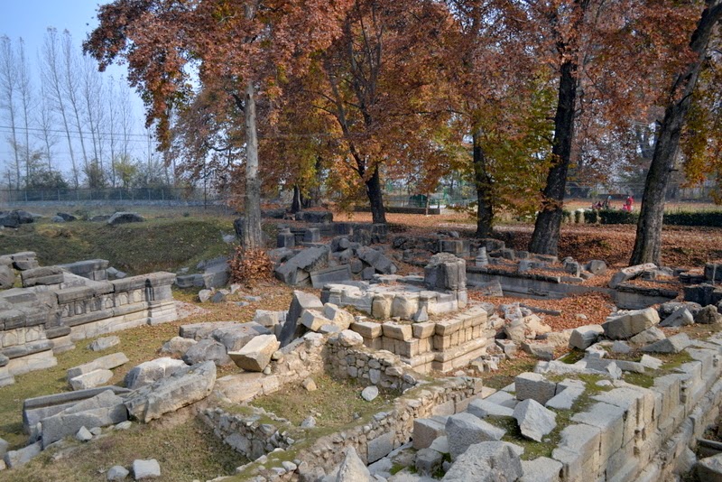
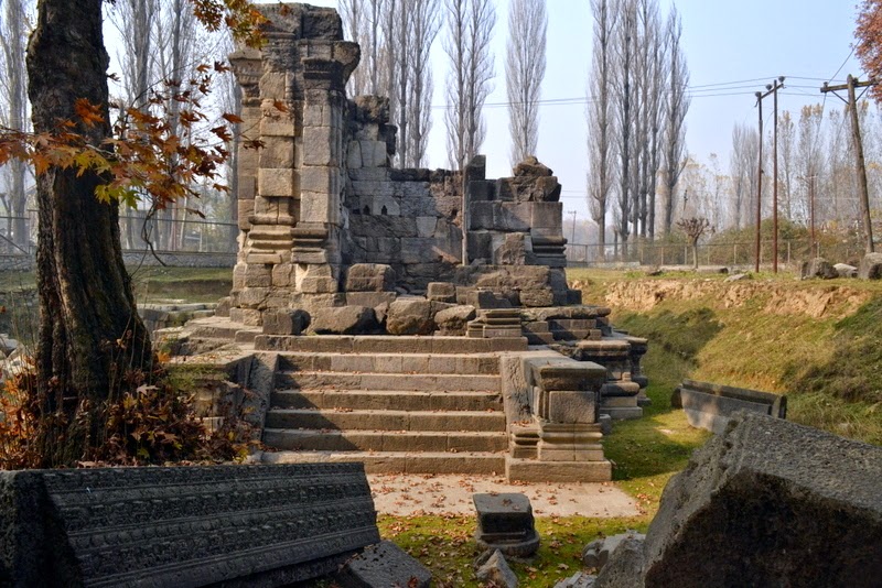
The entrance to the courtyard is in the middle of the eastern wall of the peristyle, and consists, as usual, of two chambers with a partition wall and a doorway in the middle.
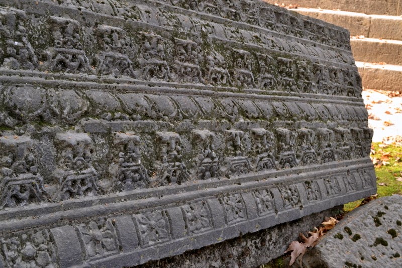
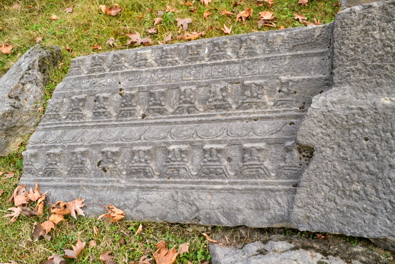
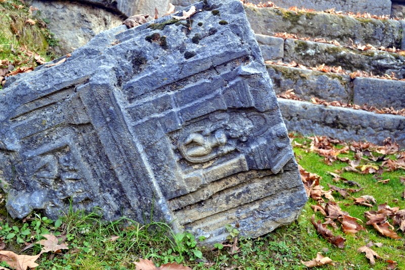
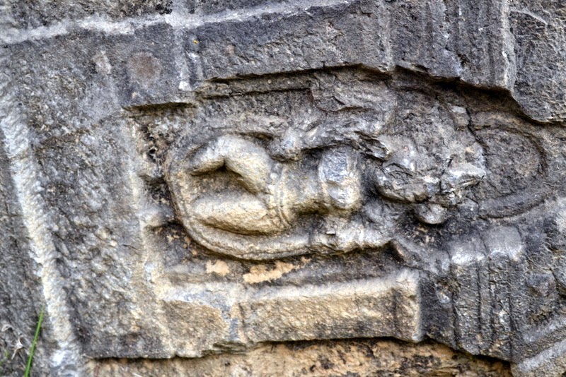
Among the architectural fragments lying loose on the site, the most noteworthy are (a) two fragments of fluted columns with their capitals, (b) two bracket capitals with voluted ends and carved figures of atlantes supporting the frieze above, (c) a huge stone belonging to the cornice of the temple, bearing rows of kirtimukhas (grinning lions’ heads) and rosettes, and (d) a stone probably belonging to the partition wall of the entrance, having (1) two small trefoiled niches in which stand female figures wearing long garlands and (2) below them two rectangular niches, in one of which is an atlant seated between two lions facing the spectator, and in the other are two human-headed birds.
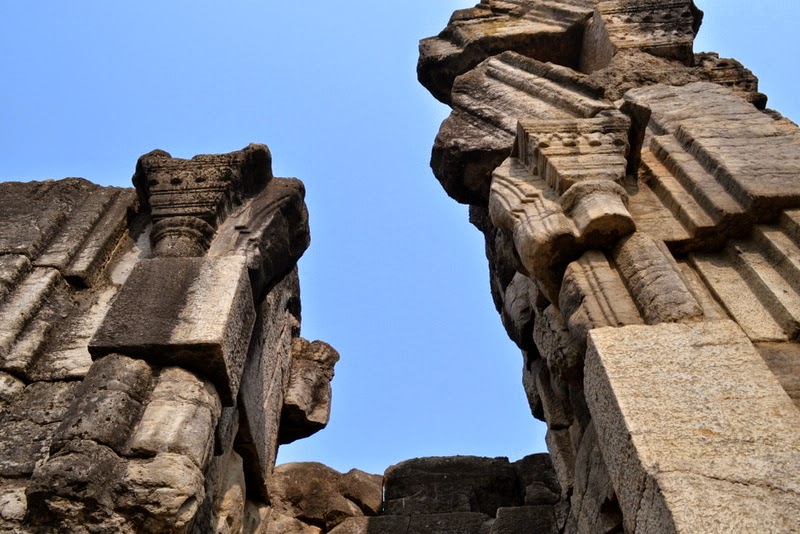
The cornice of the base of the peristyle is similar to that of the Avantisvami temple. The cells were preceded by a row of fluted columns, bases of some of which are in situ while those of others are scattered about in the courtyard.
The attention of the visitor is called to the slots in the lower stones of the jambs of the cells. These are mortices for iron clamps which held pairs of stones together. Pieces of much-corroded iron are still extant in some of the mortices.

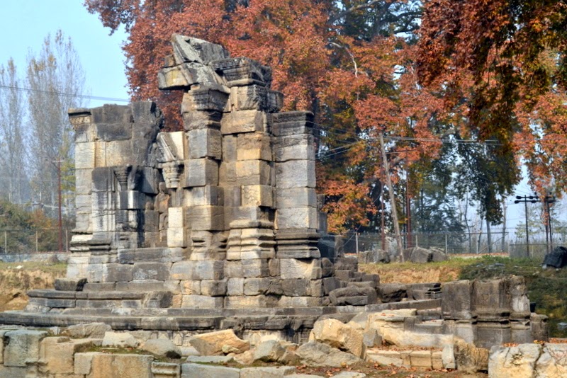
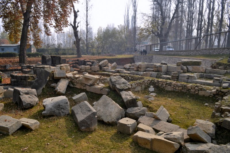
Cunningham noticed an interesting fact that while the temple of Awantiswamin at Avantipur had lost its central structure and yet retained its wall. At Sugandhesa the central structure was intact while the walls were lost. A recent study of stones at Sugandhesa suggests, “collapse in the tenth or eleventh century, and significant damage in 1885, with at least one intervening earthquake possibly in the seventieth century.” [link]

Another place. Same treatment.

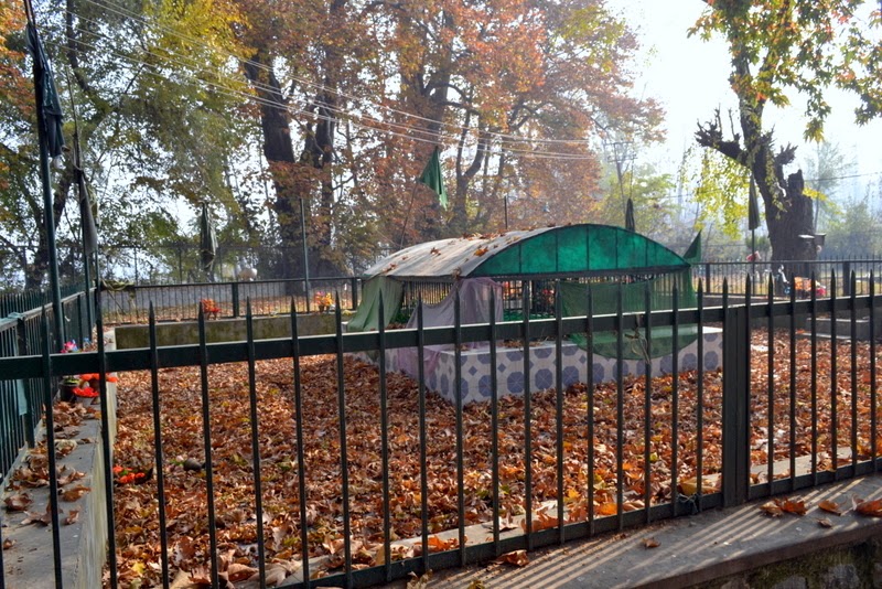
In 1847, Cunningham noticed that the chambers of the temple measuring about 6 feet by 4 feet, once must have contained linga: for he found the pedestals of three of those emblems, which had been converted into Muslim tombs within fifty paces of the temple. [‘An Essay on the Arian Order of Architecture, as exhibited in the Temples of Kashmir’ (1848), link to book]

All this essentially means, this Muslim shrine at the temple would now be more that 150 years old. Just as old as Parihaspora was when Sugandhesa Temple and the town of Pattan came up.

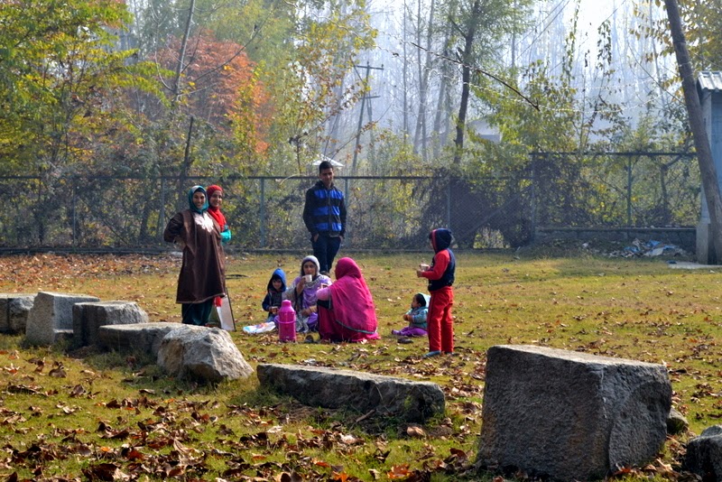
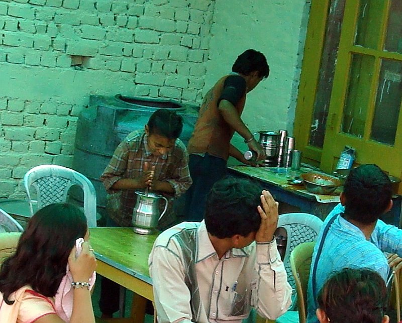
Traditional Kashmir morning tea outing 

by John Burke

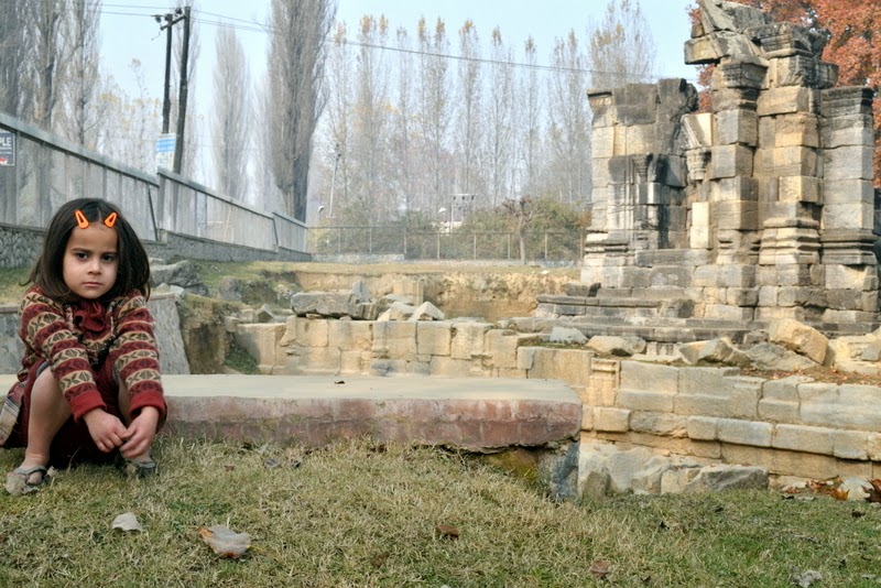
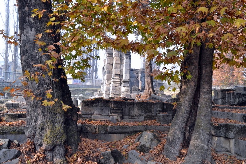
Little Uruja and the temple

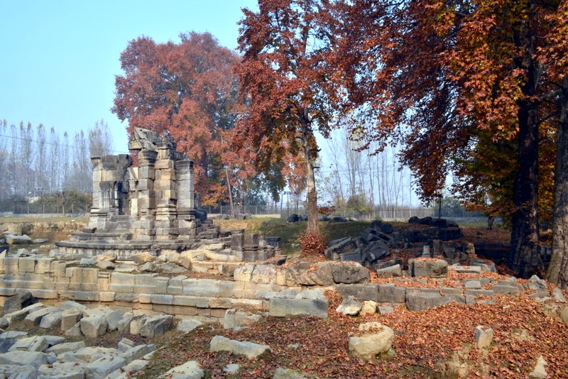
1913. Arch. Survey of India.
[source of old images: Universiteit Leiden, Netherlands]
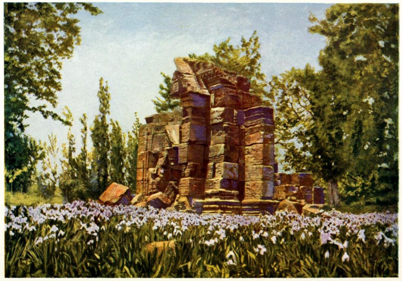
Sugandhesa in ‘Our summer in the vale of Kashmir’ (1915) by Frederick Ward Denys.
Probably  
by Col. H.H. Hart.

-0-

infamous Shaitani Nala

‘Shaitani Nala’ on way to Srinagar.
Winter 2012.
Sent in by my Father.

A story told by a cousin: Years ago, I had a friend in school whose father was taken at Shaitani Nala. The man was on way to Jammu in a bus. It was winter night. The bus stopped at Shaitani Nala because of a jam in vehicles ahead. The man got down to take a leak. That was the last anyone saw of him. He never returned. Wav, the powerful winds that blow at Shaitani Nala part of Pir Panjal, took hiim.

-0-
Previously: infamous Khooni Nala

Jawahar Tunnel, Banihal Pass

2194.56 meters above sea level, Jawahar tunnel or Banihal tunnel, situated between Banihal and Qazigund, has been operational since 22 December 1956 – built with the help of german engineers, at that time it was the longest in Asia.

This 2.5 kilometer long tunnel, dug through a mountain of Pir Panjal range, is the main link that connects Kashmir to the rest of the country. In fact, it’s not a single tunnel, “Jawahar Tunnel” is a set of two long wet tubes, each 2825 meter long, dug inside the mountain range.

Prior to the construction of these tunnel, to enter kashmir through this route, people had to cross the Pir Panjal  using a mountain pass high up in the range. This old mountain pass is still visible from the main highway.

World’s Highest Rail Bridge in Jammu!

The railway bridge being constructed at Kauri, a hamlet in Jammu’s Reasi district, will stand 359 m above the Chenab River. The bridge is supposed to complete by December 2009. Once completed it will dethrone the Millau Viaduct of France (343 metres) as the the World’s highest bridge deck. Built at a cost of more than 600 Cr Rupees, the bridge will be 1315 metres long.
Here’s a NDTV new report from year 2007.

Misty Mountains and the Road

The weather was rainy. Air cool, it must be raining somewhere. Raindrops, not so frequently, hit the windscreen and became water..

Traffic slowed down to a crawl and then stopped completely. During some stretches of the highway, this road becomes a one way narrow lane ploughed in the mountain range.

The vehicle stopped, it’s going to take some time for the traffic to get going again. The driver jumped out. All the people in the bus got talking, shared some old stories and some domestic gossip. The truck drivers of this route seen to have a peculiar habit. If the spot be right, they make it a point to park the truck right parallel to the edge of the gorge. Those big fat tyres sit just  inches away for the plunging depth of hundreds or thousands of feet – it makes no difference to them if it’s hundreds or thousands, they just park their truck and get out of the other door. Is this a fool proof method to protect the truck from truckjackers? Or is it their institutionalized method of maximizing the road surface area so that other vehicles can still pass by while their truck just sits on the corner of the narrow road. I don’t know.
Time passed, the traffic snarled back to life. But our driver was nowhere to be seen. From the window we looked for him in every direction. Minuted passed, a plastic ghee dibba in hand, our driver came walking down a nearby mountain pathway looking calm and content. Jangal pani. He got into the vehicle and put the dibba back at its place, under the seat. I don’t think he washed his hands.

-0-

The area around Banihal looks kind of strange. Some things here seem to suggest it is culturally closer Kashmir and some things that make it  look like part of Jammu district. A masjid seemed to be designed like those in Kashmir, particularly like charar-e-sharif.

The dhabbas lining the road make it a point to tell you that they are offer 100% pure Hindu vegetarian Vaishnav food, and the dhabba right next to it advertises 100% pure Muslim Non-vegetarian ‘Waazwan’.

infamous Khooni Nala

Before passing through the Banihal tunnel, one has to pass through a stretch of road simply known as Khooni Nala. Here the human race battles the powerful forces of nature. And you can almost see this struggle. Man maybe winning but once in a while nature lands in a crushing blow.

Khooni Nala got this name because of the alarming number of people who died in road mishaps and accidents at this very spot. It is the “Killer Rivulet”.

A steel mesh structure (a rather recent engineering solution) protects the passing vehicles from falling boulders. The steel nets need to be replaced every few months. During winter, this stretch of road becomes avalanche prone.

From the road in this area, you can see mountains that just seem to be melting away, eroding swiftly, mountains turning into sand and stone, mountains flowing down into rivers.

on road, Baglihar Dam, Chenab

That’s no monastery perched on top of a hill.

Baglihar Dam on river Chenab as seen from a place called Peerah.

Wiki Entry:

Baglihar Dam, also known as Baglihar Hydroelectric Power Project, is a run-of-the-river power project on the Chenab River in the southern Doda district of the Indian administered state of Jammu and Kashmir. This project was conceived in 1992, approved in 1996 and construction began in 1999. The project is estimated to cost USD $1 billion. The first phase of the Baglihar Dam was completed in 2004. On completion on 10 October 2008, Prime Minister Manmohan Singh of India dedicated the 450-MW Baglihar hydro electric power project to the nation.

In the 90s, this project was a one of the major source of discontent between India and Pakistan. Matter was sorted out amicably with the help of World Bank. Without doubt ‘Water’ is going to be the big issue of future.

 -0-

Added this image to wikipedia page about Baglihar.

on road, Kud

Photographs around Kud.

Kud, around 103 Kms away from Jammu, is a place of some great scenic beauty. Kud is popular as a spot for trekking and camping. But among the people of Jammu, Kud is famous for its sweets and sweet shops, actually the famous shop is just one. These sweets are made in the purest desi ghee possible. Pickles, aanchar, of Kud are equally famous.

Shiny steel roof tops of houses.

Birdworld Mall. Kud will be next know for this establishment. Hiring process for birds is still on.


Pine trees. Electric wires.

NH1-A to Srinagar, built precariously along ravines, cutting thorugh dicey mountain sides, at times too narrow, nature reclaiming the ground, never too wide, is a highway of diesel fumes, trucks and buses. Kud provides some respite during the journey.

Facebook
YouTube
Instagram
RSS