Panoramic view of Srinagar, 1862

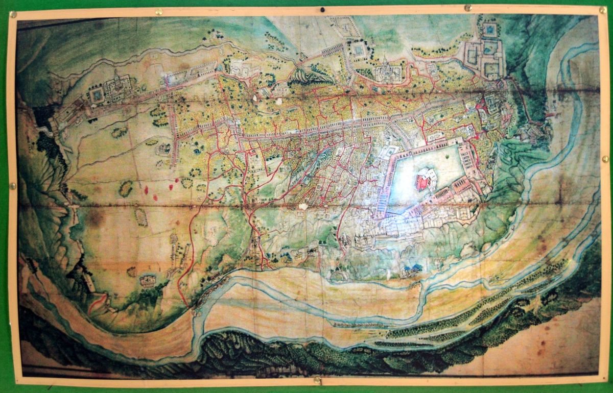
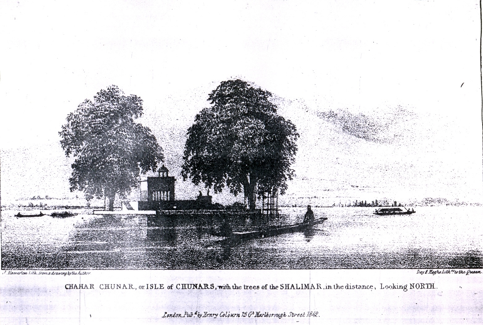
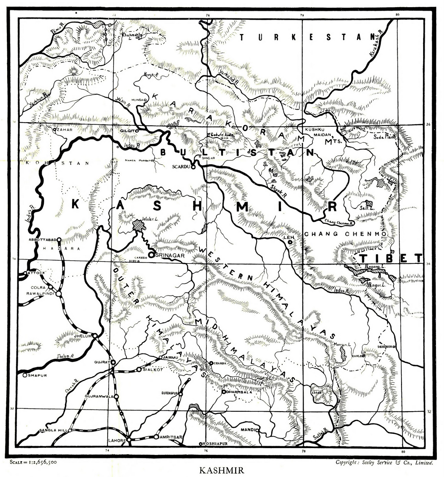
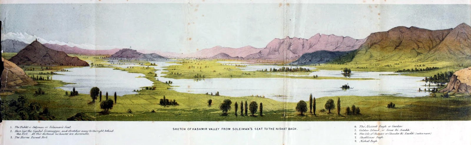
Came across this stunning painting in ‘Travels in Ladâk, Tartary, and Kashmir’ (1862) by Henry D’Oyley Torrens. The places marked in the painting (starting from left and going in clockwise direction):
1. Shankaracharya
2. The Capital city
3. Hari Parbat
4. Naseem Bagh
5. Island of Son Lank (Golden Island)
6. Island of Rop Lank (Silver Island) or Island of Chinars or Char Chinari of nowadays
7. Shalimar Bagh
8. Nishat Bagh

-0-

Old Photographs of Jammu

Map of Jammu City. Company Period Punjab. 1880-90 A.D.
First (Suspension) Bridge over River Tawi, Jammu. (1788 A.D.)
A Thirsty Special Train.
First Train to Jammu from Sailkot. 19th Cent. A.D.

Old Photograph of Raghunath Temple.
The Triumphal Arch in the Jammu Town.
Water Tank (Now Vanished) attached to Raghunath Mandir Jammu. 19th Century A.D.

-0-

Map of Dal Lake

Found it in an interesting paper (PDF LINK):

PHYTOPLANKTON POPULATION DYNAMICS AND
DISTRIBUTION IN TWO ADJOINING LAKES
IN SRINAGAR
MACROFLORA IN RELATION TO Phytoplankton
by SHASHI KANT* and P. KAOHROO, Department of Botany,
University of Kashmir, Srinagar 6
(Communicated by M. S. Randhawa, F.N.A.)
(Received 20 July, 1970; after revision 3 September 1970

Sketch Map and Pictures, 1842

Shared by Man Mohan Munshi Ji.
-0-

Sketch map of Jammu & Kashmir  by J .& C.Walker Sculpt.,  1842
Sketch of Interior of Srinagar along Jhelum 3rd bridge (Fateh Kadal)
and Shah Hamdan Ziarat in the distance  drawn by Day & Hagelith
Sketch of Charchinari island in Dal Lake by by Day & Hagelitch. Faint
view of Mahadev and SriDwara mountains  is visible in the background.

 In year 1942, the three sketches were published in London by  Henry Colburn, 13 Great Marlborough  Street.

Map of Kashmir based on Bernier’s account

Found it in ‘Travels in the Mogul Empire’ by Francois Bernier, edited by Archibald Constable (1891). Francois Bernier (1625 – 1688), French physician and traveler, visited Kashmir in 1664–65 as part of Mughal Emperor Aurangzeb’s entourage. He is regarded as the first westerner to have described Kashmir at length.

A map, based on Bernier’s description of Kashmir, was first included in the Dutch version of his travel account published in Amsterdam in 1672. Irving Brock in his 1826 edition of the book (re-edited by Archibald Constable in 1891) noticed that the map was ‘curiously incorrect’ and added ‘a new and accurate delineation’ . The map here is the new one.

-0-

Description: This original old antique print / plate originates from the fifth volume of: ‘Atlas Historique…’ (Historic Atlas…), Published by Zacharie Chatelain, Amsterdam, 1732. The atlas was published in seven volumes between 1705 and 1720, with a second edition appearing in 1732. The maps were accompanied by information pertaining to cosmography, geography, history, chronology, genealogy, topography, heraldry, and costumes of the world. The maps in the Atlas Historique were mainly based on those of the French cartographer, Guillaume De L’Isle, but were presented by the Chatelains in an encyclopaedic form.

Artists and Engravers: Made by ‘Henri Abraham Chatelain’ after an anonymous artist. Henri Abraham Chatelain (1684-1743), his father Zacharie Chatelain (d.1723) and Zacharie Junior (1690-1754), worked as a partnership publishing the Atlas Historique, Ou Nouvelle Introduction A L’Histoire under several different Chatelain imprints, depending on the Chatelain family partnerships at the time of publication.

Map of Kashmir in 1920s

found in ‘Kashmir in Sunlight & Shade: a Description of the Beauties of the Country, the Life, Habits and Humour of its Inhabitants, and an Account of the Gradual but Steady Rebuilding of a Once Down-trodden People’ by Cecil Earle Tyndale-Biscoe (1922).

Facebook
YouTube
Instagram
RSS