Birth and Journey of Vitasta – mother river of Kashmir

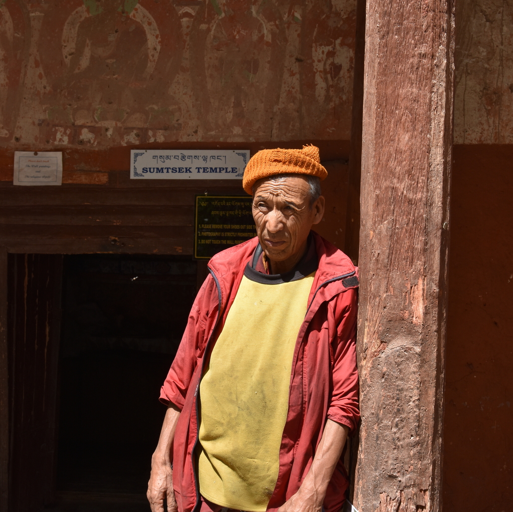
Guest post by Late Manmohan Munshi ji detailing the story of Vitasta river. He had shared it with me a decade back and wanted me to publish it by adding detailed maps, images and illustrations. It was quite a task, I wasn’t sure if I could do it and then I forgot about it, but I think the work is finally complete. Manmohan Munshi ji passed away last year.

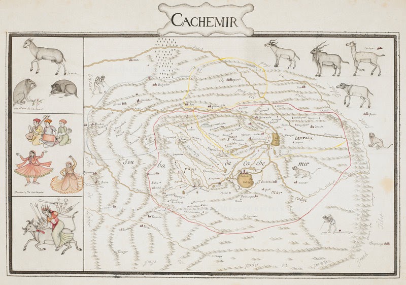
According to Nilmatpurana it was Sati daughter of Himal Parvata consort of Shiva who was called Uma in Vaisvara Antra and is the same goddess as Vitasta and the same is Kasmira. The Goddess Vitasta is verily the holy river remover of all sins. People who offer their bodies to, or die within its water in their bellies reach heaven without any hindrance. Those persons who take bath in Vitasta do not see even in dreams the tortures of Hell. Vitasta gives protection with her hands to the evil doing sinners falling into the hell. Fire of hell is pacified with cool outpourings of the drops sent from the waves of Vitas carried by the wind,. A person merely listening to the glory of Vitasta goes free from sins. The only thing that Ganga has more that of Vitasta are the heaps of bones of human beings all other things are equal. The river draining the entire Kashmir Valley called by Kashmiris as “Vyath” is the direct derivative of the original Sanskrit name Vitasta. The intermediary Prakit from Vidasta was altered by Greeks to Hydaspes. Vitasta is also mentioned in the river names of Rigveda. In Vayupurana, Vitasta has been referred as Biloda and Wular Lake as Bilodia situated south of Dumra Lohita ( Nanga Parbat)- The king of mountains. The present name Jhelum River has been adopted from the city of Jhelum besides which it flows in Pakistan . The name was brought to Kashmir by European travelers and found its way in official use otherwise the river is still known to the natives as Vyath.

Kashmiri painting collected by David J. F. Newall in 1850s and presented in his book ‘The Highlands of India’ (1882) and Preliminary Sketches in Cashmere; Or, Scenes in “Cuckoo-cloudland.” By (D.J.F. Newall.) [With Illustrations.] (1882).
route of jhelum river. 1920. You could take a doonga or a house boat for a month and this be the tourism highway from Kashmir valley. All a hundred years back.

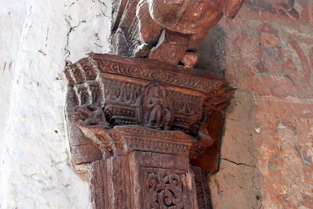
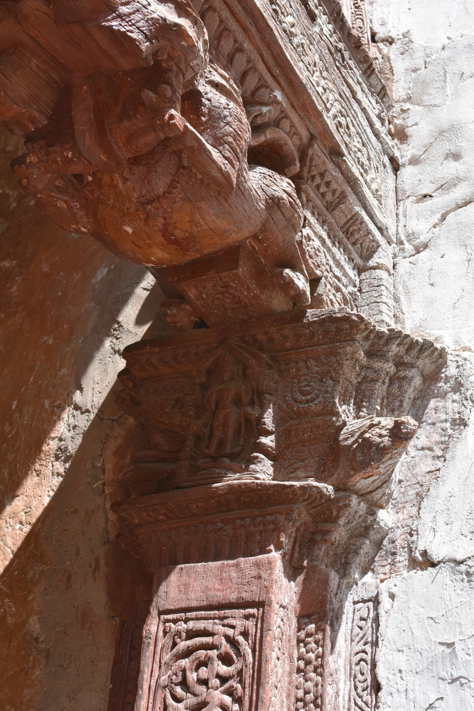
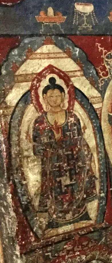
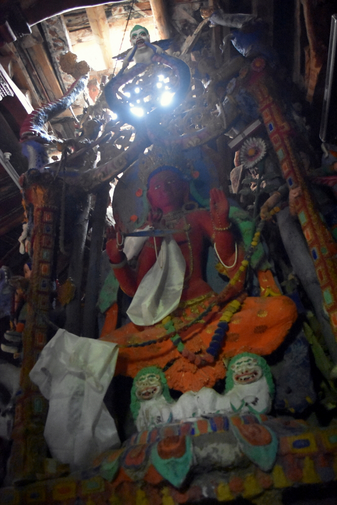
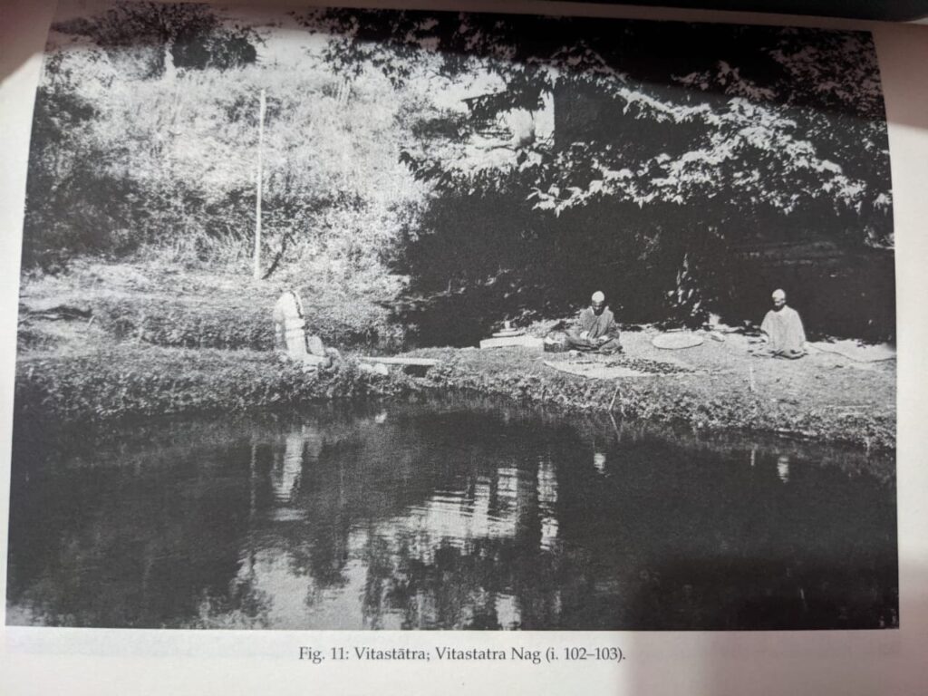
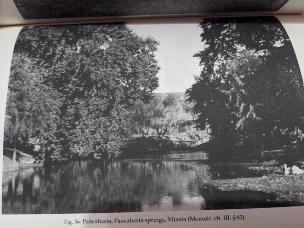
The river Vitasta can be considered to have formed at the confluence of [i]Harspatha(Arapat), [ii] Bringa (bring) and [iii] Sandran[older name not known]. But the old holy scriptures have traced the origin of Vitasta to a more specific source. As already stated in Nilmata Purana, Harcaritacintamani and subsequently quoted in latter references Vitasta is a manifestation of goddess Parvati. After Satisar(Parvati’s lake ) was drained of its water and demon Jalodbava destroyed by Vishnu, Brahma and Maheshvara, at the request of sage Kasyapa Maheshvara persuaded Parvati to show herself in Kashmir in the form of a river to purify the Manavs (humans) from the unholy contact of Pisachas . The goddess assumed the form of an underground river and asked Shiva to make an opening by which she could come to the surface in the form of a river. Shiva by striking the ground with his trisul on 13th of Badra Shuakula Paksha from which the river gushed forth receiving the name of Vitasta, after the measure of the ditch of one Vitasti. Since then the birthday of Vitasta is celebrated on on 13th Badra Shakula Paksha. The spring from where the goddess flowed in river form became known by several names Nilanaga (Abode of Nila), Nila Kunda, Sulaghata(Trisul thrust) or simply Vitasta. The name of Varnag /Veri nag seems to have adopted at a latter stage probably after the administrative unit of Var Pargana. It is said that Vitasta disappeared from fear of defilement from the contact of Sinful men but reappeared second time by the prayers of Kasyapa at Panchasta (Panzath) in Devsar Pargana., disappeared again and reappeared at Narasima. The Goddess was finally induced to stay permanently when Kasyapa secured for her the company of Lakshmi in the form of Visoka (Vesheu) and Ganga in the form Sindhu(Sind River) [not to be confused with Indus. Sachi consort of Indra as Haraspatha(Arpat), Aditi the mother of the gods as Trikoti [probably Sandran] and Ditti as [Chandravati] mother of Datiyas [close to verinag, probably Bring]. According to another legend Vitasta made her second appearance at Vitastatra (Vethvatur) close to Verinag. Clear mention of Nilanaga (Verinag) as the birth place of Vitasta by Kalhana leaves no doubt about the tradition prevailing in his time.

Map of Shahbad, Anantnag. By Sahib Ram Kaul. 1860s. Vitasta and the springs taking birth below Panchaladeva(Pir Panchal) range. What starts as snow in mountains, melts, seeps into moulins, drops, emerges as river goddesses and spring gods at bottom. Giving birth to life in valley and a civilization.

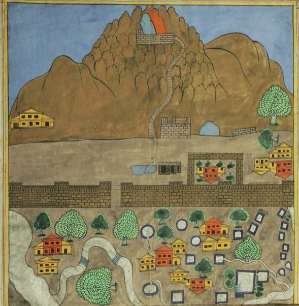
This map is important as this is specifically map of village Gutalgund, the place with nits many spring which is/was known as actual source of Vitasta.

The place gets its name from spring of vitasta bagwati (marked on map next to big splash).
Map of Verinag Spring. Sabib Ram Kaul. 1860s.
Nilanag Spring. Verinag. Vinayak Razdan. 2014.
Vitastatra Nag/Vethvatur. Early 1940s. Stein collection.
Pancahasta Springs. Panzath. Early 1940s. Stein collection.
Shushramnaga (Sheeshnag), Circa 1955
Kapatesvara. Early 1940s. Stein Collection.
Akasvala (Achibal ). Circa 1915
Machbawan(Matan). Circa 1910

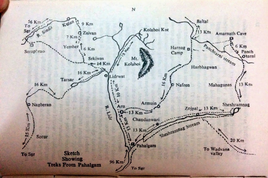
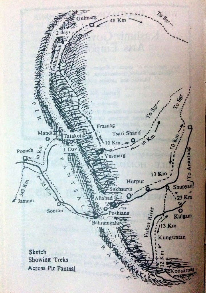
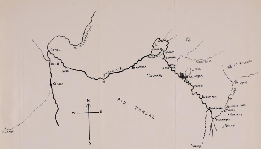
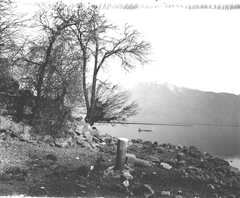
The rivulet of Bring is fed by springs of Trisandhya, Ardanarisvsra, and Kapartesvara(Koter). Akasvala(Achibal) feed the Harspatha (Arpat). Lidari which derives its waters from the glaciers of Koenjar and Gashbrar (Kolahoi glacier), Lakes of Shushramnaga (Sheeshnag), Tarsar, and springs of Machbawan(Matan) and other sources joins the Vitasta slightly down stream of Anantnag and flows in a single channel except in Srinagar City. In its north westerly course between Anantnag and Baramulla a distance of about 90 Kilometers , the river bed falls slightly less than seven meters in elevation. Islands if any are sandy and temporary except the one at the present Vitasta-Sindhusamgama near Shadipur which was artificially built.

Locality of Shivpora. 1903. Viewed from Gopadari Hill named after King Gopaditya, circa 3rd century AD. After him is named Gupkar ( Gopa – Agrahara (“Agrahara” + land given by Kings to Brahmins for maintenance of temples)). In late 19th century, Gupkar came into prominence as English had villa there and Maharaja was close by. Stein also studied Kashmir history Rajatarangini here in one such lodge quarter.

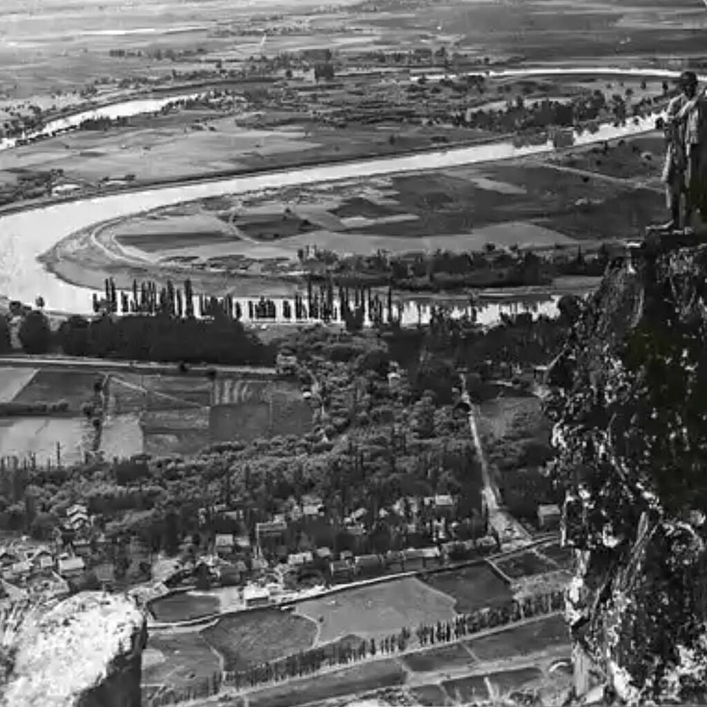
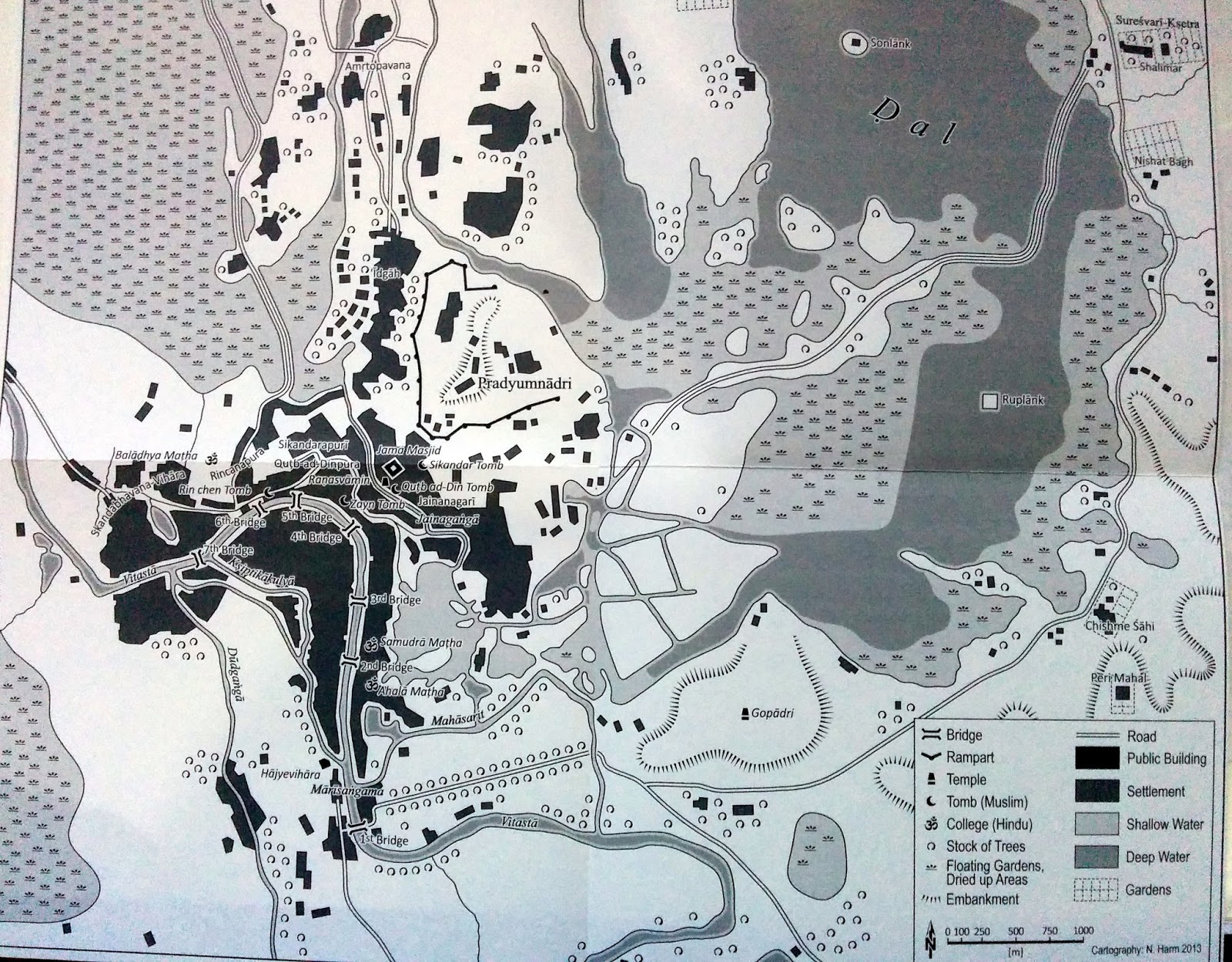
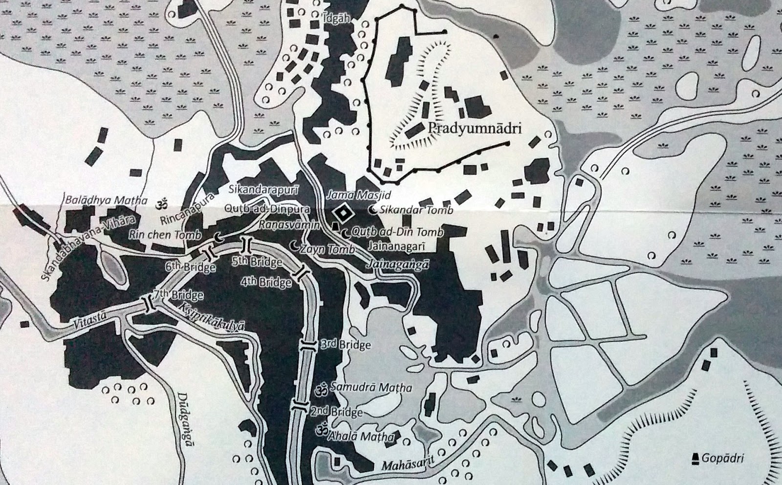
The most conspicuous meander of the river is located immediately south of Gopadri (Shankracharya hill) round the flood prone locality of Shivpura. The course of Vitasta has not changed during the historic times except at the Vitasta-Sindhusamgama where it was altered by Suyya the able engineer of King Avantivarman in the 9th century.Between Mahpadamsaras (Wular Lake) and Huskapura (Uskar) Vitasta flows in a south westerly direction and beyond Uskar in a west-noth-westrly direction upto Muzafrabad Kohala aree where it is joined by Krashna (Kishenganga)river. At Wular and Muzafrabad Vitasta abruptly makes south westerly due to the Synataxial bend of the western Himalayas in common with other rivers of the region. Downstream of Anantnag is located Vijayeksetra,(modern Vijbror) one of the holiest sires where temples of Shiva, Vajesvara, Vishnochakradara Ashokvehara and numerous viharas and agarharas and a university of learning [where students- scolars from countries beyond Kasmira used to come for study of Shastras, astronomy astrology and other subjects]once flourished.

Gambhira Sangam = Vitasta + (Vishav + Rembyar, Stein’s Gambhira). Gambhira Sangani of Rajatarangini. Sangam at Kakapora. Between Bijbehara and Avantipur. 2014. Vinayak Razdan.
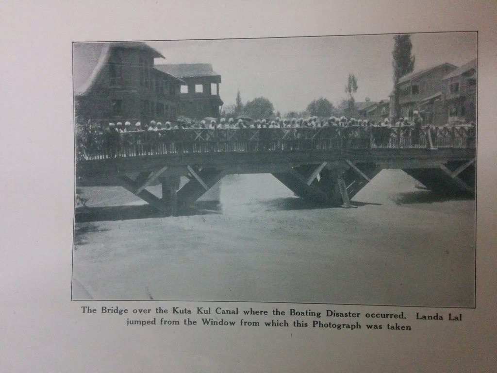
Something about the bridge from updated Rājataraṅgiṇī:
“It may be noted that this crossing has a certain strategic impotence. On occasion of a rising in 1930 in parts of Jammu territory, sympathizers in the Kasmir valley took care to burn the wooden bridge by which the modern motor road from Srinagar to Banhal pass crosses here the river. It has been since replaced by an iron one duly guarded.” ~Luther Obrock (ed.) Marc Aurel Stein – Illustrated Rājataraṅgiṇī (2013)
Konsar Nag. Source of Visoka (Vesheu). Early 1940s. Stein collection.

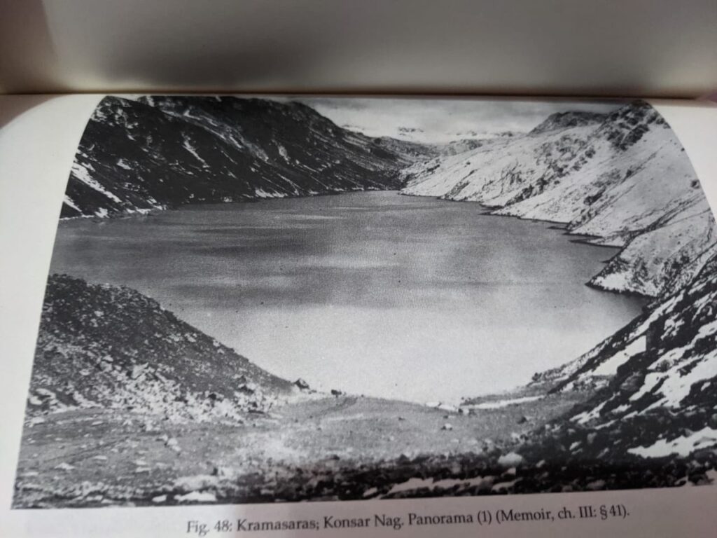
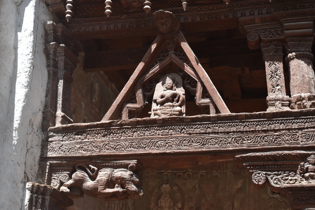
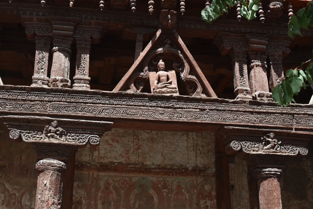
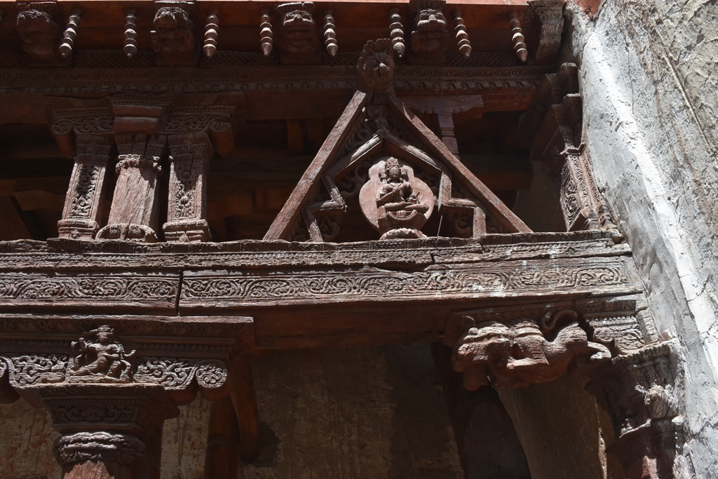
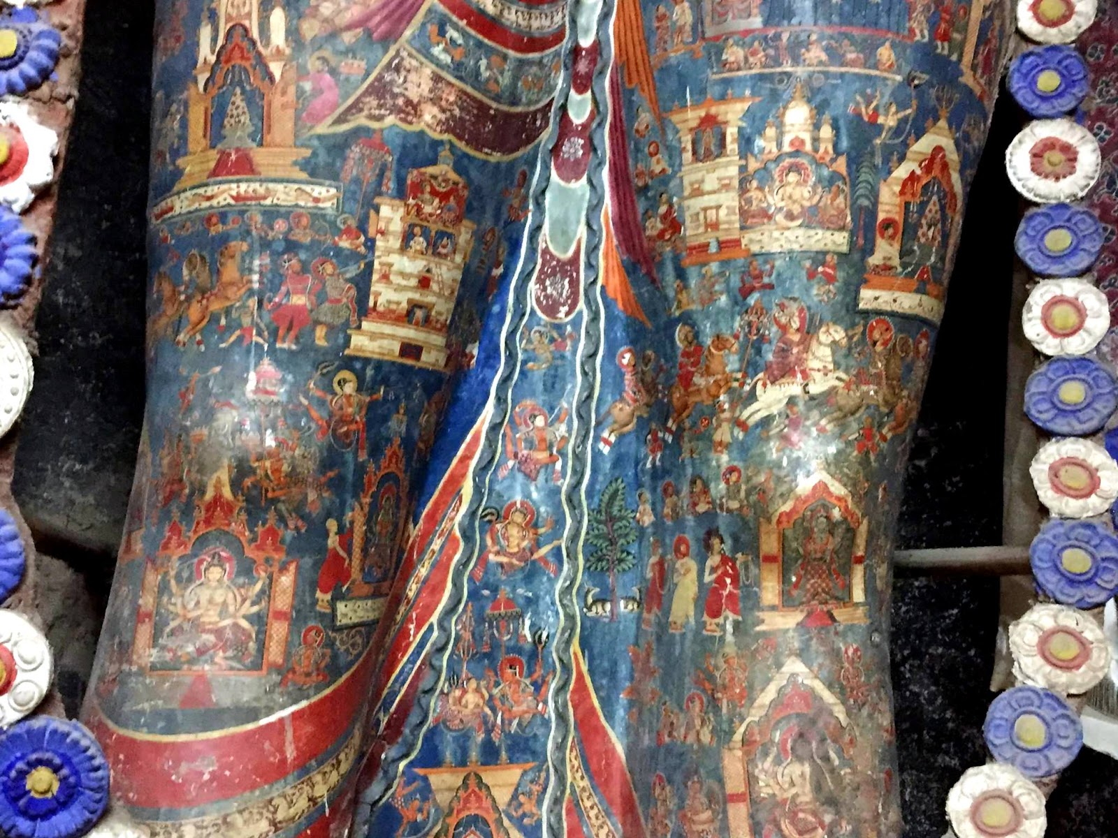
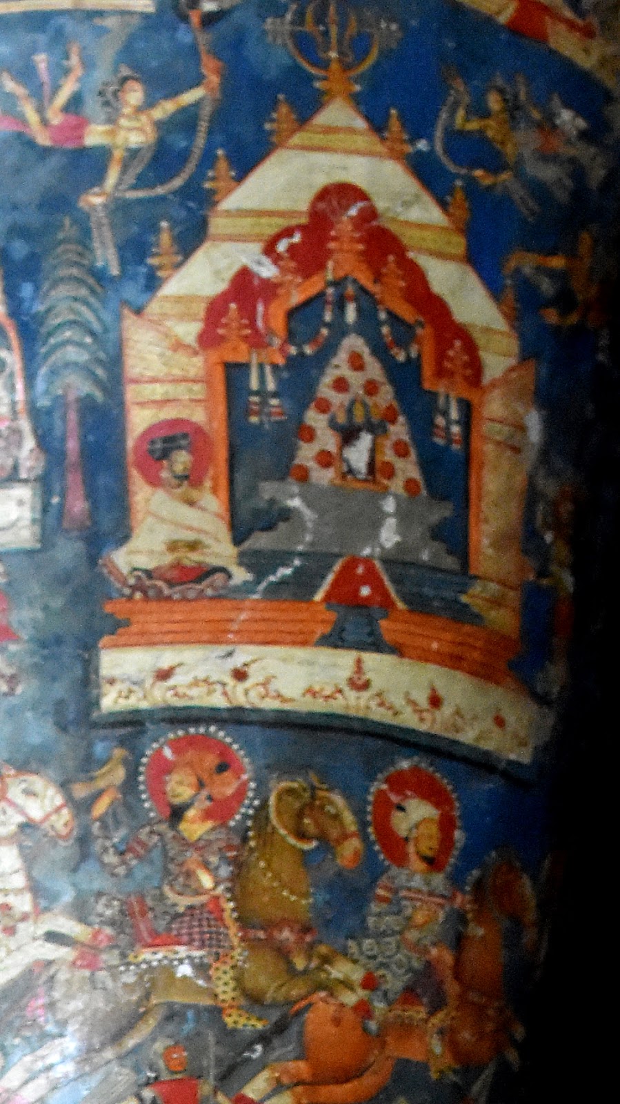
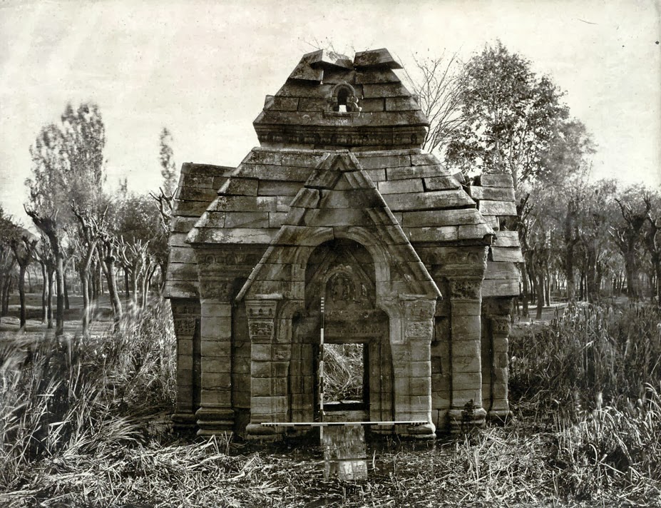
United waters of(i) Visoka (Vesheu) issuing from Kramasaras (KonsarNag) also known as VishnuPad near the tirtha of Naubandana where Vishnu, Brahma and Mashevara took positions to destroy the demon Jalodbhava and (ii)Ramanatvi (Rembyar)originating near Bhab and Nandan sars join the Vitasta along the left bank as Gambhira (the deep) at Gambhira Samgama (Sangum) below Vijbror where king Chandrapida built a Vishnu temple Gamirsvamin of which no trace is left now A few kilometers downstream of Sangum Vitasta is joined by a relatively smaller stream Chaturvedi (Narastan nala ) Below the confluence of this stream King Awantivarman founded his capital at Awantipura and built two temples Avantisvamin and Avantisvara dedicated to Vishnu and Shiva respectively. Both of these and like other temples of the valley Were vandalized by by Skindar butshikan at the end of 14 th Century. The ruins at present are testimonies to their former glory. Some of the carved stones from these temples have been used in foundation and plinth of nearby Muslim Ziarats.

Vitasta near Awantiswamin Temple, Avantipur. John Burke’s photograph from 1868

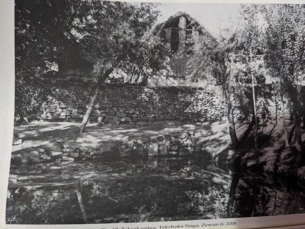
Further downstream Vitasta is joined along the left bank by Ramshu (Ramu or Kakpor Kol) rising in the Pantsal mountains by the side of the forgotten temple of Gangodbheda or Bhedagiri(Badbrar) one of the few Sarasvati temples of Kashmir. At the present village of Kakpor ruins of an old temple believed by some authorities of the time of King Khagendra the founder of Khagendapura (Kakpor) and by others as remains of the Utplasvamin, a Vishnu temple built by Utpla an uncle of King Cippatajayapida . In case the former identification is correct the ruins can be one of the oldest in Kashmir, if the latter is correct can be of the ninth century . Just opposite Kakpor on the right bank of the river is the saffron karewah and small township to Lalitpura(Letpur) founded by architect of Laltaditya. North of Lalitpur in former Viha Pargana a number of ruins of old Hindu temples at Barsu, Ladhu, Balhom some converted to Muslim Ziarats can be traced even today. The Vishnu temple of Padmasvamin built by Padma another uncle of King Cippatajayapida at Padmapura (Pampore) is also now in ruins. Stones from its ruins have been used in the construction of Muslim Ziarats.. Another Vishnu temple by the name of Samarasvamin on the left bank of the river opposite Panduchak was built by Samara a minister of King Avantivarman of which no trace is seen now. Close to Panduchak in Viha pargana is the Tirtha of Takshakanaga at Jeyyavana (Zewan ) and is visited by devotees even today especially at the time of solar eclipses .Further downstream is the temple of Merudasvamin built by Meruda a minister of King Partha.

Takshaka Naga. Zewan. Early 1940s. Stein collection.
Course of Vitasta river through Srinagar. 1920

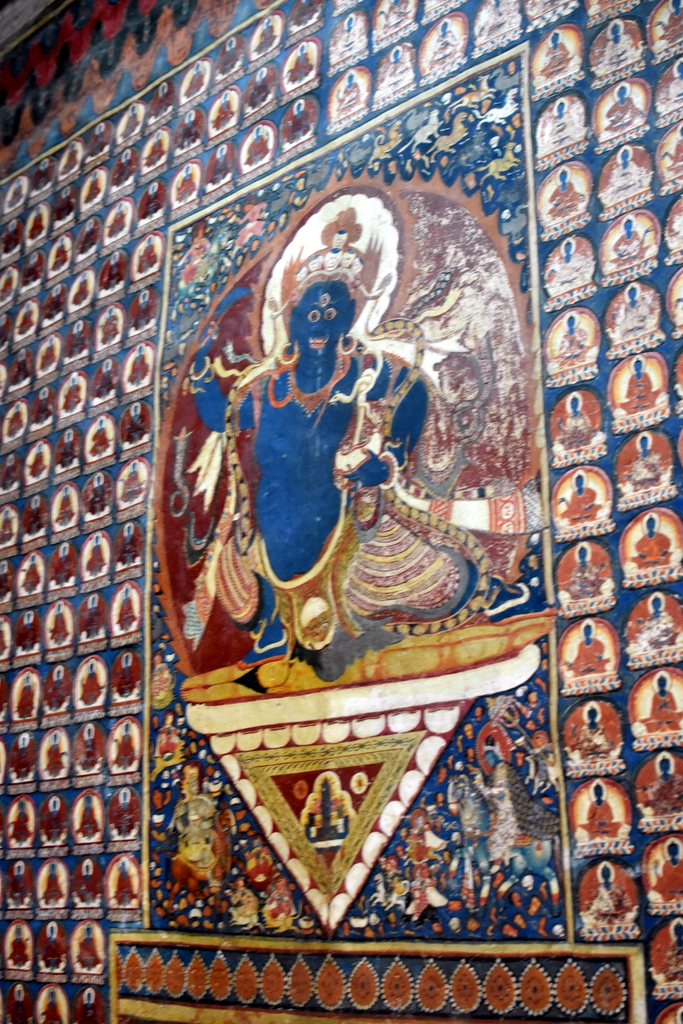
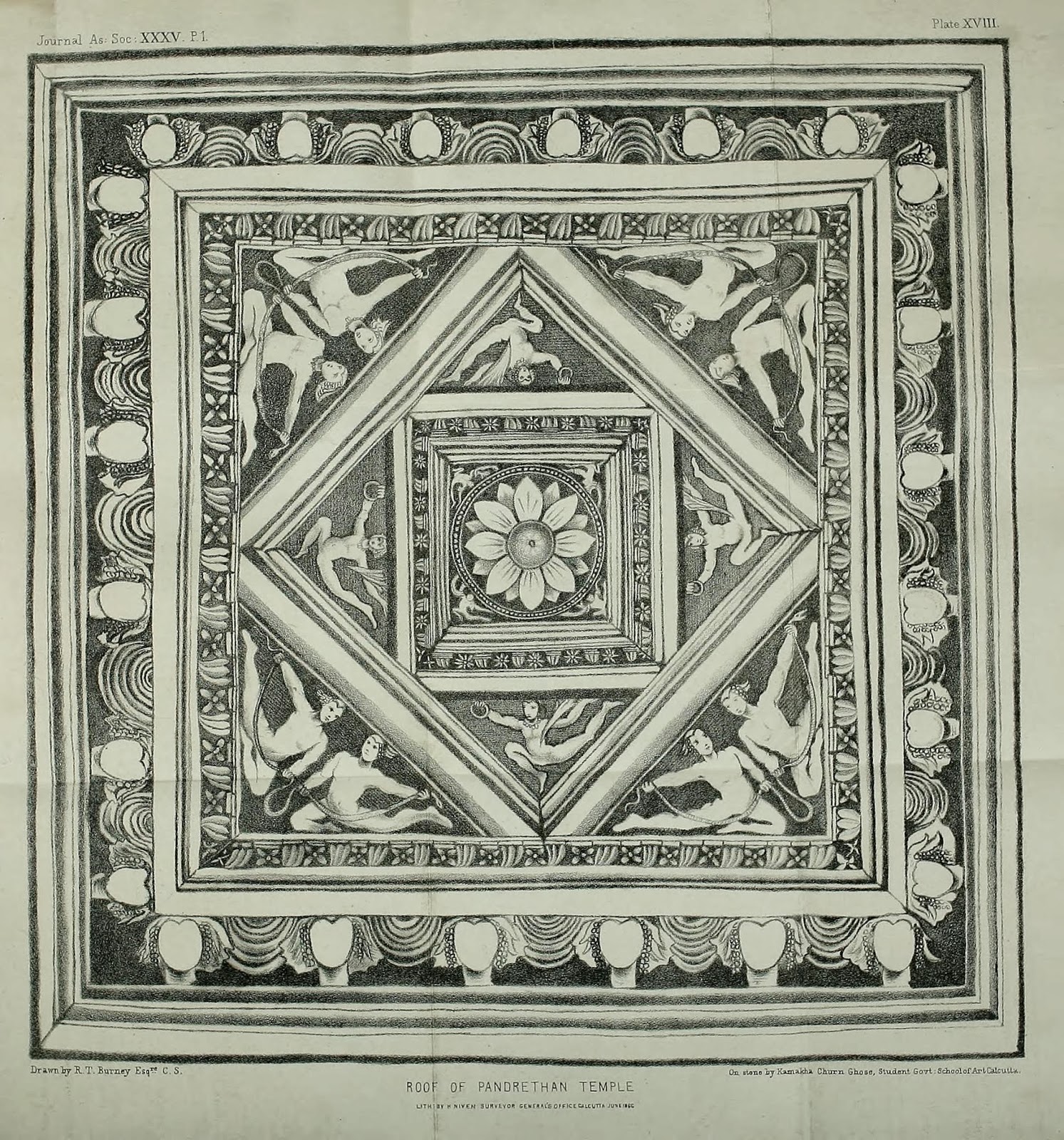
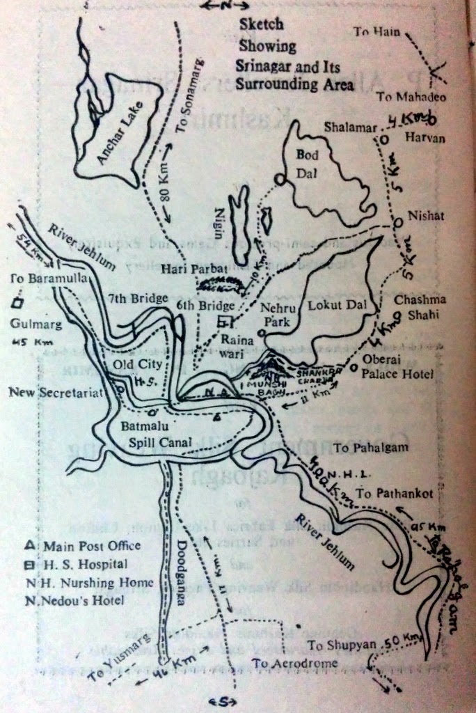
It is believed that the City of Srinagari (Srinagar) capital of Kasmira was founded by Emperor Ashoka At Pandrethan – the present cantonment of Badami Bagh when Pravarasena ii shifted the capital to Pravapura [the high ground between Kasurikabla(Khodbal) and Harparvata(Hariparbat) the old capital came to be known as Puranadisthana. The ruins of other Hindu temples around Pandrethan were seen till beginning of early twentieth century About two Kilometers north of Puranadisthana is the hill of Gopdari also known as Jeyesthirudrarodrakhyparvata (Shankracharia Hill) top of which stands the temple of Jyestherudra (Shankrcharya temple) believed to have been originally built by Jaluka of which only the outer plinth remains. King Gopadiya rebuilt the temple at a later date and also viharas of Guphra (Gupkar). The temple was repaired again by King Zainulabdin the pious muislim ruler of Kashmir in 15th Century and also by Dogra rulers of Kashmir since early 20th century since then it is looked after by the Dharmarth trust. It is believed that the temple was approachable by a stone staircase from Sudhkshikheta (Shurayar). The stone steps were removed and built into Pathar Masjid o0jn the left bank of the river near Mujahid Manzil during the 17 th century by Noor Jehan ,queen of Emperor Jahangir.

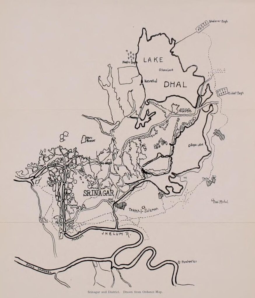
Vitasta is joined by along its right bank by Mari or Mahasirat(Tsuntkol) issuing from Jeyarudrasaras (Dal Lake) at Marisamgama which was considered as a holy Tirtha in ancient times . The island formed between Vitasta Tsuntkol and latter’s southerly flowing branch was known by the name of Maksvamin and had a Vishnu temple by the same name of which no trace is left today. Opposite the Marisamgama on the left bank of Vitasta Kippitiska or Kutkulia (Kutkol) leaves the Vitasta and after flowing in a north westerly direction bifurcates into two the right one falls back into Vitasta above Safakadal and and the left one joins Duddhaganga (Dudganga or Chat Kol) which also falls into Vitasta near Chatabal. The area between Vitasta and Kutkolia was known by the name of Katol. It is not very clear if the Kutkolia is a natural channel or manmade. It may have been build by Hindu Rulers as a defense moat after Srinagar started spreading along the left bank of Vitasta.

Zaina Kadal. Srinagar. Dome of tomb of Zaina,s mother in background.
People watching Nehru’s Boat procession from Ganpatyaar Ghat, Srinagar. May 1948.

Below the Marisamgama at the present Malyar Ghat stood the temple of Vardamanesa of which nothing is left today . A Linga serving as lamp post in a nearby Mosque believed to be from the original Vardamanesa temple was removed and installed in Malyar Temple in 1818. Immediately below Habakadal Bridge on the right bank is the Somyar temple, site of the ancient Somatirtha . Similarly situated on the left bank is Purushyar the site of ancient temple of SadaSiva. Between Haba Kadal and Fatehkadal on the right bank of Vitasta is the locality of Narparistan near Malikangan, stood the temple of Naresheri which was converted into a Ziarat during the muslim rule. Further downstream between Fateh Kadal and Zaina Kadal also along the same bank was bank was located the temple of Kalisheri which was destroyed and rebuilt as ziarat of Shah Hamdan by Sikandar Butshikan. The oldest bridge over the Vitasta in the City was known as Mahasetu it was a boat bridge like a modern poonton bridge which could be removed during emergencies like war etc. At the location of the Mahasetu Zainulabdin built the first permanent timber bridge across the Vitasta in 15 th century which came to be known as Zaina Kadal and other muslim rulers followed by building a number of timber bridges in the city and elsewhere across the Vitasta. Again on the right bank of the river betwen Zainakadal and Alikadal is the tomb of the queen of Sikandar Buthshikan and burial place for other muslim rulers known as Mazar Salatin. The Tomb which is built entirely of bricks very similar in architecture to the tomb of Bibi Jawandi at Uchchh Sharif near Multan in Pakistan. Its foundations & embankments on the riverside and material used in the surrounding walls betray it to be site of an ancient Hindu temple.

Further downstream on the same bank of the river almost touching the bridge is the Ziarat of Wyusi sahaib which also due to its foundations,embankments and the entrance appears to be site of an original Hindu temple. Nothing is known about the antiquity of these two temples/shrines. Near the locality of Chatabal confluence of Dudhaganga (Dudganga or Chata Kol) [issuing from the Pantsal Mountains] with Vitasta was the site Tirtha of Dudhagangasamgama now completely forgotten. The other temples and hindu shrines, namely Hanuman Mandir, Ghadadhar Kharyar,Malyar Raghunath temple are relatively of recent construction. However it is possible that a few of these temples like Ganpatyar were rebuilt at ancient sites.

Bridge over Kutkol canal. 1926.
 Starting point of Tsont Kul near Chinar Bagh. 1910
Tsunt Kul. Apple Canal, 1881..
Vitasta leaving Srinagar. Chattabal Weir. 1920s. Personal collection. Vinayak Razdan

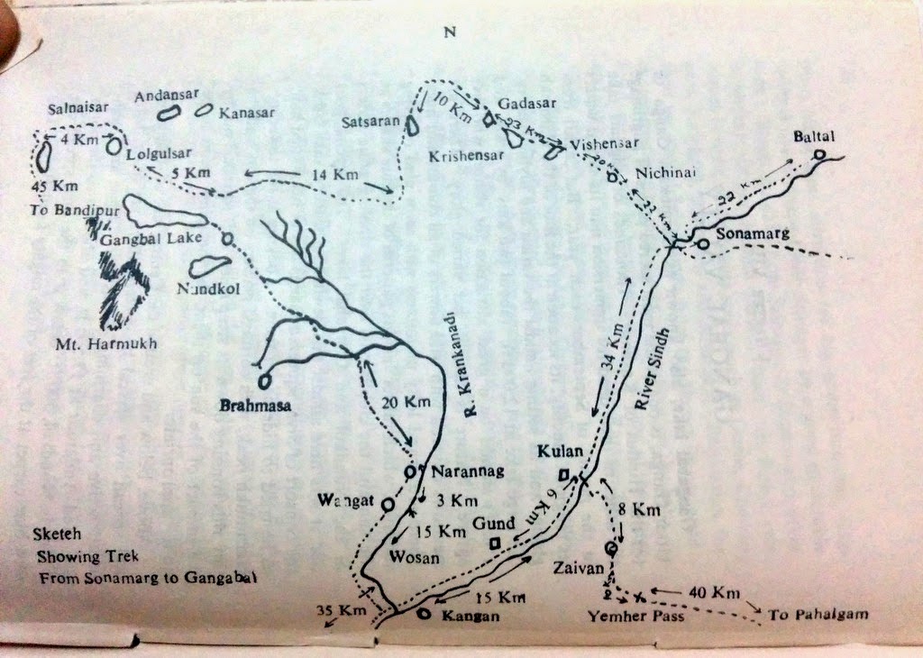
Between Srinagar and Shadipur the Vitasta is not joined by any major tributary except the Sukhnag along the left bank. The Sindhu(Sind river) rising from the Great Himalaya Range south east of Amreshvara ( Amarnathji Cave) joined by glacier fed streams of Panjtarangini (Panjtarni), Amurveth(Amravati), Nehnar etc, outflows of of the lakes of Utrasaras or Utraganga(Gangabal), Koladuga,(Nandkol) springs of Sodara (Naranag) uniting into Kankavahini (krenk nadi) flowing in Nandiksetra at the foot of Harmukh mountains by the sides of Buthesvara, Jyesterudra, Ciramokana, at Kankpura (Kangan) used to meet Vitasta at Vitasta-Sindhu Samgama till the ninth century. Immediately west of the gap of Badrakhel nala between the Vudars (karewas) of Parihaspura (Paraspur) and Trigami (Trigom) close to the sites of ruined temples Vishunosvamin, Vinayaswamin about 5 Kms south west of the present confluence at Sundribavana (Naran bagh) near Parihaspura was founded by Lalitaditya as his capital which according to Kalhana excelled heaven. Lalitaditya whom Kalhana has called “Indra of the earth “ built numerous other temples Parihaskesva with the image ofVishnu in silver pearls, Mukhtakesva with golden image of Vishnu, Mahavara with Vishn’s image in golden armour. And silver image of Goverdandhara, Bradbuddha numerous viharas ,agarharas and palaces. Even his queen Kamlavati built Kamlahatta with silver image of Kamalakesva. One of Lalitaditya ‘s ministers Mitrasarmamn installed the Shivlinga of Mitresvara. Needless to say that the site of the capital Parihaspura and numerous temples was apparently chosen for proximity to Vitasta-sindhusamgama, the former being regarded as manifestation of Yamuna and the latter that of Ganga. Suyya the able engineer of King Avantivarman by his expertise shifted the location of Vitasta-Sindhu Samgama from Parihaspura to the vicinity of Sundribhavana by forcing the course of Vitasta north eastwards by construction of embankments to reclaim cultivable land fromfrom Nambals (marshes) and flood prone areas. A Vishnu temple by the name of Yogasvamin was also built by Suyya at Sundribhavana at the instance of King Avativarman. The material from the ruins of the said temple seem to have used for building of the solid masonry walls of the island with a solitary chinar tree at the present confluence [referred as Prayaga in the Vitasta Mahatmaya ] at a latter date.

Vitasta-Sindhusamgama. The Chinar tree at Shadipore in a photograph by Fred Bremner. 1905 
The river in the left foreground with greyish coloured water is the Sind river and the other with the bluish green coloured water in the right background is the Jhelum. Suyya the able engineer of King Avantivarman by his skill shifted the position of Vitastasindhusamgama from Parihaspura Trigami area to its present location in the vicinity of Sundribhavana (Naran Bagh) by forcing the course of Vitasta north east wards by blocking its original course with embankments to reclaim the cultivable land from flood prone areas and marshes. A Vishnu temple by the name of Yogavasmin was also built by Suyya at the instance of Avantivarman. Photo: Manmohan Munshi

Beyond the Sangama, Vitasta continues to flow north west wards by the side of Vaskur village [Rupbhawani’s shrine) and receives the outflow of Manasaras (Manasbal Lake) at Sumbal, and after passing Jayapura (Indrakoot) enters the Mahapadmasaras (Wular lake). The ruins of the ancient buildings and temples at Jayapura founded by King Jayapida on an island like raised ground among the nambals (marshes) south of Sumbhal were seen up o the middle of 20th century. King Jayapida also built the castle of Bayokota on the peninsulalike ridge Dwarpati with three images of Buddah and a temple of Jaya devi. According to Kalhana inner town of the castle excelled heaven in beauty. According to an ancient legend the site of Mahapadamsars was occupied by a wicked Naga Sadangula who was exiled by the Naga king Nila to Darvisara . The site left dry was occupied by the township of Chandrapura ruled by the king Visvagavas.. Mahapadma Naga in the disguise of a Brahman approached Visvagavas and after securing the king’s permission to reside in the city appeared in his true form with the result that the king and his subjects had to migrate westwards to a new town of Visvagaspura.

Ruins on Zaina Lank island, Wular Lake. Kashmir. ) circa 1910. [via: Leiden University Libraries, Netherlands]
The story goes that Zain-ul-Abidin was told about the existence of an island temple in Wular lake. He sent men to investigate. Some ruins and gold sculptures were found under water at the spot. The sculptures were sold and a proper island was built with a palace and a mosque atop the temple. The purpose of Island creation was not just religious. The creation of man-made islands was an ancient technique used to make big lakes navigable. The island cause wave diffraction, smaller waves do not collide to become bigger waves, hence reducing the chances of creation of giant waves (“wav jinn” in Kashmir) for which Wular was famous. This is also the reason why there are islands in Dal lake.
It was here that the Persian inscription in stone bearing the name of Zain-ul-Abidin in relation to founding of the island in 1443/4 was found. The inscription reads:
May this place endure like the foundation of heaven !
Be known to the world by the name of Zaina Dab!
So that Zain-ul-abdin may hold festivities therein,
May it ever be pleasant like his own date !
Ruler on a boat with attendants
17th century, reign of Jahangir
British Museum
Jahangir’s trip to Wular Lake. Island with ruins.

At present Vitasta enters Mahapadamsars (Wular lake) at the north eastern corner and leaves it at the south western corner near Suyyapura (sopore). A glance from a high mound will show that a peninsula like ridge projects into the lake . Due to continuous deposition of silts from Vitasta along the eastern side of the lake has resulted in turning the eastern side of the lake into marshes and swamps and shrinkage of the clear water area of the lake. Similar silting relatively on a smaller scale going along its northern fringes of the lake by Madhumati stream (Bandpur Nala). It can also be summarized from the fact that waters of Vitasta are silty at the inflow (especially during rains ) and clear at the outflow near Sopore. The scientific reason for this being that transporting capacity of water is directly proportional to the velocity of the current. When any river enters a lake the velocity of its current drops ,resulting in deposition of silts in stagnant and relatively low velocity of water It is corroborated from the historical facts that man made island of Jainalanka (Zainlank) which according to Jonaraja was surrounded by waters and at present is surrounded by marshes and dry land . If the silting of Wular is not checked, the great and biggest fresh water lake in the state will be reduced to a marshy land similar to Anchar,Hokarsar or Pambsar with river slowly meandering through it. In case Wular has to be preserved for future generations, an alternative between Sumbal and downstream of Sopore by passing the lake which existed in the past has to be rejuvenated through which the waters of the river will have to be regulated by a barrage/ veer during heavy rains, floods or whenever the water of the river will turn muddy thus saving the Wular lake from silting. The silts of Bandipur nala can be prevented from entering Wular Lake by construction of a cofferdam and the silts thus accumulated upstream of the dam can be removed from time to time for construction purposes.

Sopore. Early 1950s.
Vitasta at Baramulla. 2014. Vinayak Razdan

Downstream of Suyyapura (Sopore ) in Kashmir valley Vitasta receives its last major tributary along its right bank the Pahara (Pohur) draining the north western corner of the valley and being of steeper gradient and faster current than Vitasta deposits silts in the latter’s bed resulting in rise of the water level upstream. However from time to time at the site of confluence of Pahara with Vitasta silts have been removed by dredging in the recent past. Vitasta after leaving the last major town of the valley Baramula enters its mountainous course at Huskapura(Uksur) beyond which it becomes unsuitable for navigation. The name Vaharamula (Baramula or Varmul) has been derived from the ancient Tirtha of Vishnu -Adi -Vahara where Vishnu was worshiped since time immemorial as a medieval boar. On western extremity of the town near KothiTirtha till very recently a number of ruins were seen but not much is known about their antiquity.

Vitasta near Uri. 2014. Vinayak Razdan.

Between Uskar and Uri, Vitasta flows in a south westerly direction and beyond somewhatin a north Westerly direction upto Muzafrabad where it is joined by Krashna (Kishen Ganga) Kunar, Kahgan follows a southerly course up to Mangla near Jhelum forming the boundary between West Punjab and State of Jammu & Kashmir. From Mangla onwards Vitasta again heads in a south westerly direction before meeting Chandrabhaga( Chenab) near Jang-Sadar.

-0-

Sahib Ram’s Tirathsangrah Maps and the Sacred Geography of Kashmir

Like for many of his generation, Sahib Ram Kaul’s exact date of birth is not known. What is known is that his father Dila Ram Kaul was revenue officer in the court of Maharaja Gulab Singh and lived in Anantnag. His mother was daughter of scholar Pandit Tika Lal Razdan of Srinagar. When his father died, Sahib Ram was only seven. His mother moved to Srinagar and that is where he grew and got his education. Sahib Ram eventually started his own family at Drabiyar, Srinagar.

Sometime after 1865 when Maharaja Ranbir Singh ascended the throne of Jammu and Kashmir, Sahib Ram Kaul, the best of Pandits of the time, the head of newly formed Sanskrit Mahavidyalaya was tasked with finding the old ancient texts of the place, in Sanskrit, Persian, Arabic, so that they could be placed in the library of the university for production of fresh scholarship. It was for this project that Sahib Ram Kaul procured various copies of Nilamatapurana and then finding them unsatisfactory, produced a critical edition that however was never published even as few decades later western scholars like Georg Bühler and Aurel Stein were to find Sahib Ram Kaul had shown which parts of Nilamatapurana had been used by Kalhana in Rajatarangini even as they at times disagreed with Sahib Ram’s approach. His work was to prove beneficial to these western men who arrived seeking glimpses of Kashmir past and it was widely accepted that Sahib Ram Kaul was the pinnacle of Kashmirian scholarship of his era.

What made Sahib Ram Kaul stand out was not just his skills of the languages (Sanskrit, Persian [he studied in a Persian language Maktab (school)] till the age of 18, picking up sanskrit only in adulthood) and his work on texts (ranging from shastras, kvyas, itihasa, commentary on erotica [Pañcasāyaka of by Kaviśekhara Jyotirīśvara], translation of work on Islamic morality [Ahalq-e Mohseni/Viraratnasekharasikha]) but his rooted understanding of geography of Kashmir in which he was able to visualize the past from present. The materialization of that vision of Sahib Ram Kaul was Kashmiriatirathasangrah, a work compiling all the major holy spots of Kashmir, mostly various nagas/springs all over the valley based on texts like Nilamatapurana, Kalhana’s Rajatarangini and Abu’l Fazl’s Ain-i-Akbari. Along with notes (in Sanskrit) Tirathasangrah had maps of the holy sites with topographical identifiers, local lore and village names. To compile the work, pandits across the valley were roped in to help collect the material. If there was a local spring or a holy village in some remote village, even that was recorded by Sahib Ram diligently. However, the work was never completed as Sahib Ram died in around 1870 or 72. The incomplete work already comprised hundred on pages of folia with maps, many of them incomplete, just sketched, not painted, some with no notes. The monumental work however was taken up again a few years later by his son Damodar Kaul

In 1875, when George Buhler arrived in Kashmir looking for Sanskrit manuscript, the “original” Rajatarangini and Nilamatapurana, he was directed to meet Sahib Ram’s son Damodar who was now the head of Sanskrit Mahavidyalaya. The visit triggered Damodar [who was working on continuing Kalhana’s Rajatarangini] to dwell into his father’s work. He again visited the locations mentioned by Sahib Ram in his maps, did a bit of digging at sites, probably to re-verify the claims of the text. The folios of Tirathasangrah got more notes. A copy was taken by Buhler to Poona. Decades later Stein for his translation and notes to Kalhana’s Rajatargini was to use the text to add notes to location of many (and many a) ancient sites like Sharda (which based on Sahib Ram’s work we find also existed at Khuyhom, Bandipore. Buhler probably informed by Damodar tells us it is at Horil in Khuyhom. Stein to add to that besides finding the actual Sharda, also tells us of a Sharda pilgrimage taken by Srinagar pandits to Harwan at a place called Sharda Kund ).

We find (and Stein mentions) that Pandits had forgotten the sites which were outside of valley, outside their area of influence, the “urban” areas, in the distant places, only lore, often mangled and jumbled, remained. They would visit holy sites, but often the origins were freshly re-invented. The limitation this brought about was noticed by Stein in Sahib Ram. Thus Stein who was trying to find the “true” meaning of texts, Sahib Ram’s work often proved too problematic. Centuries later, the work was summarised rather simplistically by political commentators as a political project of the Maharaja. A project to reclaim the Hindu past, ignoring the question if such a reclamation was needed by the community for survival.

The motivation of Sahib Ram Kaul in making the maps and studying the sites perhaps can be best understood by the fact that it was this man who pulled together the ruined pieces at top of Hari Parbat and reactivated the Chakreshwari Shrine. For Sahib Ram it was not just an academic project (like say for someone like Stein), instead, for Sahib Ram it was about putting back pieces and reclaiming. It was personal. When Stein notes that most Pandits didn’t know much of their own past, he is not wrong, and perhaps Sahib Ram was aware of that, and thus his project on the sites and history. It was a conscious effort by someone who could do something about it. It was not an act of some political vengeance as we can see that while executing his maps there is no erasure of islamic sites, the ziyarats. In fact, in the Maps, we find such monuments diligently shown in all their beauty. In Abul Fazal he must have read that in Kashmir valley there were 45 shrines dedicated to Shiva, 64 to vishnu, 3 to Brahma, 22 to Durga and around 700 nagas. In Sahib Ram’s time, in 1850s, although Pandits were again going on pilgrimages to sites like Tulamulla and Jwaladevi, the actual functional temples in Kashmir were not there yet. The temples that came up later and in this time were sites, which had lingered in memory, often people would bring broken discovered sculptures, place then at a site and worship. It was these sites that were verified by texts, sanctified by ruler, that gave birth to modern surviving functional temples in Kashmir. It was possible because of efforts of people like Sahib Ram. Yet, even today we find that most Kashmiri Pandits would be hard-pressed to make sense of the maps drawn by Sahib Ram. If Stein were to ask random Pandits today the same questions he asked them in 20th century, he would still conclude that they know little and have made up stories where the facts were missing, or that they have no interest. However, in all this it should be remembered that there has been no actual study of the work and few have actually seen the maps of Sahib Ram, fewer still even know about their existence, or even where it exists.

An original copy of Tirathsangrah was sold few years back on Bonhams. That told me the work did indeed exist (multiple copies?) and was in circulation.

About 250+ pages of maps from Tirathsangrah of Sahib Ram are at S.P.S Museum Srinagar (not on display!). A low-res digital version (with no proper details) was shared by them with National Mission on Monuments and Antiquities (NMMA), the (statewise) database for heritage, sites and antiquities.

Here, I am presenting some of the interesting maps from the collection, along with my notes on them.

Fig 1: Hari Parbat, Srinagar. Pradyuman Parbat of ancient texts. The walled city “Nagarnagar” of Akbar. Steps leading to the shrine of Chakreshwari. Various springs outside the wall, some of which still exist. [saw one a few years back which had been cleaned and revived as a public project by local government]

Sahib Ram has given quite detailed maps of the hill. Covering all the sides of it. Important in the light of the fact that he was instrumental in rebuilding the Hari Parbat temple.

Continue reading “Sahib Ram’s Tirathsangrah Maps and the Sacred Geography of Kashmir”

All maps are purely for propaganda purposes

“Later that night I held an atlas in my lap, ran my fingers across the whole world and whispered; “where does it hurt?” It answered everywhere, everywhere, everywhere.”
— Warsan Shire.
A Turk goes to see a doctor. He tells him: “When I touch my body with my finger, it hurts “When I touch my head, it hurts, my legs, it hurts “my belly, my hand, it hurts” The doctor examines him and then tells him: “Your body is fine but your finger is broken!”
~ Joke from “Taste of Cherry” (1997), anti-war film by the Iranian filmmaker Abbas Kiarostami
-0-

Splendor of Ancient Kashmir in Alchi


In 9th century, Buddhism was in decline in trans-himalayan region due to persecution from Bon Tibetan rulers like Langdarma of Guge (A.D. 836 to 842). The faith was in decline until King Yeshe-Ö (A.D. 947-1024) came to the throne of the kingdom that consisted of the present Indian territories of Ladakh, Spiti and Kinnaur, and Guge and Purang in western Tibet.

To revive the faith, Yeshe-Ö sent 21 young men to viharas of Kashmir and other parts of India where Buddhism was still flourishing. They were to study and translate the texts of Mahayana Buddhism and bring them to west Tibet. Of these 21 men, only two survived the journey and returned home. One of them was Rinchen Zangpo who in 10th century is credited to have built over 100 monasteries all over Himalayan region from Ladakh to Sikkim. Of these building few survive, the best and the most famous remains Alchi about 10,500 feet above sea level in Ladakh, by the side of Indus.


At the entrance of Alchi a contemporary painting representing Lochen Rinchen Zangpo (958–1055) . He is said to have founded the Alchi monastery by planting a pipal tree here. Lochen means ‘the great translator’. 
Rinchen Zangpo was a student of Buddhist Bengali master named Atiśa (Born 980, Bikrampur, Bengal, Pala Empire (now in Bangladesh)). Zangpo is said to have spent quite sometime studying in Kashmir. His biography mentions that for building Alchi and other monasteries, Zangpo brought 32 artists from Kashmir. Thus, laying foundation for one of the oldest and the most unique monasteries of Ladakh. It is here, you can see scenes from ancient Kashmir – 900 year old glimpses left by those Kashmiri hands. Kalhana was to offer us such glimpses only some time later in 12th century. The best place to visualize his Rajatarangini is at Alchi rendered in a style mixing Indian, Kashmiri, Tibetan and central Asian artistic traditions.

Bodhisattva Avalokiteśvara in Sumtseg temple

The Kashmiri painters at Alchi have drawn these scenes around bodhisattva Avalokiteśvara in Sumtseg temple of Alchi. Avalokiteśvara, ‘the lord who looks down’, the buddha of compassion, is said to live on mythical mountain Potalaka which modern scholars say is in fact Pothigai hills of Western Ghats (Tamil Nadu/Kerala).

Site map of Alchi Chhoskhor
The monastery was abandoned in 16th century for some unknown reasons
It is now run by Likir Monastery, currently headed by the Dalai Lama’s younger brother, Tenzin Choegyal.

Although Ladakhi tradition places the monastery in 10th century and to Zangpo, inscriptions at the temple ascribe the monastery to a Tibetan noble called Kal-dan Shes-rab later in the 11th century. The various temples here are now dated to be between early 12th and early 13th centuries. A period of great religious and political upheaval for the entire region with the coming of Ghaznavid Attacks on the sub-continent, but miraculously, owning to its geographic location, left this place untouched.

Sumtseg/Sumtsek temple
made in stone and mud brick supported by wooden beams


Alchi temples are also the oldest surviving big wooden structures done by Kashmiris. 


Maiteya Buddha

Akshobhya Buddha

Bodhisattva

The upper floors are off limits for tourists

the caretaker monk
If you are a woman, there is a chance he will grab your hand and try to explain away the place.

Inside the temple:
Pattern drawn on the beams is now believed by scholars to have patterned on the design of Kashmiri textile, 
making it the only surviving sample of Kashmiri cloth design of medieval times. 
West niche of Sumtsek temple
Bodhisattva Avalokiteśvara
the most interesting part of Alchi complex
Avalokiteśvara’s painted clay dhoti

Scholars like British anthropologist David Snellgrove and German art historian Roger Goepper have suggested that the scenes depict ancient pilgrimage sites of Kashmir or famous sites of Kashmir known to the artists (depicts 13 places in all and a place). It is a map of Kashmir.

A Shiv Temple
And
the Riders

The figures in the painting look too Kashmiri, with typical nose, beards and half-closed eyes. But the over-all feel seems a bit Islamic.

Not just Trans-Himalayan and Indian subcontinent, 10th, 11th and 12 century Kashmir was also going through some major changes.

The Hindu Shahi Kings in Kabul were going to rise and then fall under Ghaznavid blade. Kashmir of Lalitaditya Muktapid ( 724- 761 A. D.) when Hinduism and Buddhism flourished together in Kashmir was past but its legacy in form of architecture was still alive (One of the oldest Kashmir text from the era, ‘Nilamata Purana’, mentions Buddha was one of the lords worthy of worship).

Queen Didda (979-1005 AD), grand-daughter of Bhimadeva, Shahi ruler of Kabul, arrived to rule Kashmir. Shivaie Abhinavgupta wrote the great work of Kashmir Shaivism, Tantrāloka. Mahmud Gaznavi couldn’t get Kashmir due to its remoteness. For the moment valley was safe from outsiders. But, wasn’t safe from insiders.

Kashmir was to see the reign of Harsha (ruled 1089-1111 AD),  a destroyer of Hindu and Buddhist temples. He had many ancient temples destroyed, had their golden statues melted for financial reasons. In fact, for his temple destroying ways, Kalhana calls Harsha a ‘Turushkas’. Apart his temple destroying ways, Kalhana (whose father was a minister for Harsha) in his Rajatarangini also remembers the King as a patron of arts and music. It is mentioned that under his rule new fashions of dress and ornaments from foreign were introduced. His ministers were always luxuriously dressed. In his army were employed Turk soldiers (foreign Muslims, in Rajatarangini any Muslim from Central Asia was a ‘Turk’). Can these be the riders seen in the paintings at Sumtsek?

Rajatarangini, mentions that the scale of Harsha’s temple destruction was immense, but some temples did survive. Among those saved was one at Parihaspora, left untouched as a favor to a singer named Kanaka. The year was 1097.

Parihaspora was the capital of Lalitaditya. Here he had built five large buildings viz.,(1) the temple of Mukta-keshva with a golden image of Vishnu, (2) the temple of Parihasa-keshava with a silver image of Vishnu.(3) the temple of Mahavaraha with its image of Vishnu clad in golden armour, (4) the temple of Govardhanadhara with a silver image and (5) Rajavihara with a large quadrangle having a large copper Buddha. At the site, was also a stupa built by Chankuna, Tokharian minister of Lalitaditya.

The site has earlier been plundered by S’amkaravarman (A.D. 883-902), son of Avantivarman. But, obviously some of it must have survived. The silver image of Vishnu Parihasa-keshava was carried away and broken up by King Harsha. Rajavihara was not touched. The site was finally destroyed by Sikandar But-Shikan (A.D. 1394-1416). However, even up to the year 1727 A.D. the Paraspur plateau showed architectural fragments of great size, which were carried away as building materials.

Caitya of Cankuna which housed Brhad Buddha
1915, Parihaspora

The scholars now suggest that these Buddhist sites of Parihaspora can be seen depicted in the paintings on the west niche of Sumtsek temple.

west niche of Sumtsek temple.

representation of Lalitaditya chaitya at Parihaspora
Stupa built by Cankuna at Parihaspora
In the center
Green Tara in varada mudra
Born of Avalokiteśvara’s tear
protects from ‘unfortunate circumstances’
Style in which her eyes are drawn can be seen in Ellora murals (8th Century), Aurangabad, Maharastra

Manjushri
Right wall
Dhoti depicting scenes from life of Shakyamuni
Mahakala
Lotsa Temple 
Mahakaal Inside
Gate of Manjushri temple

Red Manjushri Inside
Bodhisattva of wisdom
Saraswati of Hindus,
the goddess of Kashmir

Outside the temple, there are some monk cells meant for meditation.
The inside of the monk cells tell another interesting tale.

the designs and paintings
inside the monk cell

Notice the flying apsara…now see this:

Photograph of the Meruvardhanaswami temple at Pandrethan near Srinagar, taken in 1868 by John Burke. Pandrethan, now mostly in ruins, is one of Kashmir’s historic capitals, said by Kalhana in his poetical account of Kashmiri history called Rajatarangini to have been founded by king Pravarsena in the 6th century AD.

The ceiling of the temple:

Copy of Pandrethan ceiling prepared by one R.T. Burney was presented by W.G. Cowie in his 1865 paper ‘Notes on some of the Temples of Kashmir, especially those not described by General A. Cunninghan’ (Journal of The Asiatiic Society of Bengal Volume 35, Part 1. 1866)

The design on the ceiling was first copied by Alexander Cunningham in around 1848 after a tip-off by Lord John Elphinstone. When Cunningham visited the temple, there was evidence that one time the ornamentation, the designs and the figures of the temple must have been profusely plastered over to cover its naked idol beauty. [for details read: Ceiling of Pandrethan]

By 13th century, the Buddhist Kashmiri Pandits in Ilkhanate court where heading back to Kashmir as Iran became Islamic. But, by the end of 14th century, Kashmir also became Islamic. The famous Bodh vihara of Nalanda in Bihar was destroyed by Muhammad Khilji. It’s last head a Kashmiri named Shakyashri Bhadra (1127­-1225) headed for Tibet and then retired to Kashmir.

Later Rajataranginis tell us that temples with beautifully painted walls were found in Kashmir till Akbar arrived in 16th century. The area around Hari Parbat in Srinagar was full of such temples. But, these got lost or destroyed and none remain. Around 16th century Alchi monastery was abandoned for unknown reasons. The stories on its walls remained etched and untouched for centuries. A little time capsule, storing the glory of ancient Kashmir and its artists.
-0-

References and further reads:
Mural paintings of Alchi by Dr. Monisha Ahmed

Glimpses of the Lost World of Alchi By Jeremy Kahn

Holidaying and Trekking in Kashmir (1969) by N. L. Bakaya

The free book released this month under SearchKashmir Free Book project is part of a legacy of Biscoe School where a special emphasis was laid on familiarizing the students with the local geography. The school was famous for its trekking tours.  Over the years, after the British left, some of these students went on to become the advocates of the importance of such activities in overall growth of an individual. One of such persons was N. L. Bakaya.

“N.L. Bakaya born in 1892, received education at the C.M.S. Tyndale Biscoe High School and later at the S.P. College, Srinagar. In 1914, he joined the Biscoe School as a teacher and retired in 1954 as Headmaster. It was at this school that he developed a passion for trekking and climbing, besides water and other sports.

As Sports Secretary, he organised regattas, tournaments and other sports. Every summer he organised parties to climb prominent peaks and treks across the charming side valleys of Kashmir. He has also travelled widely all over India as well as Burma.
After retirement in 1954, Bakaya was asked by the State Government to organise sports for the State and was appointed Special Sports Organiser for five years. In this capacity, he organised youth camps and put physical education in the State Educational Institutions on a sound basis. He is one of the founder members of the Kashmir Olympic Association and the Kashmir Football Federation.”
What this book offers is clear precise details on how to proceed about trekking in Kashmir. 
Some maps from the book:

Map of Srinagar City
Sketch Showing Treks from Pahalgam

Sketch Showing Trek From Sonamarg to Gangabal
Sketch Showing Treks across Pir Panchal

Kashmir Map, 1851

A puzzling image for most of post-1947 generations. Interesting, how unfamiliar a place can get just by changing the way its map is laid out.  

Cabool, The Punjab & the Beloochistan
Issued 1851, London & New York by John Tallis & Company
Drawn & Engraved by J. Rapkin

And in this mind wrapping map: This is Kashmir….

-0-

Facebook
YouTube
Instagram
RSS