
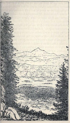
Above: Martand shot by Brian Brake in around 1957.
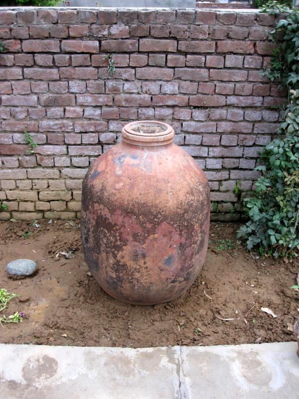
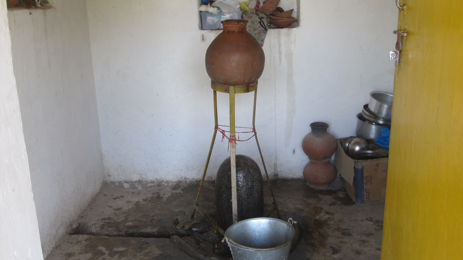
Below: A photograph of an old terracotta Kashmiri vessel brought to Jammu along with other things. Shared around two years ago by Man Mohan Munshi ji.
-0-

in bits and pieces
Above: Martand shot by Brian Brake in around 1957.
Below: A photograph of an old terracotta Kashmiri vessel brought to Jammu along with other things. Shared around two years ago by Man Mohan Munshi ji.
-0-
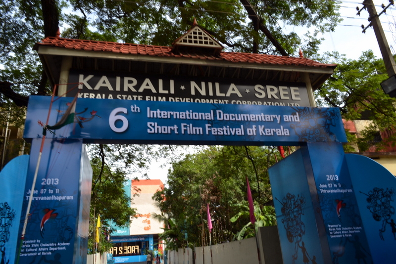

I spent this Sunday doing nothing but watching films and just films. Traveled from Cochin to Trivandrum to catch some short films made by Kashmiris on the “Pandit” experience.
First up was in “showcase” segment Siddharth Gigoo’s The Last Day (12 min.). Siddharth Gigoo was already was a poet, then a novelist and now he is a filmmaker. The scene he picked to shoot is something that a lot a pandit’s witnessed and can relate to. Old pandits slow dying in Jammu with fading memories of Kashmir. The execution is simple. Not bad for a first attempt.
Second up was Rajesh Jala’s 23 Winters (30 min.), competing in ‘Fiction’ category. The story follows the “Back to Kashmir” trip of a pandit in Delhi named Bhota (a popular nickname among pandits of a certain generation) who is suffering from schizophrenia. It makes strong use of visuals and sounds to put the viewer in the mind of the protagonist. The experience is unnerving. Specially when you know it is not fiction.
The director was present at the function, so later had a little chat with him over a coffee (which he generously sponsored). Rajesh Jala was living with the real life protagonist Bhota as a neighbor in a Delhi camp for nine years. When he started shooting him last year, he didn’t know Bhota was going to visit Kashmir and have a breakdown. Rajesh went back to Kashmir to trace him and get him medical help.
I could hear sneers in the hall during the screening. Rajesh probably heard that. Even though I didn’t ask, he did mention its not a film for everyone and its the only way he could have made this film.
The use of radio sounds in the film reminded me of a little video I made around 4 years ago:
In addition to these two movies, there was Firdous/Paradise (11 min) by Tushar Digambar More. What this film offers is the ‘military’ experience of Kashmir. The episode takes place inside an abandoned Pandit house where a group of troops and a local Muslim villager, under some sort of protective custody, take shelter during a “cordon and search” operation. Here they share a brief conversation on the former owners of the house. By the end of the story we realize, unknown to him, the helpful and decent villager has lost his house to the operation.
The surprise for me in this little film was a sequence in which an officer goes through an old family album he finds in the house. The bits and pieces from this blog have again helped someone fill a gap.
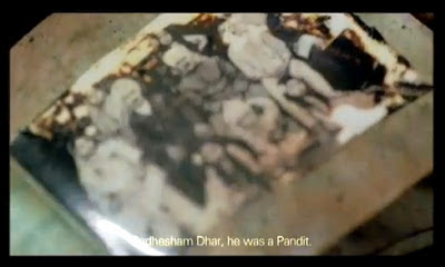 |
| A screenshot from the film |
 |
| Photograph of of a Kashmiri Pandit Family taken in front of their farm house at a stones throw from the famous Neolithic site of Burzahom, Kashmir in 1930s. Shared by a reader, Man Mohan Munshi Ji, in 2010 |
Although the makers didn’t give credit or a line of thanks. Some of those images are from this this blog. Some from vintage books. Some shared generously by readers from their private albums.
-0-
Oddly enough there was a Bulgarian film too that somehow reminded me of Kashmir. Tzvetanka by Youlian Tabakov (66 min). This stylish documentary tells the story of modern Bulgaria, mapping it to the events in the life of a girl born in a bourgeois family just before World War 2. By the end of the war, her idyllic life is destroyed with the coming of communist regime. The regime ends in 1989, democracy comes, she thinks the world will now be a better place. It turns out to be a mirage. She realizes world is still the same. It’s the same men from the regime now championing the cause of democracy. Revolution came and nothing changed. It is clear that this woman has seen a lot in her life and yet her love for life is unshakable and inspiring.
-0-
-0-
After catching these films (and around 15 others), I headed further south to Kanyakumari. Where I was greeted by this:
-0-
 |
| The Shiva temple at Naran Bagh with the Muslim Pujari |
 |
| Shivling inside the temple |
 |
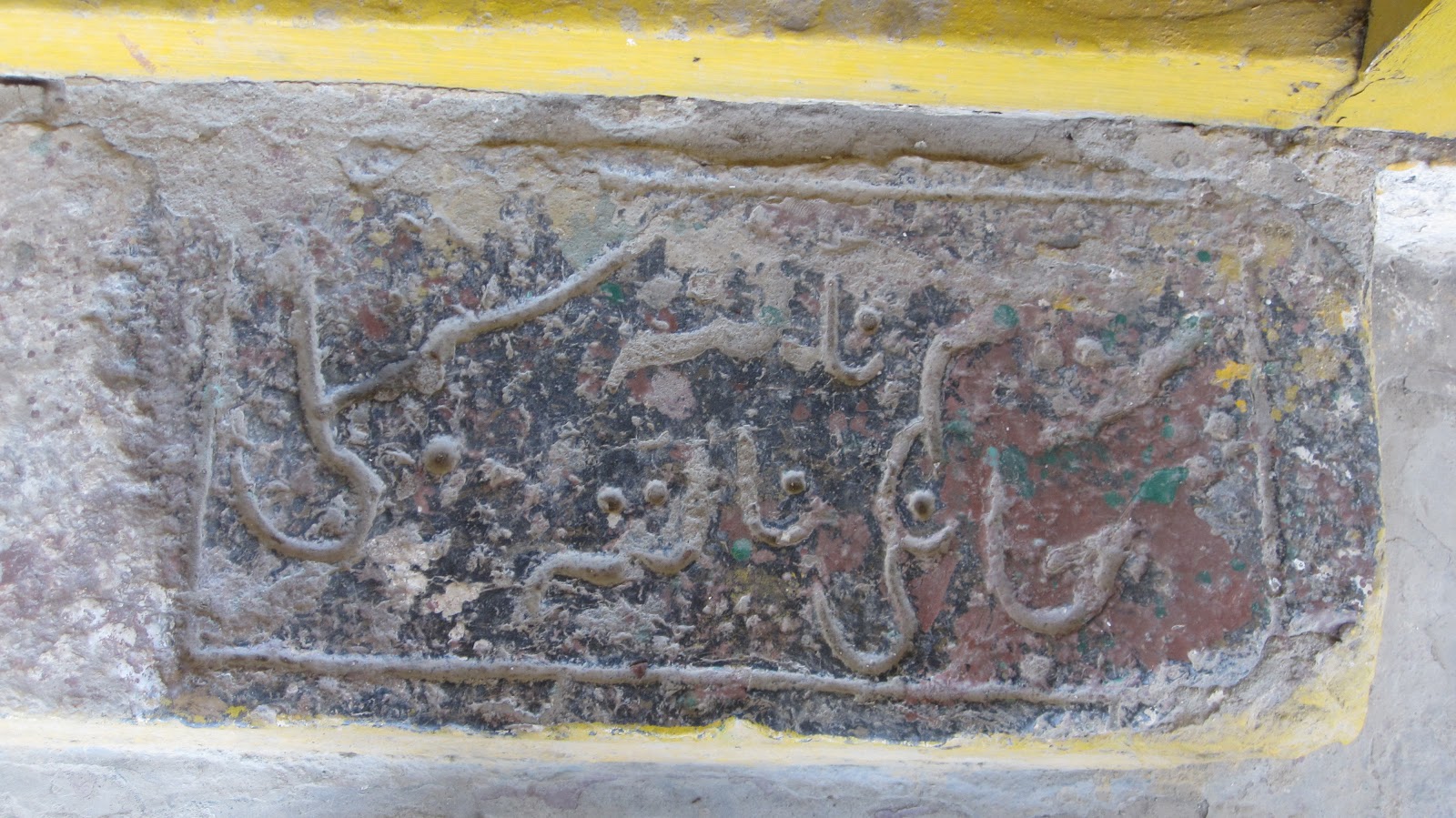
| Memorial stone of Resh Bhat Sahaib |
 |
| Footstep in front of the temple reads Janki Nath Sumbli [Rest is illegible] |
-0-
 |
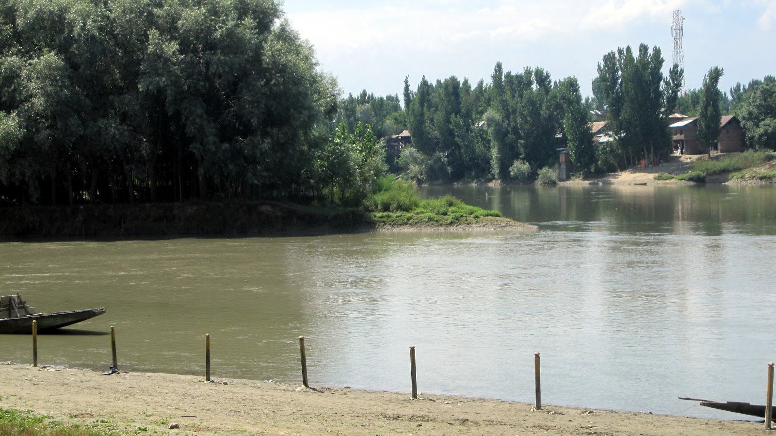
| The present Vitasta -Sindhu -Samgama the conflunce of Jhelum and Sind rivers at Naranbagh near Shadipur. The river in the left foreground with greyish coloured water is the Sind river and the other with the bluish green coloured water in the right background is the Jhelum. Suyya the able engineer of King Avantivarman by his skill shifted the position of Vitastasindhusamgama from Parihaspura Trigami area to its present location in the vicinity of Sundribhavana (Naran Bagh) by forcing the course of Vitasta north east wards by blocking its original course with embankments to reclaim the cultivable land from flood prone areas and marshes. A Vishnu temple by the name of Yogavasmin was also built by Suyya at the instance of Avantivarman. |
 |
| The solitary Chinar standing in water in the immediate vicinity of the confluence is considered holy and compared to the holy fig tree at Triveni near Allahbad |
-0-
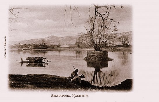 |
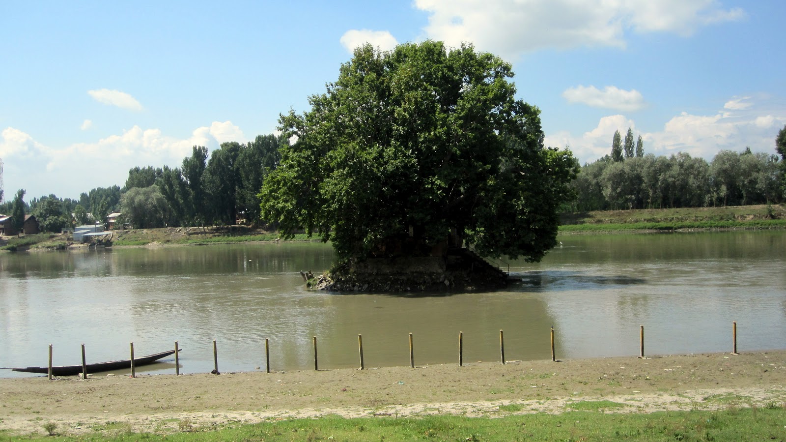
| The Chinar tree at Shadipore in a photograph by Fred Bremner. 1905 |
-0-
Preyaghuch buni nah thadan nah lokan nah badan.
The chinar of preyag neither become taller, nor shorter, nor bigger.
A poor sickly child, who does not grow or become fat.
An explanation about the Chinar tree of prayag that can be found in the book ‘A Dictionary of Kashmiri Proverbs and Sayings’ by James Hinton Knowles (1885):
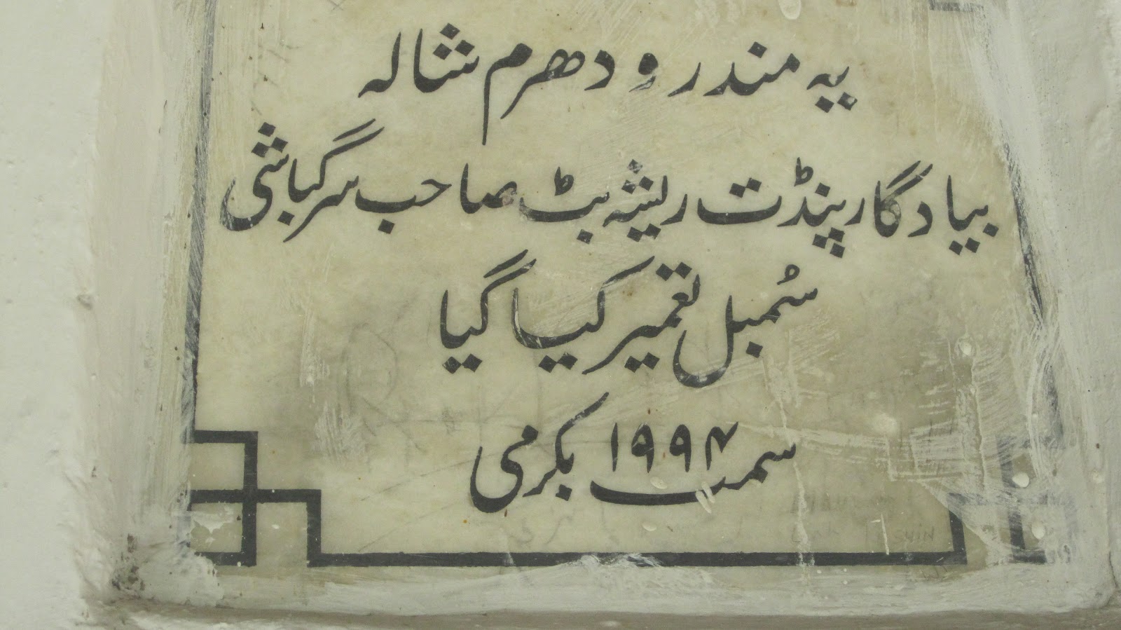
This chinar tree is in the middle of a little island just big enough to pitch your tent on, in the midst of the Jhelum river by the village Shadipur. The Hindus have consecrated the place, and a Brahman is to be seen twice every day paddling himself along in a little boat to the spot, to worship and to make his offerings.
This chinar tree at Shadipur is believed to be the (sangam) confluence of rivers Indus (Sind) and Jhelum (Vitasta) and is called `Prayag’ by Kashmiri pandits – alluding to Prayag that is Allahabad where Yamuna and Ganga meet up. Kashmiri Pandits used to immerse the ashes and remains of their dead at this spot.
-0-
Previously: Kashmiri Proverbs borne of Chinar tree
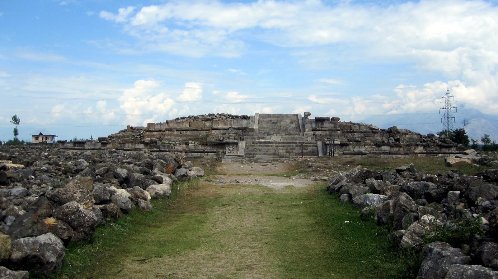
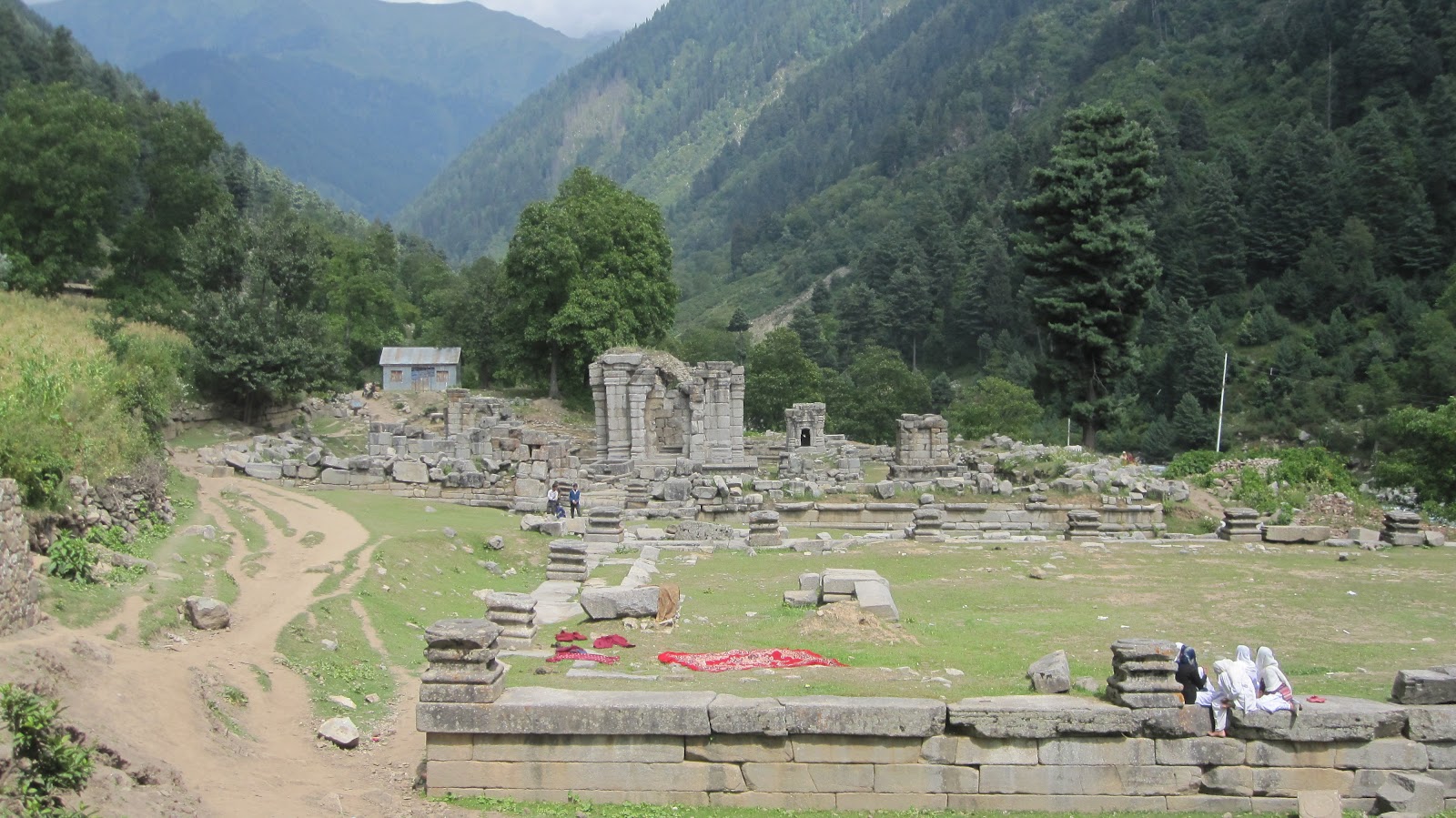
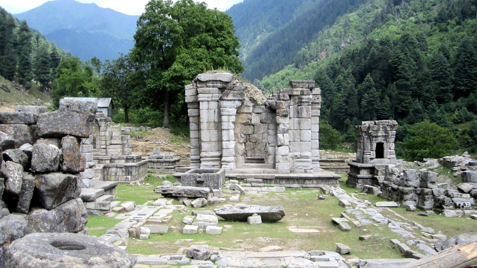
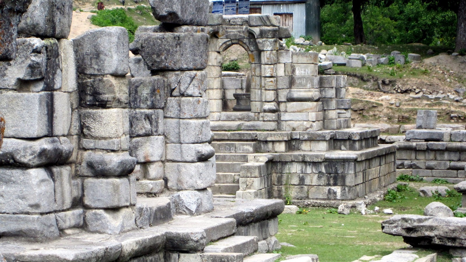
 |
| Distant view of Govardanadhara temple |
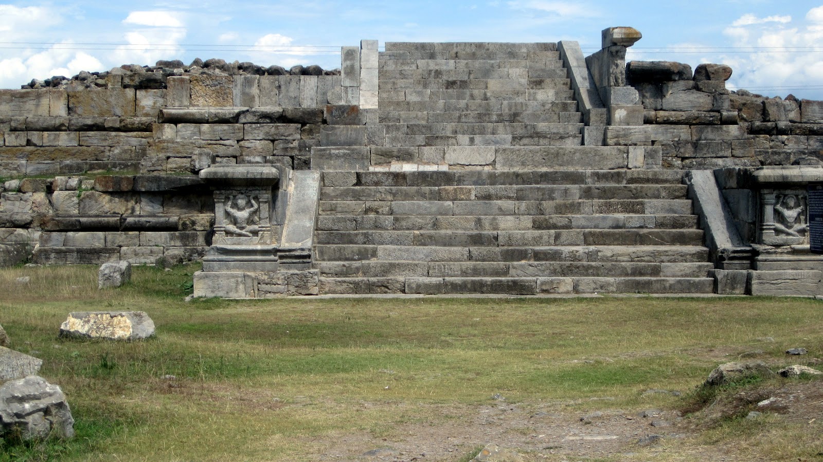 |
| Closer view of the ruins only staircases and plinth is left |
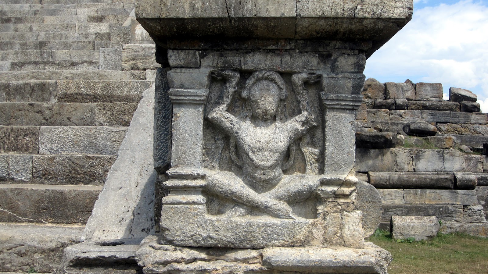
 |
| Only surviving statues |
 |
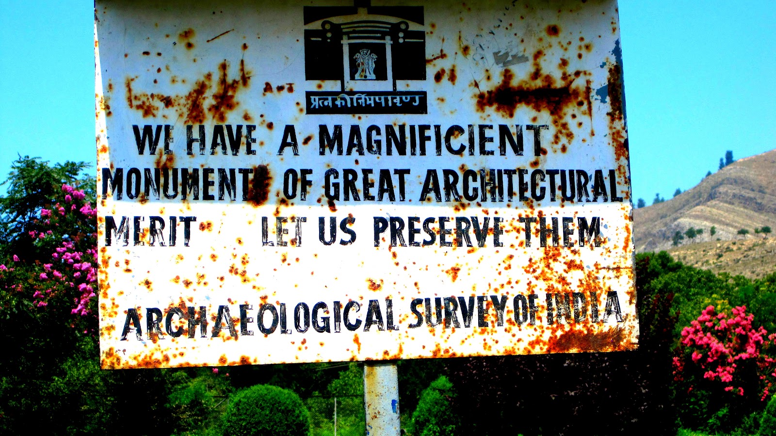
| ASI Notice Board |
-0-
To these images I am adding following notes:
Note on the ancient site by Pandit Anand Koul from his book ‘Archaeological Remains In Kashmir’ (1935) . [You can read the complete book here]:
Ruins at Paraspur
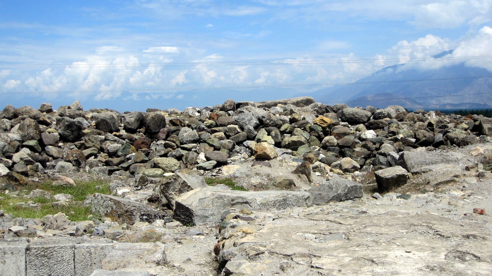
The site of ancient Paraspur (Parihasapura) lies nearly 2 1/2 miles south-west from Shadipur. On leaving the boat one crosses some corn field and, after ascending a gradual slope and passing through Trigam, reaches the plateau on which the ancient mounds rise. This city, says Kalhana, was founded by Lalitaditya Muktapida (A.D. 701-37) one of the greatest sovereigns of Kashmir, and a brief account is given of the five large buildings he erected here viz.,(1) the temple of Mukta-keshva with a golden image of Vishnu, (2) the temple of Parihasa-keshava with a silver image of Vishnu.(3) the temple of Mahavaraha with its image of Vishnu clad in golden armour, (4) the temple of Govardhanadhara with a silver image and (5) the so-called Rajavihara with a large quadrangle.
Here was a colossal statue of Buddha in copper. The confluences of the Sindhu and Vitasta was at this place inn ancient times. It was a very renowned place in by-gone days. There are many ruins of ancient temples still found in and near it, e.g.(1) temple ruins at Paraspur, (2) well preserved foundation of the temple of Vainya-swamin on the Paraspur Udar, near Ekmanpur, and (3) ruins at Malikpur. Of the temples to the west of Divar village there remains only a confused mass of huge blocks. The quadrangle too is utterly ruined and traceable only by wall foundations and broken pillars, etc. The large dimensions of these temples are indicated by the fact that the peristyle of the one further to the west formed a square of about2 75 feet. and that of the other an oblong of 230 feet by 170 feet. There are other ruined temples at this place, but they are all in a state of destruction. On the top of the mound lies a block remarkable for its size, being 8 1/2 feet square and 4 1/2 feet in height which, to judge from the large circular hole cut in its centre, must evidently have formed the base of a high column, or of a colossal image. The character of the ruins at Divar agrees exactly with that of the shrines mentioned in Kalhana’s account.The shrine Vainya-swamin can be recognized with certainty in the ruined temple at Malikpur, one mile from the northern group of the Divar ruins. Sir Aurel Stein writes in the Rajatarangini about this place: –
“The vicissitudes, through which Parihaspura has passed after the reign of Lalitaditya, explain sufficiently the condition of utter decay exhibited by the Divar ruins. The royal residence, which Lalitaditya had placed at Parihasapura, was removed from there already by his son Vajraditya. The great change of the Vitasta, removed the junction of this river with the Sindhu from Parihasapura to the present Shadipur,nearly three miles away. This must have seriously impaired the importance of Parihasapura. Scarcely a century and a half after Lalitadiya’s death,King Shankaravarman (A.D. 883-901) used materials from Parihasapura for the construction of his new town and temples at Pattan. Some of the shrines, however, must have survived to a later period, as we find the Purohitas of Parihasapura referred to as an apparently influential body in the reign of Samgramaraja (A.D. 1003-28). Under King Harsha the colossal Buddha image of Parihasapura is mentioned among the few sacred statues which escaped being seized and melted down by that king. The silver image of Vishnu Parihasakeshava was subsequently carried away and broken up by King Harsha. The final destruction of the temple of Parihasapora is attributed to Sikandar But-Shikan (A.D. 1394-1416).Even up to the year 1727 A.D. the Paraspur plateau showed architectural fragments of great size, which have since been carried away as building materials.It is interesting to find that these ruins were yet at a comparatively so recent time generally attributed to Lalitaditya’s building”
-0-
Aurel Stein made a spot visit to Paraspora in Sept. 1892. There he traced the actual ruins of the building describedin the Rajatarangini. These remains were situated near the village Sambal on a small plateau (Udar) between themarshes of Panznor and village Haratrath. Stein identidied five great buildings which Lalitaditya had erected at Parihaspura. These were identified as Parihasakeswa, Mukatakeswa, Mahavaraha, Govardhanadhara and Rajavihara.The first four were temples dedicated to worship of Vishnu and the last named was a Buddhist convent. However whenrevisiting the site in May 1896, Stein found many of the stones missing that existed in 1892. On inquiry heleared that these stones were taken away by the contractors engaged in building the new Tonga road to Srinagar.To prevent such callous damage that was being caused to these relics of past, Stein made a representation to theResident Sir Adelbert Talbot for urgent need of protecting the remains. The Resident supposted his petition andeffective steps were ordered by the Maharaja to prevent repetion of similar vandalism
~ via siraurelstein.org
-0-
Note on the site from ‘Ancient Monuments of Kashmir’ (1933) by Ram Chandra Kak.[Read the complete book here at KOA]:
 |
| Plate LV |
The karewas of Paraspor and Divar are situated at a distance of fourteen miles from Srinagar on the Baramula road. They were chosen by King Lalitaditya (c. A.D. 750) for the erection of a new capital city, and it is certain that, given a sufficient supply of drinking water, the high and dry Plateaus of Parihasapura have every advantage over the low, swampy Srinagar as a building site. Lalitaditya and his ministers seem to have vied with each other in embellishing the new city with magnificent edifices which were intended to be worthy alike of the king’s glory and the ministers’ affluence. The Plateau is studded with heaps of ruins of which a few have been excavated. Among these the most important are three Buddhist structures, a stupaj a monastery, and a chaitya. Their common features are the enormous size of the blocks of limestone used in their construction, the smoothness of their dressing, and the fineness of their joints. The immense pile at the north-eastern corner of the Plateau is the stupa (Plate LV) of Chankuna, the Turkoman (?) minister of Lalitaditya. Its superstructure has entirely disappeared, leaving behind a huge mass of scorched boulders which completely cover the top of the base. There is a large massive block in the middle of this debris, which has a circular hole in the middle, 5′ deep. It is probable that this stone belonged to the hti (finial) of the stupa, and that the hole is the mortice in which was embedded the lower end of the staff of the stone umbrellas which crowned the drum.
The base is 128′ 2″ square in plan, with offsets and a flight of steps on each side. Its mouldings are of the usual type, a round torus in the middle and a filleted torus as the cornice. The steps were flanked by plain rails and side walls which had pilasters in front decorated with carved figures of seated and standing atlantes. Some of these are in position, while others, which were lying about loose, have been transported to the Srinagar Museum. They are not grotesque creatures like those so commonly seen in Gandhara, but have the appearance of ordinary respectable gentlemen, whose placid features seem to indicate that the superincumbent weight sits lightly upon them. The top surface of each of the two plinths is broad and affords adequate space for circumambulation. Among the loose architectural stones lying scattered about the site are a few curious blocks in the south-eastern and south-western corners. They are round torus stones adorned with four slanting bands or fillets running round the body. As this type of torus moulding is not used in either of the bases, it is probable that it belonged to the string-course on the drum of the stupa. There are fragments of trefoiled arches also, which contained images of the Buddha and Bodhisattvas.
The large square structure to the south of the stupa is the rajavihara, or royal monastery. A flight of steps in the east wall gives access to one of its cells which served as a verandah. The monastery is a quadrangle of twenty-six cells enclosing a square courtyard which was originally paved with stone flags, some of which are extant. In front of the cells was a broad verandah, which was probably covered, the roof being supported by a colonnade which ran along the edge of the plinth. A flight of steps corresponding to the one mentioned above leads down to the courtyard. Exactly opposite to this, in the middle of the west wall, are three cells preceded by a vestibule, which is built on a plinth projected into the courtyard. It is probable that these were the apartments occupied by the abbot of the monastery. Near a corner of it is a large stone trough, which may have served as a water reservoir for bathing purposes. A couple of stone drains passing underneath cells Nos. 18 and 21 (if we begin counting from the cell to the south of the entrance chamber) carry off the rain and other surplus water from the courtyard. Externally the plinth is about 10′ high. In cell No. 25 (that is the one to the north of the entrance chamber) was found a small earthen jug which contained forty-four silver coins in excellent preservation. They belonged to the time of kings Vinayaditya, Vigraha, and Durlabha. They are now exhibited in the Numismatic Section of the Srinagar Museum. The monastery was repaired at a subsequent period. The repairs are plainly distinguishable in the exterior of the wall on the eastern and western sides.
The building next to it on the south side is the chaitya built by Lalitaditya. It stands on a double base of the usual type. A flight of steps on the east side leads to the entrance, which must originally have been covered by a large trefoil-arch, fragments of which are Iying about the site. This building possesses some of the most massive blocks of stone that have ever been used in Kashmiri temples, and which compare favourably with those used in ancient Egyptian buildings. The floor of the sanctum is a single block 14′ by 12′ 6″ by 5′ 2″.
The sanctum is 27′ square surrounded by a circumambulatory passage. It is probable that its ceiling was supported on four columns, the bases only of which survive at the four corners. The roof, which was probably supported on the massive stone walls of the pradakshina, may have been of the pyramidal type.
The courtyard is enclosed by a rubble-stone wall which has nothing remarkable about it. In front of the temple steps is the base of a column which probably supported the dhvaja, or banner, bearing the special emblem of the deity enshrined in the sanctuary.
The flank walls of the stair were adorned with atlantes similar to those of the stupa.
Near the chaitya is the foundation of a small building of the diaper-rubble style.
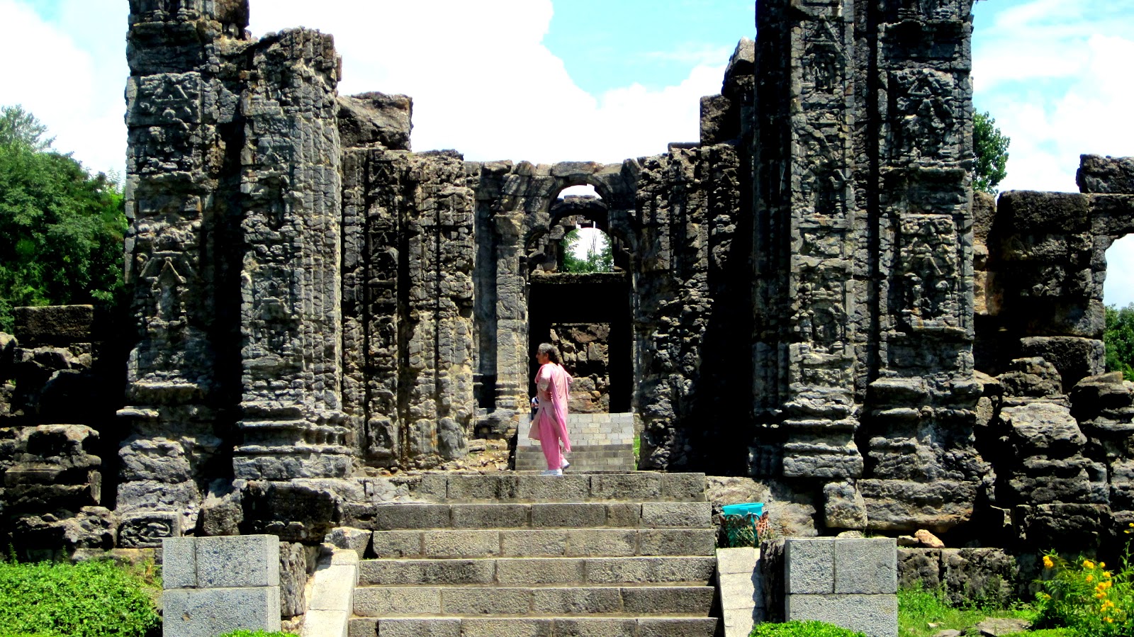
While this Plateau was reserved for the erection of Buddhist buildings only, the other two were exclusively appropriated by Hindus. Perhaps the arrangement was intentional, to avoid possible friction between the two powerful religious bodies. On the karewa locally known as Gordan there are ruins of a Hindu temple which are probably all that remain of Lalitaditya’s temple of Govardhanadhara. Crossing the ravine in which nestles the little village of Diwar- Yakmanpura, and ascending the Plateau opposite, are seen the immense ruins of two extraordinarily large temples – one of them has a peristyle larger than that of Martand – which may represent Lalitaditya’s favourite shrines of Parihasakesava and Muktakesava.
-0-
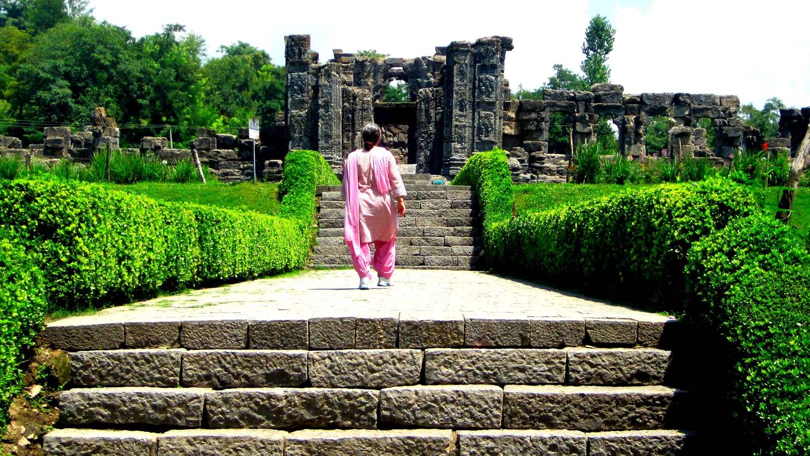
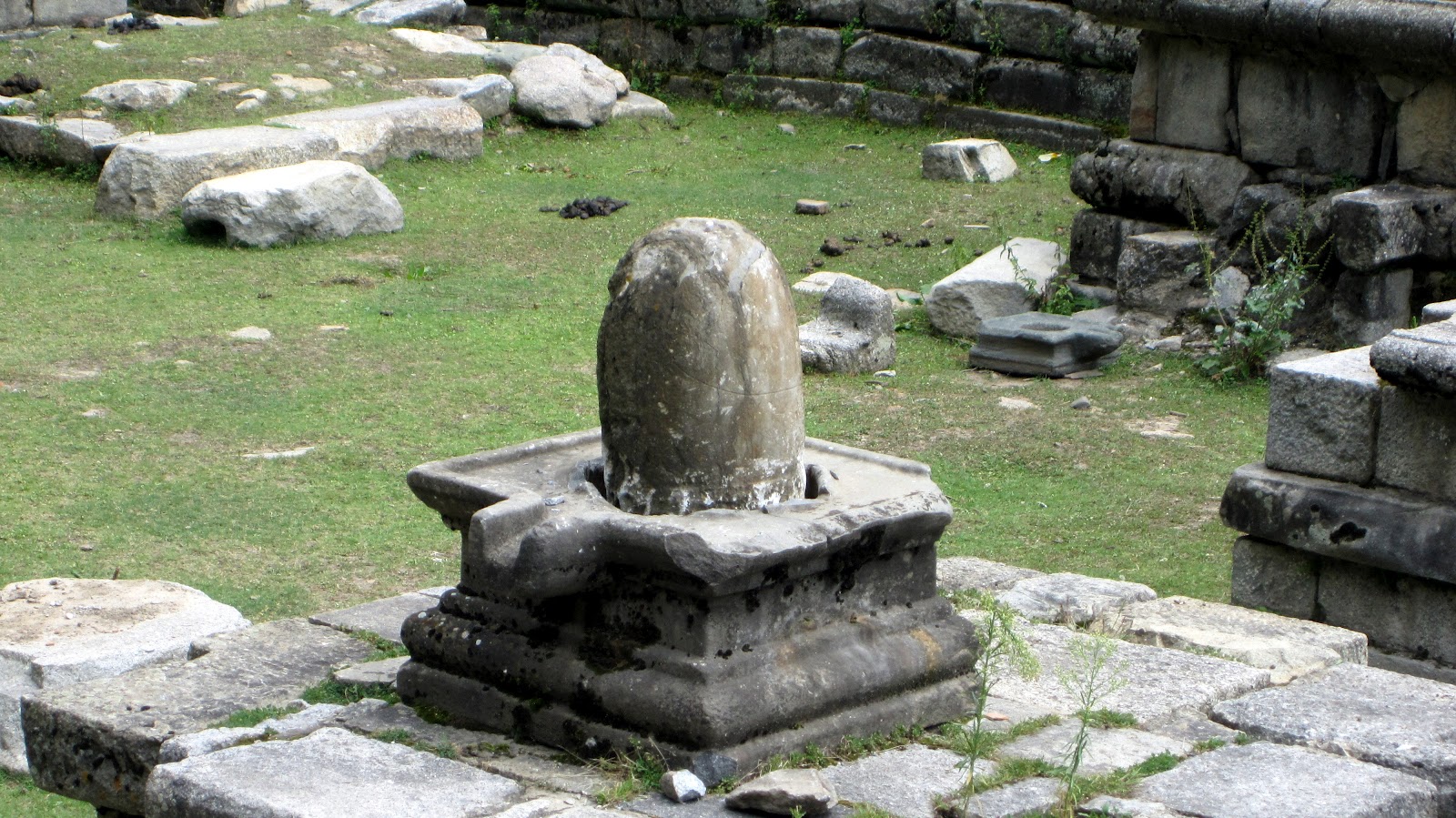
The famous sun temple of Martand built by Laltaditya Mukhpida of the Karkota dynasty during the 8th century on an arid Karewa (Vudar) between Mattan and Achibal. It is believed that Laltaditya build a township of Martanda Desa for which he brought water by the Martand Canal from the Lidar river. The location of the temple/township was selected as it provided a beautiful view of the sunset behind the snowy peaks of Pir Panjal Range. But the view of sunset from the temple is now blocked by hefty overgrown Chinars of the Ranbir Pur Village immediately west of the temple.

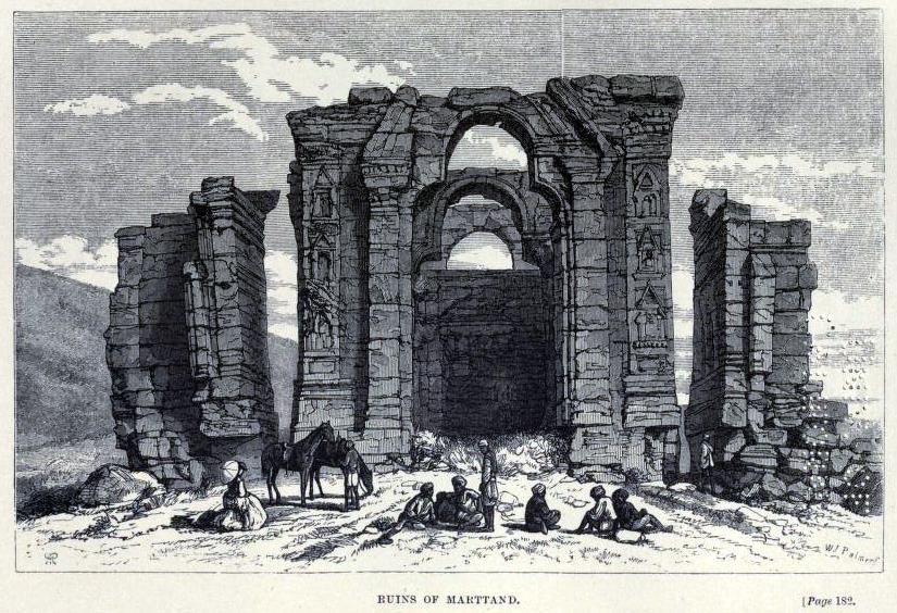 |
| 1870
-0- |
Previously:
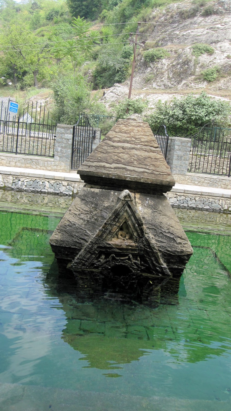
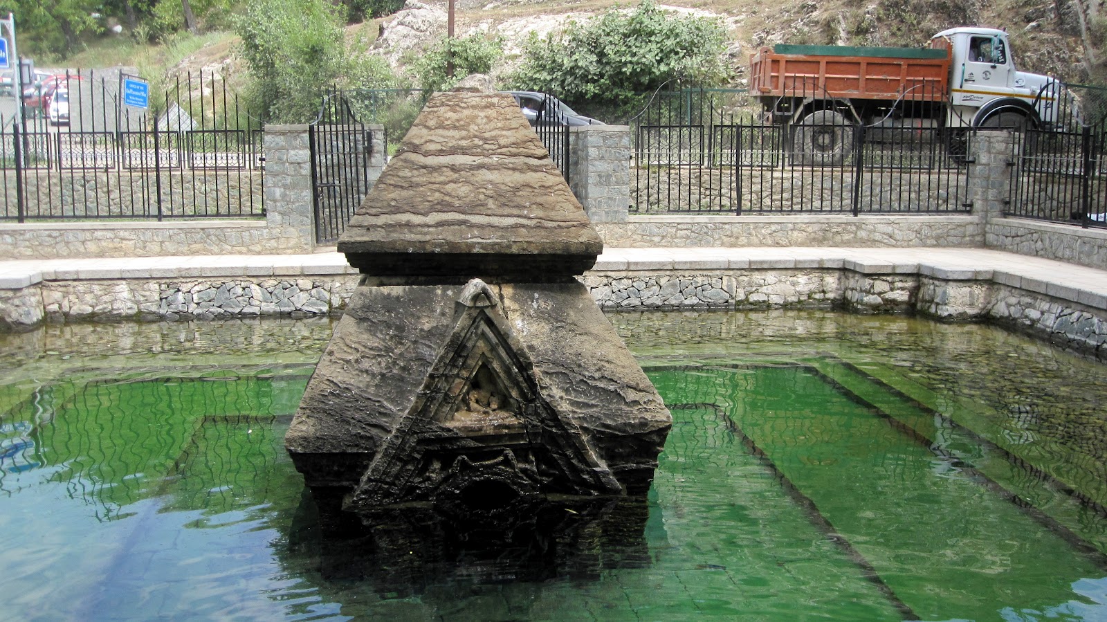
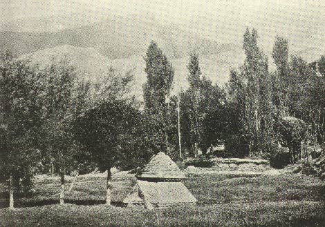
Man Mohan Munshi Ji shares photograph of Submerged ancient temple at Manasaras (Manasbal). It is an ancient spot recently re-discovered and re-claimed. About the place he says:
 The temple is an ancient one but not much is known about its antiquity. Some time back it was reported in the print media that it was recently uncovered. I visited the place last month and found that a parapet and fence was built around it but the level of water has remained the same and water was oozing out from an underground spring. I took a plunge inside the water logged temple and felt with my hands about one foot tall Shivling inside the temple.
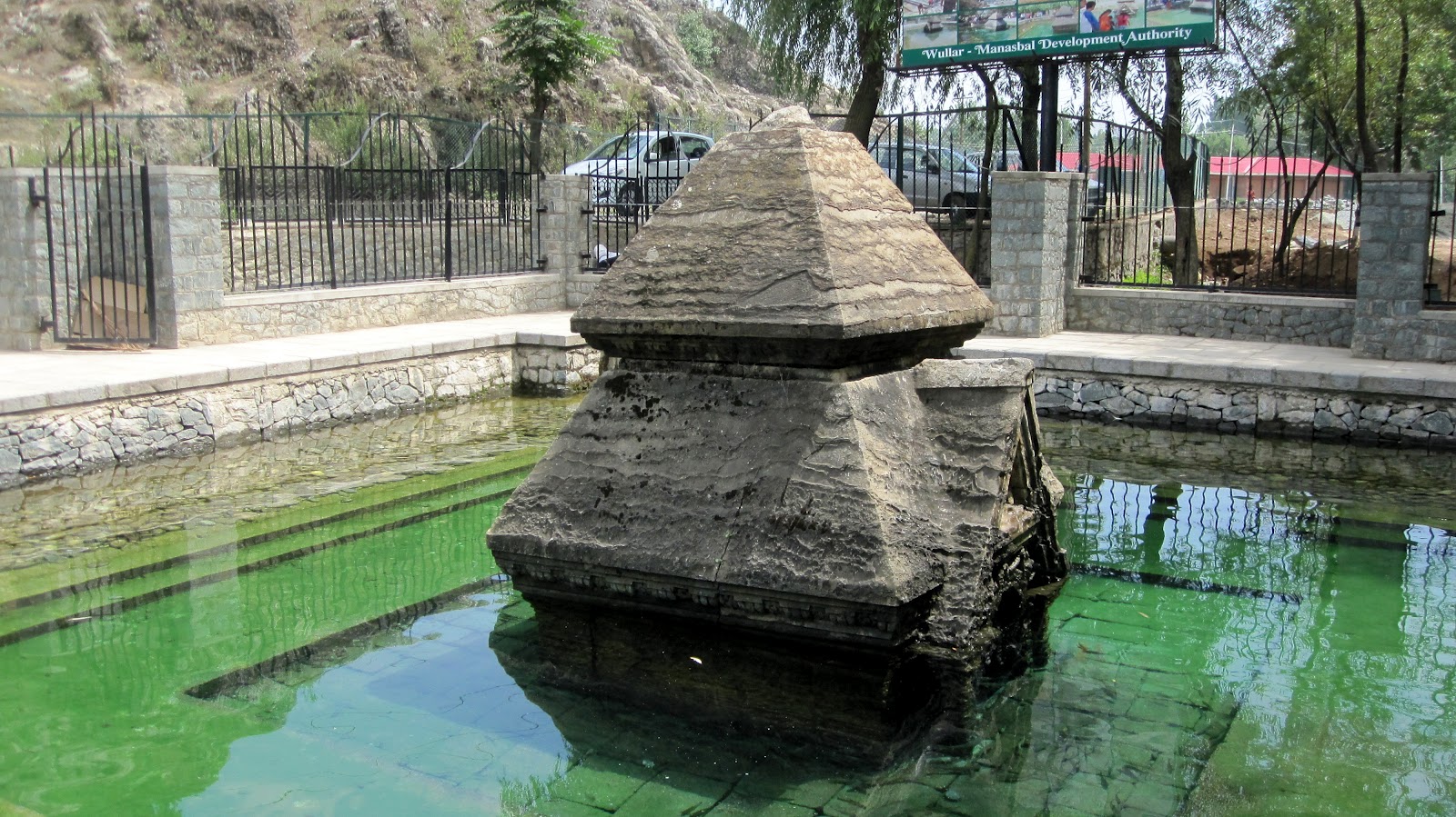
-0-
To these photographs I am adding following old note:
“One of the most attractive places in the valley is the Manasbal lake. Being absolutely free from disturbance of any kind, and nestling in an oval basin surrounded on all sides by hills and uplands, the lake is an ideal abode for the happy lotus-eater, who dreams away his days reclining under the shady chinar, and passes his evenings in watching the long streaks of moonlight flitting across the mirror-like surface of the water. Naturally, such a delightful spot would not have been overlooked either by the devout Hindu or the nature- adoring Mughal. The former have left a small temple, now partially submerged during the greater part of the year. It is a very small structure, and only its two pyramidal roofs are visible in the driest seasons. The cornice of the lower roof, and the horizontal band which divides it from the upper storey, are decorated with series of dentils and metopes. Only the upper part of the pediment of the entrance is visible. It faces west.
~ Ancient Monuments of Kashmir (1933) by Ram Chandra Kak.[Read the complete book here at KOA]
-0-
Note on the temple by Pandit Anand Koul from his book ‘Archaeological Remains In Kashmir’ (1935) . [You can read the complete book here]:
Miniature Temple at Manasbal
At the south-east cornner of the lake of Manasbal is a miniature temple built of stone, standing in the water.
The temple appears to be a square of about six feet and has only one doorway to the west covered by a pyramidal pediment, which is divided into two portions by a horizontal return of the said mouldings as in the case of the Martanda colonnade. The upper portian is occupied by the head and shoulder of a figure holding a sort of staff in the left hand. The angles of the lower portion of the doorway pediment, below the horizontal moulding and above the trefoil, are occupied each with a naked figure leaning against the head of the trfoil, and holding up over the arch a sort of waving scarf which is passed on through the other hand.
-0-
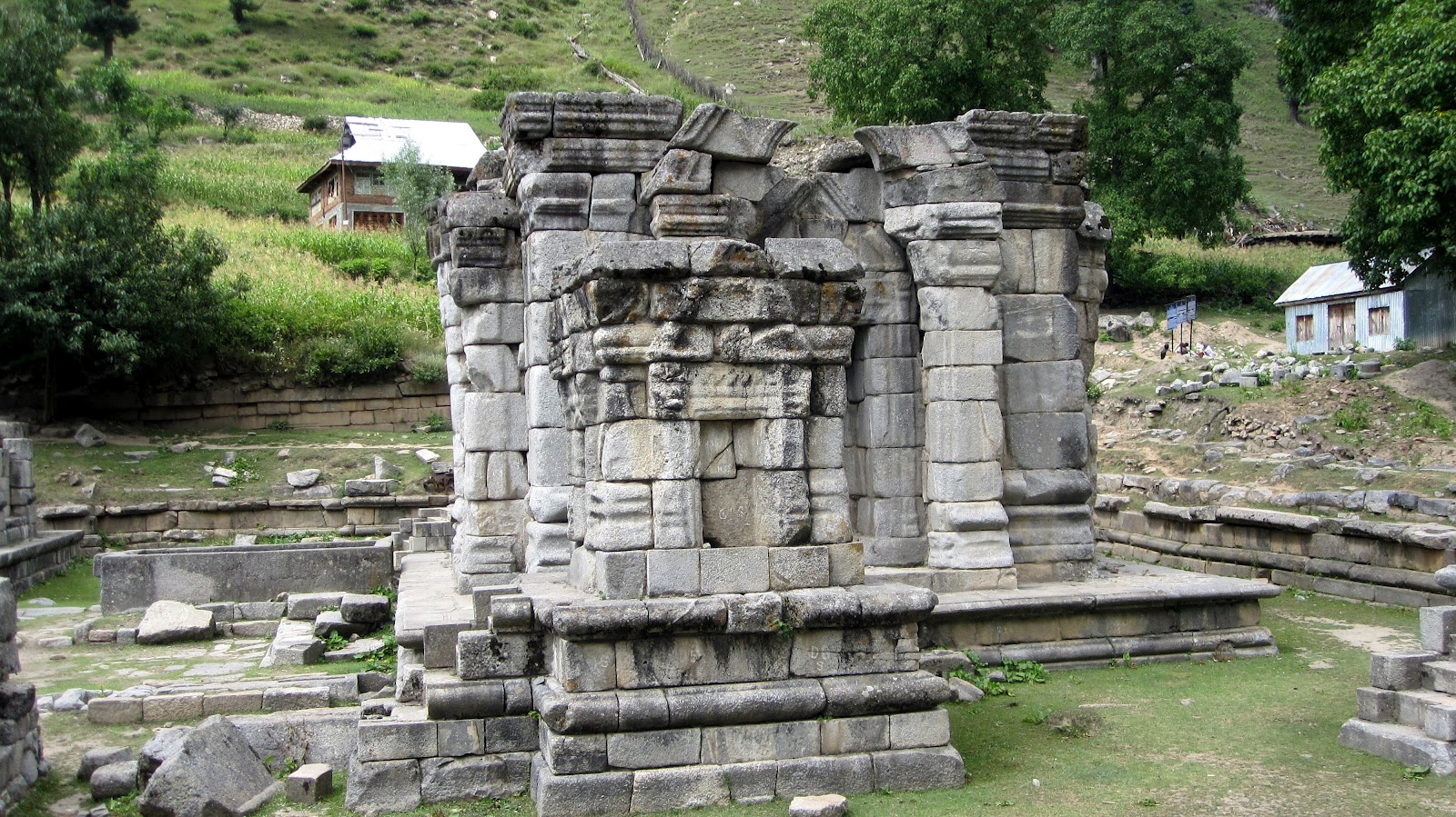
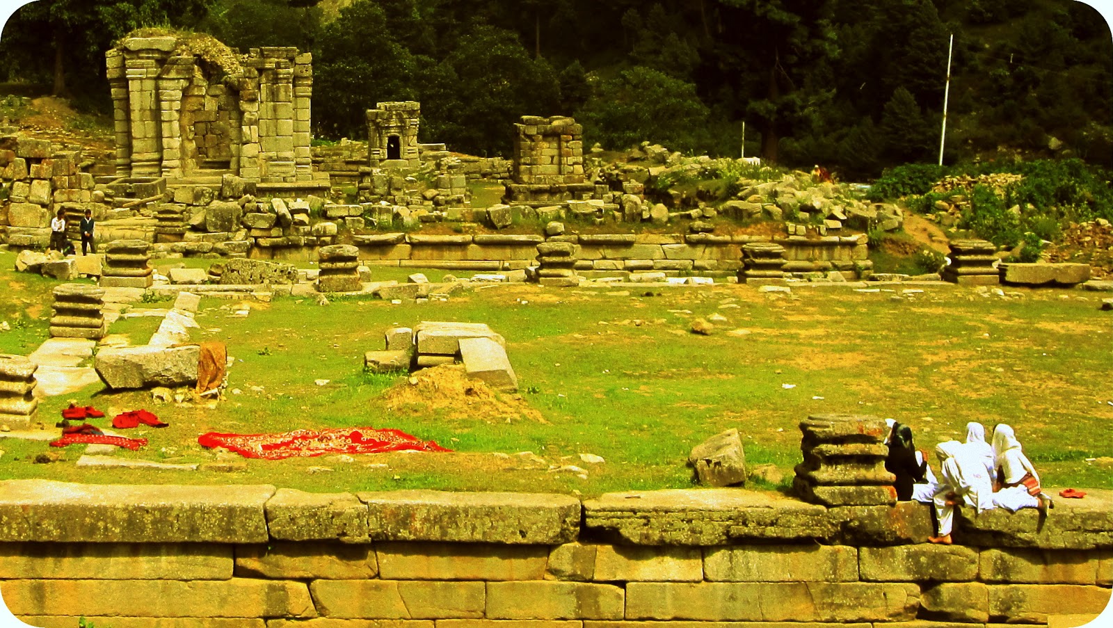
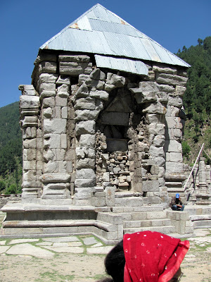
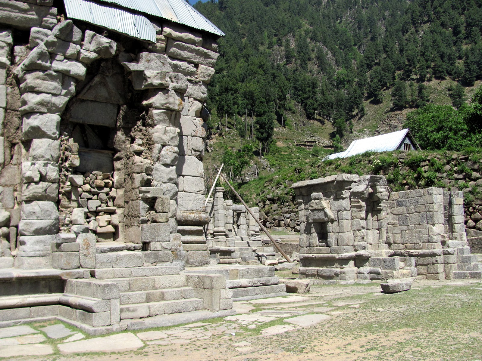
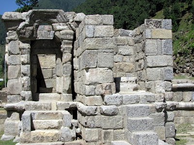
A number of ruins of ancient temples exist at Narang Nag near Wangat locted by the side of Kankahini (Krenk Nadi) above the township of Kangan in Sind valley. It is believed that these temples were built by well to do Pilgrims as a thanks giving for successful yatra of Haramukh above Utrasaras (Gangabal).

-0-
To these photographs I am adding a note on Naran Nag temple complex by Pandit Anand Koul from his book ‘Archaeological Remains In Kashmir’ (1935) . [You can read the complete book here]:
“Five miles to the east of Vangat (Vasishtbashrama) higer up in the Sindh Valley, there are some
ruined temples near the spring called Naran Nag, at the foot of the Bhutsher or Bhuteshvara spur of
the Haramukuta peaks. They are in two groups, situated at a distance of about 100 yards from each other.
The locality of these temple nearer Vangat is known by the name of Rajdhani, or metropolis.
This group consists of six buildings, all more or lss ruined, and the remains of an enclosing wall, measuring
176 feet by 130 feet, may still be traced, although there is no evidence of the form it originally had.
The largest temple of the group measures 24 feet square and has a projection on each of its four sides, measuring
3 feet by 15 1/2 feet 6 in. The main blovk is surmounted by a pyramidal roof of rubble formerly, no doubt, faced with stone; and
the gables which terminated the porch-like projections on all four sides, can still be traced. Ther are two entrances facing east
and west. Not far from the group is a platform, rectangular in shape, (100 feet by 67 feet) which appears to have been
the basement of some building or temple. A colonnade once existed all round it – numerous bases of pillars are to be seen in their
places on one of the longer sides of the rectangle, and several fragments of fluted columns are lying about, their average diameter being
two feet.
About 20 yards to the north-east of the platform are the ruins of the second group of temples, eleven in number, with the remains of a gateway
in the centre about 22 feer wide, similar to that belonging to the first group. The principal one among them is 25 feet square with projections
on each face.
A mass of stone measuring 22 feet by 7 feet shaped into a tank for water, exists on the south face of the principal temples.
The whole group is encircled by the remains of a rectangular wall of which the foundation can be traced, together with several bases of pillars;
and at the N.W. corner is a large tank of stone, full of cold and clear water. The dome of the chief temple is of rubble masonry, but all the other
parts of the building are of sculptured stones.
The chief peculiarities of these ruins are the number of temples contained withing the same enclosing wall, and the absence of symmetry in their
arrangement. There is a rock in the middle of the Kankanadi stream, half a mile from here, with a room cut into it which is sufficient to accommodate
four persons. In its centre there is a linga and there is also a niche in one wall.
In antiquity these ruins are supposed to rank next to those on the Shankracharya hill. Major Cole assigned the age of these building to about the commencement of
the Christian era.
The worship of Shiva Bhutesha, the Lord of Beings, localised near the sacred mountain-lake of Haramukuta-Ganga, has played an important part in the ancient religion of
Kashmir. Sir Aurel Stein has been able to show the identity of these temples with the buildings which the Kashmir kings had, at the different periods, raised in honour of
Shiva Bhutesha and the neighouring lings of Shiva Jyeshtesha. The small tank above the ruins, which is now known as Naran Nag, is, according to him, identical with the Sodara
spring mentioned in connection with King Jalauka, son of Asoka, and king Samdhimat-Aryaraja (35 B.C.). A large store pith or seat, 15 feet long 8 feet broad and 6 feet high,
has been recently unearthed near Naran Nag. The eastern group clusters round a temple, which Sir Aurel Stein identifies with the Bhutesha shrine and which, according to Kalhana,
was situated close to that of Bhairava. The western group is, therefore, identical with the temple dedicated to Shiva Jyeshtesa. King Jalauka erected here a stone temple to
Shiva Bhutesha, and made donations to the shrine of Shiva Jyeshtesha.
King Narendraditya Khinnkhila (250-214 B.C.) consecrated shrines to Shiva Bhuteshvara here. If he is identical with Khinkhila, whose reign is known from a coin, he probably
belonged to the 5th or 6th century, so says Dr. Sten Konow. Lalitaditya Muktapida (700-36 A.D.) erected a temple for Shiva Jyeshtesha here, which Sir Aurel Stein thinks is the
is the existing principal shrine in the western group. Kalhana inform us that King Avantivarman (855-83 A.D.) visited this place and made a pedestal with silver conduit for bathing
at Bhutesha. He further relates how the temple was plundered in the days of Jyasimha in Kalhana’s time (1128-49, the date when the Rajatarangini was written). No important additions
were believed to have been made to the building there, and the conclusion one arrives at is that the central shrine of the western group belongs to the 8th century A.D., while others
are older.”
Update: P. Parimoo Ji sends in photographs of the place shot around a year ago on 14th June 2011.
“No sheets were not there during my visit to the place in August but entrances to some of the temples were blocked with wooden planks and crude stone masonry.”

In response to my previous post about short diminutive old Kashmiri women, Man Mohan Munshi Ji recalled an old Kashmiri folktale/song told to him as a kid by his grandmother and mother.
The story goes like this: A crow and a Shod [marijuana addict] were friends and they planned a picnic, got some mutton and cooked it in a lej [Kashmiri pot] on the bank of a stream. Shoda asked the crow to keep watch till he returned after having a wash.The crow out of curiosity lifted the lid [anuit] of the lej but unfortunately fell inside the cooking pot with the lid closed on him. When the Shoda returned he thought that the crow has consumed the mutton and run away. But, when he lifted the lid he saw the dead crow floating along with mutton pieces in the gravy. He was grief-stricken at the loss of his friend and as a sign of mourning shaved off his beard. The stream learning the reason for Shoda’s missing beard dried its water. A deer who came to take water dropped one of its antlers in sympathy. A tree under which the deer used to feed also dropped its branch. A calf also used to come to feed under the tree and after hearing the tragic death of the crow, dropped its tail. The cow after hearing the story from the calf, dried her udder. The milkman in sympathy for the crow cut his finger. His wife after hearing the tragic story, started crying and cut her arm. Then, a camel passed by and after hearing the complete story said, “Both Shoda as well as the crow got what they deserved. Rest of you are fools. What did you gain by doing silly things?”
Here are the Kashmiri lyrics and a translation.
Shoda legeji kaw gow
Crow fell in Shoda’s lej
Shodan dar kas
Shoda shaved his beard
Pokri poin chumrov
Stream dried its water
Hanglan haing trov
Deer dropped its horn
Bran Kuil lang trow
Tree dropped its branch
Vatsth harith lot trov
Calf dropped its tail
Gav maji bab gai kain
Cow dried its udder
Gure chat kis
Milkman cut his little finger
Gure Baie chat nar
Milkmaid cut her arm
Wontan dupnak toi chew fatir
Camel said you are all fools
Toi kiaze karew baif kufi
What did you do silly things?
-0-
 |
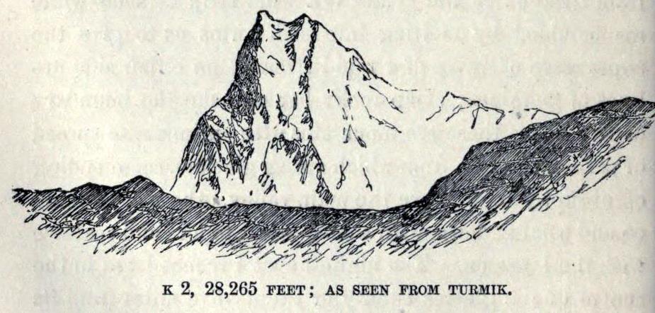
| K2,28,265 feet; as seen from Turmik |
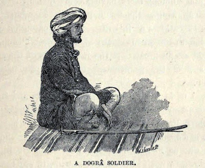 |
| A Dogra Soldier |
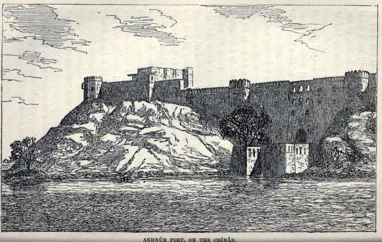 |
| Akhnoor Fort, on the Chenab |
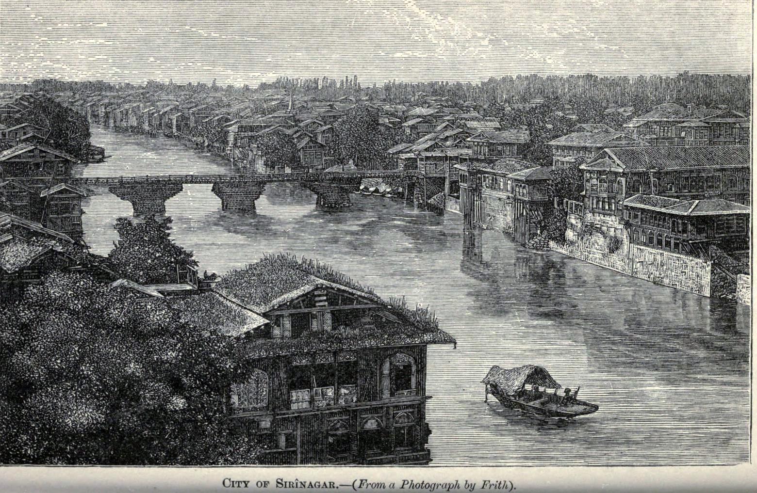 |
| City of Srinagar. From a photograph by Francis Frith |
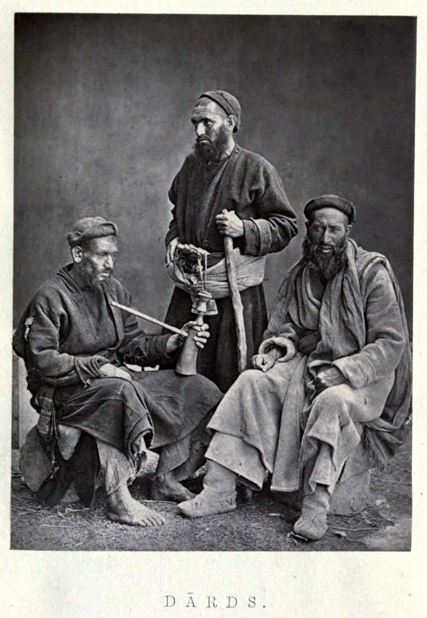 |
| Dards. Photograph by Francis Frith |
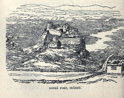 |
| Dogra Fort at Skardu |
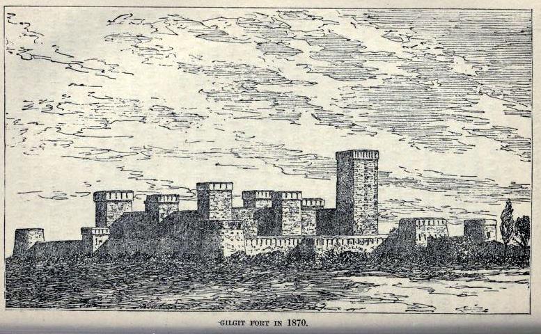 |
| Gilgit Fort in 1870 |
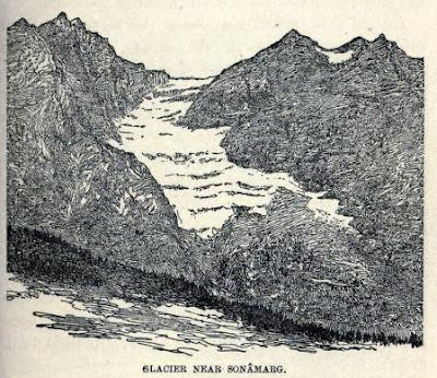 |
| Glacier Near Sonamarg |
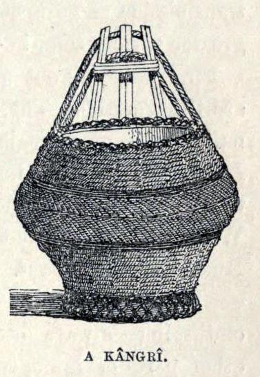 |
| Kangri |
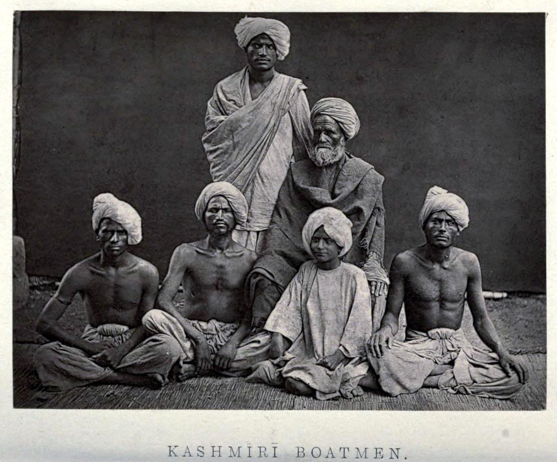 |
| Kashmiri Boatmen. Photograph by Francis Frith |
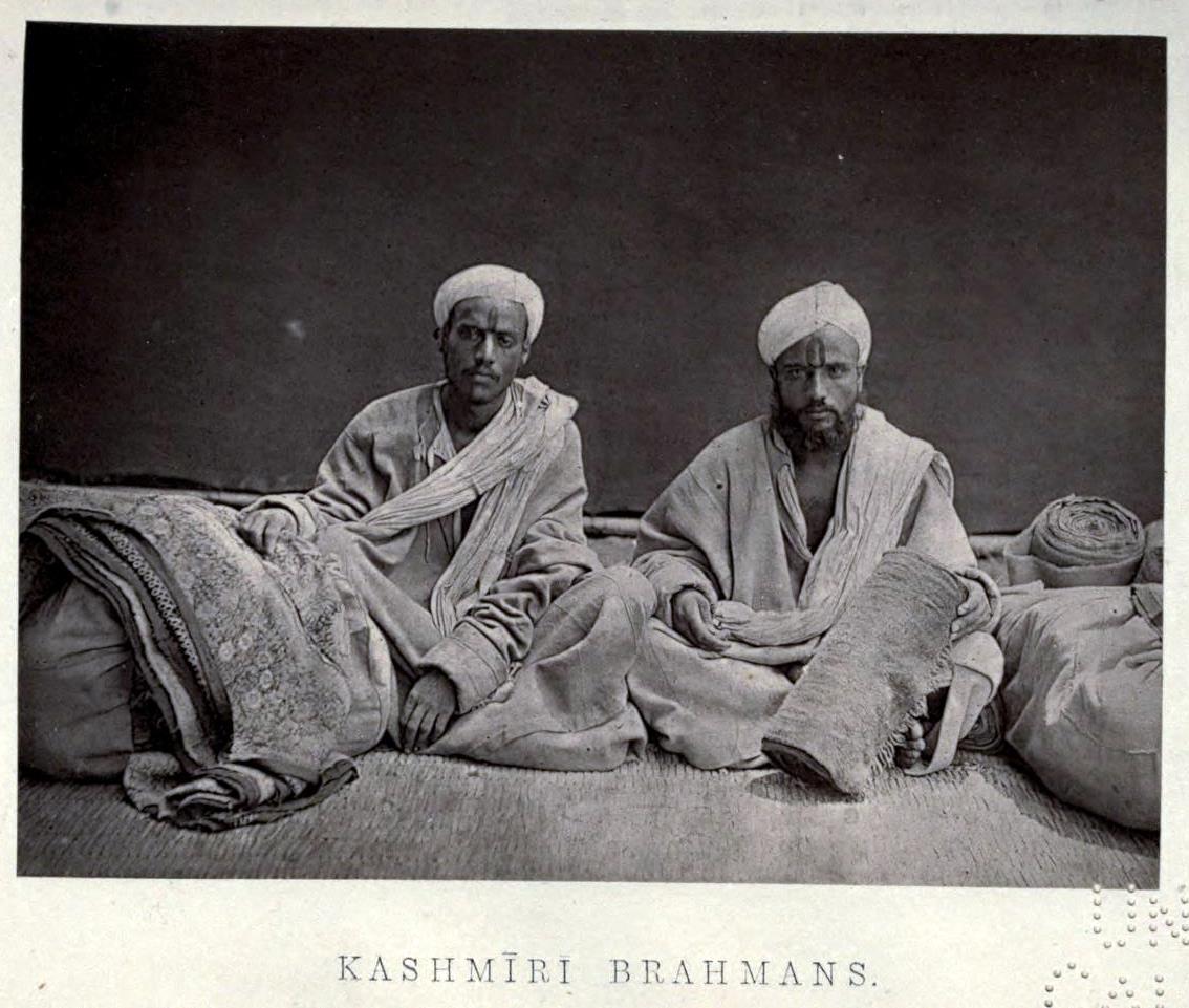 |
| Kashmiri Brahmans. Cloth sellers. Photograph by Francis Frith. More about it here |
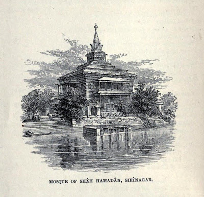 |
| Mosque of Shah Hamadan, Srinagar. With view of the Kali Temple (?) |
 |
| Note on the image from Man Mohan Munshi Ji: Nanga Parbat (also known as Diamir by people of Astore and Chilas etc). It is apparently drawn with a camera lucida. The ridges in the foreground are of Tragbal and Kanzarwan |
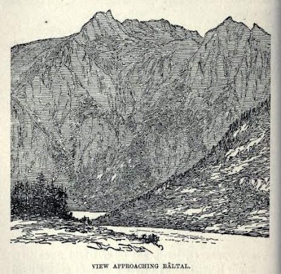 |
| View approaching Baltal |
-0-