Photo Feature: Kashmir and Pandits in 1983

In Aga Khan archive there are about 1000+ Kashmir photographs by Prataap Patrose and Rita Sampat, dated to 1983. I went through them looking for KP culture. Idea was to see how the community remembers. Shared them on FB and curated comments. Sharpness of memory was surprising. People, places, even things were identified.

Comment by Vinod Razdan: [Location]Ganpatyar , the small dilapidated house was occupied by Ram Ji , Kashmiri Hindu Baker . The person on the window is late Gopi Nath Raina . The photograph must have been surely taken from the house of Late R C Pandita.
[ His family was able to identify]

[Location: Badiyaar bala]
Subject name: Krishan Joo Shah [Bai Lal] of Nai Sarak. His family was able to identify.
Comment by Meetu Koul: This is Chandra’s house in Ganpatyar and the side of our house is also seen.These houses are in the lane opposite to the Ganpatyar mandir.And this lane leads to the kralkhud area. And the girl visible in the photo is one of their daughters.
Comment by Ramesh Sapru identifying the exact place: Safriyar HABBA KADAL Behind somyar temple
Comment by Shiban Sapru: Name of this pandit is late Ramji, the pujari of Purshyar temple
Comment by Vinod Razdan: This is Habbakadal Chowk after the front line Pandit houses were demolished to widen the road .This photograph seems to be having a commonality with one of the photographs you shared recently.
[Girls are in Vishwa Bharti Uniform]

Habba Kadal
Comment by Vinod Razdan: Kharyar , near Kralkhod. At the end , it is the building where Sangeet Niketan was functioning.I know this place brick by brick ; On right hand is the Cycle repair shop who used to repair kerosene stoves too and is below the house of Sahibs . Next shop was a meat shop and the owner was Mohd Akbar . Opposite to them ( to the left of Scooterist ) was the shop of Pandit Janki Nath Koul and popularly known in the city as ” Jaan Military “
Vinod Razdan: This is also Ganesh Ghat, Ganpatyar. On the right side of the Ghat is Ganpatyar Temple Building , upstairs in front and across the road is the house of Braroo’ s , the left tall house is that of Prof.Late R C Pandita and behind it is the house of Nadir’s. [Ower Pandita family was able to identify the house]
2021. Access to Ghat. PIC: Arun Kaul
1948/49 During procession of Nehru. Same spot. Previously posted
Sanjay Raina: This was also the main tempo stand and later a matador stand as the tempo’s faded. The road ahead leading to bhan mohalla onwards to Zaiba kadal, Nawa kadal etc. Many a political speeches were made from this open chowk and I recall 1983 being the election year when Farooq Abdullah sought votes after the demise of his father . He made an infamous remark – oh battas, if you don’t vote for me, I will throw you all in the Dal lake. I was there and heard it! Terrifying.

General Elections for national assembly were coming. Message on banner: Jazba hubul watni aur kashmiriyat se sarshaar abdul rashid kabuli national conference ka parlimani umeed waar hai

Zaina Kadal

Flags: Awami Action Committee of Mirwaiz + red plough of NC. This election Mirwaiz and Shiekh had called truce. These joint flags were put out after that.

Vinod Razdan: This shop was between Kralkhod and Habbakadal near Agahamam lane.
Sanjay Raina: Have spent so many of my childhood days on the Kak shops, two of them lined this lane. One Kak sahab had a smaller one and the other was much larger. In the same lane were shops selling wool that would be thronged just before the winter season would set in and also shops selling crystallized sugar and ‘sheeren’
Vinod Razdan: This is at the intersection of Badiyar Bala road and Nai Sarak just near the house of Ghulam Mohd Bhat , popularly known as Gul Raidd . He was initially a traditional rival of Tikka Lal Taploo and was contesting as Independent candidate & later joined NC.
 
Vinod Razdan: I was just waiting to find that someone will identify this place .In fact this lane was a connecting lane between the two lanes : one Leading to Ganpatyar and another terminating through the milk Shop owned by ” Freich Dedd” .Both lanes led to Nai Sarakon the other end.The projected link between the two houses ( Dabb) is near the house of Prof.M L Wangoo , back side of the houses were those of Vijay Garyali , Sumbli’s etc.
Vinod Razdan: These houses have contributed to the cultural and Religious aspects of the valley besides Education.The person clad in a white Dhoti was a retired Head Master in the Education Deptt .Mr Raina .Though he lived nearby Malyar but he has been caught in the picture . These houses are inside the Mohalla of Ganpatyar .The houses just facing the lane are in fact a cluster of houses owned by Kalla Parivar as there were three more houses behind these two houses owned by them ( Cousins ) .The front one was owned by Late Sh Nand Lal Kalla who was Mannager in Neelam Cinema , Shutra Shahi. The adjacent tall house was of Prof B L Kalla whose Son Sh Siddarth Kalla has been an Engineer in Doordarshan.Father of Prof B L Kalla was Sh Nath Ram Kalla Shastry whose books are still refered by Almanac Publishers of Kashmiri Pandits.The house on right side whose plaster has come off on the outer wall in the picture is that of Late Hira Lal Jattu and the house just opposite to it in the picture is that of late Smt Dhanwati ( she was then a widow ) .The house of Prof Kalla was later purchased by Sh N N Mattoo ( father of Dr Tej Mattoo, a Child Specialist ) who again sold it to a family who came from outside this mohalla and set up a shop in Ganpatyar
Raghunath Temple. Srinagar. 1983.
left: from a postcard by Lambert. Personal collection.
2021. Renovation finally started this year. Pic: Puneet Lucky Kaul
Surindar Koul: This is Sheshyar temple (Habba kadal). The house on right belonged to KP family ‘Channas’ .The house on left belonged to Pt. Nath ji Photographer ( Pioneer studios, Bana mohalla)
Vinod Razdan: These Channas had a medical shop at Ganpatyar in Sixties .Perhaps ” Tarak Halwai ” was also nearby.
Vijay Vaishnavi: my mother was regular visitor to this temple. We lived near Srikant medical shop near Ogras. Sanjay Raina: Pioneer studios was legendary. Their shop in Banamohalla as well as a shop in Pahalgam. Ashok ji, my real uncle used to run the Pahalgam outlet. What a memorable time that was.
A reader shared a photograph from 2021. The houses that have new owners are freshly painted.

-0-

Source: Aga Khan Visual Archive MIT

Birth and Journey of Vitasta – mother river of Kashmir

Guest post by Late Manmohan Munshi ji detailing the story of Vitasta river. He had shared it with me a decade back and wanted me to publish it by adding detailed maps, images and illustrations. It was quite a task, I wasn’t sure if I could do it and then I forgot about it, but I think the work is finally complete. Manmohan Munshi ji passed away last year.

According to Nilmatpurana it was Sati daughter of Himal Parvata consort of Shiva who was called Uma in Vaisvara Antra and is the same goddess as Vitasta and the same is Kasmira. The Goddess Vitasta is verily the holy river remover of all sins. People who offer their bodies to, or die within its water in their bellies reach heaven without any hindrance. Those persons who take bath in Vitasta do not see even in dreams the tortures of Hell. Vitasta gives protection with her hands to the evil doing sinners falling into the hell. Fire of hell is pacified with cool outpourings of the drops sent from the waves of Vitas carried by the wind,. A person merely listening to the glory of Vitasta goes free from sins. The only thing that Ganga has more that of Vitasta are the heaps of bones of human beings all other things are equal. The river draining the entire Kashmir Valley called by Kashmiris as “Vyath” is the direct derivative of the original Sanskrit name Vitasta. The intermediary Prakit from Vidasta was altered by Greeks to Hydaspes. Vitasta is also mentioned in the river names of Rigveda. In Vayupurana, Vitasta has been referred as Biloda and Wular Lake as Bilodia situated south of Dumra Lohita ( Nanga Parbat)- The king of mountains. The present name Jhelum River has been adopted from the city of Jhelum besides which it flows in Pakistan . The name was brought to Kashmir by European travelers and found its way in official use otherwise the river is still known to the natives as Vyath.

Kashmiri painting collected by David J. F. Newall in 1850s and presented in his book ‘The Highlands of India’ (1882) and Preliminary Sketches in Cashmere; Or, Scenes in “Cuckoo-cloudland.” By (D.J.F. Newall.) [With Illustrations.] (1882).
route of jhelum river. 1920. You could take a doonga or a house boat for a month and this be the tourism highway from Kashmir valley. All a hundred years back.

The river Vitasta can be considered to have formed at the confluence of [i]Harspatha(Arapat), [ii] Bringa (bring) and [iii] Sandran[older name not known]. But the old holy scriptures have traced the origin of Vitasta to a more specific source. As already stated in Nilmata Purana, Harcaritacintamani and subsequently quoted in latter references Vitasta is a manifestation of goddess Parvati. After Satisar(Parvati’s lake ) was drained of its water and demon Jalodbava destroyed by Vishnu, Brahma and Maheshvara, at the request of sage Kasyapa Maheshvara persuaded Parvati to show herself in Kashmir in the form of a river to purify the Manavs (humans) from the unholy contact of Pisachas . The goddess assumed the form of an underground river and asked Shiva to make an opening by which she could come to the surface in the form of a river. Shiva by striking the ground with his trisul on 13th of Badra Shuakula Paksha from which the river gushed forth receiving the name of Vitasta, after the measure of the ditch of one Vitasti. Since then the birthday of Vitasta is celebrated on on 13th Badra Shakula Paksha. The spring from where the goddess flowed in river form became known by several names Nilanaga (Abode of Nila), Nila Kunda, Sulaghata(Trisul thrust) or simply Vitasta. The name of Varnag /Veri nag seems to have adopted at a latter stage probably after the administrative unit of Var Pargana. It is said that Vitasta disappeared from fear of defilement from the contact of Sinful men but reappeared second time by the prayers of Kasyapa at Panchasta (Panzath) in Devsar Pargana., disappeared again and reappeared at Narasima. The Goddess was finally induced to stay permanently when Kasyapa secured for her the company of Lakshmi in the form of Visoka (Vesheu) and Ganga in the form Sindhu(Sind River) [not to be confused with Indus. Sachi consort of Indra as Haraspatha(Arpat), Aditi the mother of the gods as Trikoti [probably Sandran] and Ditti as [Chandravati] mother of Datiyas [close to verinag, probably Bring]. According to another legend Vitasta made her second appearance at Vitastatra (Vethvatur) close to Verinag. Clear mention of Nilanaga (Verinag) as the birth place of Vitasta by Kalhana leaves no doubt about the tradition prevailing in his time.

Map of Shahbad, Anantnag. By Sahib Ram Kaul. 1860s. Vitasta and the springs taking birth below Panchaladeva(Pir Panchal) range. What starts as snow in mountains, melts, seeps into moulins, drops, emerges as river goddesses and spring gods at bottom. Giving birth to life in valley and a civilization.

This map is important as this is specifically map of village Gutalgund, the place with nits many spring which is/was known as actual source of Vitasta.

The place gets its name from spring of vitasta bagwati (marked on map next to big splash).
Map of Verinag Spring. Sabib Ram Kaul. 1860s.
Nilanag Spring. Verinag. Vinayak Razdan. 2014.
Vitastatra Nag/Vethvatur. Early 1940s. Stein collection.
Pancahasta Springs. Panzath. Early 1940s. Stein collection.
Shushramnaga (Sheeshnag), Circa 1955
Kapatesvara. Early 1940s. Stein Collection.
Akasvala (Achibal ). Circa 1915
Machbawan(Matan). Circa 1910

The rivulet of Bring is fed by springs of Trisandhya, Ardanarisvsra, and Kapartesvara(Koter). Akasvala(Achibal) feed the Harspatha (Arpat). Lidari which derives its waters from the glaciers of Koenjar and Gashbrar (Kolahoi glacier), Lakes of Shushramnaga (Sheeshnag), Tarsar, and springs of Machbawan(Matan) and other sources joins the Vitasta slightly down stream of Anantnag and flows in a single channel except in Srinagar City. In its north westerly course between Anantnag and Baramulla a distance of about 90 Kilometers , the river bed falls slightly less than seven meters in elevation. Islands if any are sandy and temporary except the one at the present Vitasta-Sindhusamgama near Shadipur which was artificially built.

Locality of Shivpora. 1903. Viewed from Gopadari Hill named after King Gopaditya, circa 3rd century AD. After him is named Gupkar ( Gopa – Agrahara (“Agrahara” + land given by Kings to Brahmins for maintenance of temples)). In late 19th century, Gupkar came into prominence as English had villa there and Maharaja was close by. Stein also studied Kashmir history Rajatarangini here in one such lodge quarter.

The most conspicuous meander of the river is located immediately south of Gopadri (Shankracharya hill) round the flood prone locality of Shivpura. The course of Vitasta has not changed during the historic times except at the Vitasta-Sindhusamgama where it was altered by Suyya the able engineer of King Avantivarman in the 9th century.Between Mahpadamsaras (Wular Lake) and Huskapura (Uskar) Vitasta flows in a south westerly direction and beyond Uskar in a west-noth-westrly direction upto Muzafrabad Kohala aree where it is joined by Krashna (Kishenganga)river. At Wular and Muzafrabad Vitasta abruptly makes south westerly due to the Synataxial bend of the western Himalayas in common with other rivers of the region. Downstream of Anantnag is located Vijayeksetra,(modern Vijbror) one of the holiest sires where temples of Shiva, Vajesvara, Vishnochakradara Ashokvehara and numerous viharas and agarharas and a university of learning [where students- scolars from countries beyond Kasmira used to come for study of Shastras, astronomy astrology and other subjects]once flourished.

Gambhira Sangam = Vitasta + (Vishav + Rembyar, Stein’s Gambhira). Gambhira Sangani of Rajatarangini. Sangam at Kakapora. Between Bijbehara and Avantipur. 2014. Vinayak Razdan.
Something about the bridge from updated Rājataraṅgiṇī:
“It may be noted that this crossing has a certain strategic impotence. On occasion of a rising in 1930 in parts of Jammu territory, sympathizers in the Kasmir valley took care to burn the wooden bridge by which the modern motor road from Srinagar to Banhal pass crosses here the river. It has been since replaced by an iron one duly guarded.” ~Luther Obrock (ed.) Marc Aurel Stein – Illustrated Rājataraṅgiṇī (2013)
Konsar Nag. Source of Visoka (Vesheu). Early 1940s. Stein collection.

United waters of(i) Visoka (Vesheu) issuing from Kramasaras (KonsarNag) also known as VishnuPad near the tirtha of Naubandana where Vishnu, Brahma and Mashevara took positions to destroy the demon Jalodbhava and (ii)Ramanatvi (Rembyar)originating near Bhab and Nandan sars join the Vitasta along the left bank as Gambhira (the deep) at Gambhira Samgama (Sangum) below Vijbror where king Chandrapida built a Vishnu temple Gamirsvamin of which no trace is left now A few kilometers downstream of Sangum Vitasta is joined by a relatively smaller stream Chaturvedi (Narastan nala ) Below the confluence of this stream King Awantivarman founded his capital at Awantipura and built two temples Avantisvamin and Avantisvara dedicated to Vishnu and Shiva respectively. Both of these and like other temples of the valley Were vandalized by by Skindar butshikan at the end of 14 th Century. The ruins at present are testimonies to their former glory. Some of the carved stones from these temples have been used in foundation and plinth of nearby Muslim Ziarats.

Vitasta near Awantiswamin Temple, Avantipur. John Burke’s photograph from 1868

Further downstream Vitasta is joined along the left bank by Ramshu (Ramu or Kakpor Kol) rising in the Pantsal mountains by the side of the forgotten temple of Gangodbheda or Bhedagiri(Badbrar) one of the few Sarasvati temples of Kashmir. At the present village of Kakpor ruins of an old temple believed by some authorities of the time of King Khagendra the founder of Khagendapura (Kakpor) and by others as remains of the Utplasvamin, a Vishnu temple built by Utpla an uncle of King Cippatajayapida . In case the former identification is correct the ruins can be one of the oldest in Kashmir, if the latter is correct can be of the ninth century . Just opposite Kakpor on the right bank of the river is the saffron karewah and small township to Lalitpura(Letpur) founded by architect of Laltaditya. North of Lalitpur in former Viha Pargana a number of ruins of old Hindu temples at Barsu, Ladhu, Balhom some converted to Muslim Ziarats can be traced even today. The Vishnu temple of Padmasvamin built by Padma another uncle of King Cippatajayapida at Padmapura (Pampore) is also now in ruins. Stones from its ruins have been used in the construction of Muslim Ziarats.. Another Vishnu temple by the name of Samarasvamin on the left bank of the river opposite Panduchak was built by Samara a minister of King Avantivarman of which no trace is seen now. Close to Panduchak in Viha pargana is the Tirtha of Takshakanaga at Jeyyavana (Zewan ) and is visited by devotees even today especially at the time of solar eclipses .Further downstream is the temple of Merudasvamin built by Meruda a minister of King Partha.

Takshaka Naga. Zewan. Early 1940s. Stein collection.
Course of Vitasta river through Srinagar. 1920

It is believed that the City of Srinagari (Srinagar) capital of Kasmira was founded by Emperor Ashoka At Pandrethan – the present cantonment of Badami Bagh when Pravarasena ii shifted the capital to Pravapura [the high ground between Kasurikabla(Khodbal) and Harparvata(Hariparbat) the old capital came to be known as Puranadisthana. The ruins of other Hindu temples around Pandrethan were seen till beginning of early twentieth century About two Kilometers north of Puranadisthana is the hill of Gopdari also known as Jeyesthirudrarodrakhyparvata (Shankracharia Hill) top of which stands the temple of Jyestherudra (Shankrcharya temple) believed to have been originally built by Jaluka of which only the outer plinth remains. King Gopadiya rebuilt the temple at a later date and also viharas of Guphra (Gupkar). The temple was repaired again by King Zainulabdin the pious muislim ruler of Kashmir in 15th Century and also by Dogra rulers of Kashmir since early 20th century since then it is looked after by the Dharmarth trust. It is believed that the temple was approachable by a stone staircase from Sudhkshikheta (Shurayar). The stone steps were removed and built into Pathar Masjid o0jn the left bank of the river near Mujahid Manzil during the 17 th century by Noor Jehan ,queen of Emperor Jahangir.

Vitasta is joined by along its right bank by Mari or Mahasirat(Tsuntkol) issuing from Jeyarudrasaras (Dal Lake) at Marisamgama which was considered as a holy Tirtha in ancient times . The island formed between Vitasta Tsuntkol and latter’s southerly flowing branch was known by the name of Maksvamin and had a Vishnu temple by the same name of which no trace is left today. Opposite the Marisamgama on the left bank of Vitasta Kippitiska or Kutkulia (Kutkol) leaves the Vitasta and after flowing in a north westerly direction bifurcates into two the right one falls back into Vitasta above Safakadal and and the left one joins Duddhaganga (Dudganga or Chat Kol) which also falls into Vitasta near Chatabal. The area between Vitasta and Kutkolia was known by the name of Katol. It is not very clear if the Kutkolia is a natural channel or manmade. It may have been build by Hindu Rulers as a defense moat after Srinagar started spreading along the left bank of Vitasta.

Zaina Kadal. Srinagar. Dome of tomb of Zaina,s mother in background.
People watching Nehru’s Boat procession from Ganpatyaar Ghat, Srinagar. May 1948.

Below the Marisamgama at the present Malyar Ghat stood the temple of Vardamanesa of which nothing is left today . A Linga serving as lamp post in a nearby Mosque believed to be from the original Vardamanesa temple was removed and installed in Malyar Temple in 1818. Immediately below Habakadal Bridge on the right bank is the Somyar temple, site of the ancient Somatirtha . Similarly situated on the left bank is Purushyar the site of ancient temple of SadaSiva. Between Haba Kadal and Fatehkadal on the right bank of Vitasta is the locality of Narparistan near Malikangan, stood the temple of Naresheri which was converted into a Ziarat during the muslim rule. Further downstream between Fateh Kadal and Zaina Kadal also along the same bank was bank was located the temple of Kalisheri which was destroyed and rebuilt as ziarat of Shah Hamdan by Sikandar Butshikan. The oldest bridge over the Vitasta in the City was known as Mahasetu it was a boat bridge like a modern poonton bridge which could be removed during emergencies like war etc. At the location of the Mahasetu Zainulabdin built the first permanent timber bridge across the Vitasta in 15 th century which came to be known as Zaina Kadal and other muslim rulers followed by building a number of timber bridges in the city and elsewhere across the Vitasta. Again on the right bank of the river betwen Zainakadal and Alikadal is the tomb of the queen of Sikandar Buthshikan and burial place for other muslim rulers known as Mazar Salatin. The Tomb which is built entirely of bricks very similar in architecture to the tomb of Bibi Jawandi at Uchchh Sharif near Multan in Pakistan. Its foundations & embankments on the riverside and material used in the surrounding walls betray it to be site of an ancient Hindu temple.

Further downstream on the same bank of the river almost touching the bridge is the Ziarat of Wyusi sahaib which also due to its foundations,embankments and the entrance appears to be site of an original Hindu temple. Nothing is known about the antiquity of these two temples/shrines. Near the locality of Chatabal confluence of Dudhaganga (Dudganga or Chata Kol) [issuing from the Pantsal Mountains] with Vitasta was the site Tirtha of Dudhagangasamgama now completely forgotten. The other temples and hindu shrines, namely Hanuman Mandir, Ghadadhar Kharyar,Malyar Raghunath temple are relatively of recent construction. However it is possible that a few of these temples like Ganpatyar were rebuilt at ancient sites.

Bridge over Kutkol canal. 1926.
 Starting point of Tsont Kul near Chinar Bagh. 1910
Tsunt Kul. Apple Canal, 1881..
Vitasta leaving Srinagar. Chattabal Weir. 1920s. Personal collection. Vinayak Razdan

Between Srinagar and Shadipur the Vitasta is not joined by any major tributary except the Sukhnag along the left bank. The Sindhu(Sind river) rising from the Great Himalaya Range south east of Amreshvara ( Amarnathji Cave) joined by glacier fed streams of Panjtarangini (Panjtarni), Amurveth(Amravati), Nehnar etc, outflows of of the lakes of Utrasaras or Utraganga(Gangabal), Koladuga,(Nandkol) springs of Sodara (Naranag) uniting into Kankavahini (krenk nadi) flowing in Nandiksetra at the foot of Harmukh mountains by the sides of Buthesvara, Jyesterudra, Ciramokana, at Kankpura (Kangan) used to meet Vitasta at Vitasta-Sindhu Samgama till the ninth century. Immediately west of the gap of Badrakhel nala between the Vudars (karewas) of Parihaspura (Paraspur) and Trigami (Trigom) close to the sites of ruined temples Vishunosvamin, Vinayaswamin about 5 Kms south west of the present confluence at Sundribavana (Naran bagh) near Parihaspura was founded by Lalitaditya as his capital which according to Kalhana excelled heaven. Lalitaditya whom Kalhana has called “Indra of the earth “ built numerous other temples Parihaskesva with the image ofVishnu in silver pearls, Mukhtakesva with golden image of Vishnu, Mahavara with Vishn’s image in golden armour. And silver image of Goverdandhara, Bradbuddha numerous viharas ,agarharas and palaces. Even his queen Kamlavati built Kamlahatta with silver image of Kamalakesva. One of Lalitaditya ‘s ministers Mitrasarmamn installed the Shivlinga of Mitresvara. Needless to say that the site of the capital Parihaspura and numerous temples was apparently chosen for proximity to Vitasta-sindhusamgama, the former being regarded as manifestation of Yamuna and the latter that of Ganga. Suyya the able engineer of King Avantivarman by his expertise shifted the location of Vitasta-Sindhu Samgama from Parihaspura to the vicinity of Sundribhavana by forcing the course of Vitasta north eastwards by construction of embankments to reclaim cultivable land fromfrom Nambals (marshes) and flood prone areas. A Vishnu temple by the name of Yogasvamin was also built by Suyya at Sundribhavana at the instance of King Avativarman. The material from the ruins of the said temple seem to have used for building of the solid masonry walls of the island with a solitary chinar tree at the present confluence [referred as Prayaga in the Vitasta Mahatmaya ] at a latter date.

Vitasta-Sindhusamgama. The Chinar tree at Shadipore in a photograph by Fred Bremner. 1905 
The river in the left foreground with greyish coloured water is the Sind river and the other with the bluish green coloured water in the right background is the Jhelum. Suyya the able engineer of King Avantivarman by his skill shifted the position of Vitastasindhusamgama from Parihaspura Trigami area to its present location in the vicinity of Sundribhavana (Naran Bagh) by forcing the course of Vitasta north east wards by blocking its original course with embankments to reclaim the cultivable land from flood prone areas and marshes. A Vishnu temple by the name of Yogavasmin was also built by Suyya at the instance of Avantivarman. Photo: Manmohan Munshi

Beyond the Sangama, Vitasta continues to flow north west wards by the side of Vaskur village [Rupbhawani’s shrine) and receives the outflow of Manasaras (Manasbal Lake) at Sumbal, and after passing Jayapura (Indrakoot) enters the Mahapadmasaras (Wular lake). The ruins of the ancient buildings and temples at Jayapura founded by King Jayapida on an island like raised ground among the nambals (marshes) south of Sumbhal were seen up o the middle of 20th century. King Jayapida also built the castle of Bayokota on the peninsulalike ridge Dwarpati with three images of Buddah and a temple of Jaya devi. According to Kalhana inner town of the castle excelled heaven in beauty. According to an ancient legend the site of Mahapadamsars was occupied by a wicked Naga Sadangula who was exiled by the Naga king Nila to Darvisara . The site left dry was occupied by the township of Chandrapura ruled by the king Visvagavas.. Mahapadma Naga in the disguise of a Brahman approached Visvagavas and after securing the king’s permission to reside in the city appeared in his true form with the result that the king and his subjects had to migrate westwards to a new town of Visvagaspura.

Ruins on Zaina Lank island, Wular Lake. Kashmir. ) circa 1910. [via: Leiden University Libraries, Netherlands]
The story goes that Zain-ul-Abidin was told about the existence of an island temple in Wular lake. He sent men to investigate. Some ruins and gold sculptures were found under water at the spot. The sculptures were sold and a proper island was built with a palace and a mosque atop the temple. The purpose of Island creation was not just religious. The creation of man-made islands was an ancient technique used to make big lakes navigable. The island cause wave diffraction, smaller waves do not collide to become bigger waves, hence reducing the chances of creation of giant waves (“wav jinn” in Kashmir) for which Wular was famous. This is also the reason why there are islands in Dal lake.
It was here that the Persian inscription in stone bearing the name of Zain-ul-Abidin in relation to founding of the island in 1443/4 was found. The inscription reads:
May this place endure like the foundation of heaven !
Be known to the world by the name of Zaina Dab!
So that Zain-ul-abdin may hold festivities therein,
May it ever be pleasant like his own date !
Ruler on a boat with attendants
17th century, reign of Jahangir
British Museum
Jahangir’s trip to Wular Lake. Island with ruins.

At present Vitasta enters Mahapadamsars (Wular lake) at the north eastern corner and leaves it at the south western corner near Suyyapura (sopore). A glance from a high mound will show that a peninsula like ridge projects into the lake . Due to continuous deposition of silts from Vitasta along the eastern side of the lake has resulted in turning the eastern side of the lake into marshes and swamps and shrinkage of the clear water area of the lake. Similar silting relatively on a smaller scale going along its northern fringes of the lake by Madhumati stream (Bandpur Nala). It can also be summarized from the fact that waters of Vitasta are silty at the inflow (especially during rains ) and clear at the outflow near Sopore. The scientific reason for this being that transporting capacity of water is directly proportional to the velocity of the current. When any river enters a lake the velocity of its current drops ,resulting in deposition of silts in stagnant and relatively low velocity of water It is corroborated from the historical facts that man made island of Jainalanka (Zainlank) which according to Jonaraja was surrounded by waters and at present is surrounded by marshes and dry land . If the silting of Wular is not checked, the great and biggest fresh water lake in the state will be reduced to a marshy land similar to Anchar,Hokarsar or Pambsar with river slowly meandering through it. In case Wular has to be preserved for future generations, an alternative between Sumbal and downstream of Sopore by passing the lake which existed in the past has to be rejuvenated through which the waters of the river will have to be regulated by a barrage/ veer during heavy rains, floods or whenever the water of the river will turn muddy thus saving the Wular lake from silting. The silts of Bandipur nala can be prevented from entering Wular Lake by construction of a cofferdam and the silts thus accumulated upstream of the dam can be removed from time to time for construction purposes.

Sopore. Early 1950s.
Vitasta at Baramulla. 2014. Vinayak Razdan

Downstream of Suyyapura (Sopore ) in Kashmir valley Vitasta receives its last major tributary along its right bank the Pahara (Pohur) draining the north western corner of the valley and being of steeper gradient and faster current than Vitasta deposits silts in the latter’s bed resulting in rise of the water level upstream. However from time to time at the site of confluence of Pahara with Vitasta silts have been removed by dredging in the recent past. Vitasta after leaving the last major town of the valley Baramula enters its mountainous course at Huskapura(Uksur) beyond which it becomes unsuitable for navigation. The name Vaharamula (Baramula or Varmul) has been derived from the ancient Tirtha of Vishnu -Adi -Vahara where Vishnu was worshiped since time immemorial as a medieval boar. On western extremity of the town near KothiTirtha till very recently a number of ruins were seen but not much is known about their antiquity.

Vitasta near Uri. 2014. Vinayak Razdan.

Between Uskar and Uri, Vitasta flows in a south westerly direction and beyond somewhatin a north Westerly direction upto Muzafrabad where it is joined by Krashna (Kishen Ganga) Kunar, Kahgan follows a southerly course up to Mangla near Jhelum forming the boundary between West Punjab and State of Jammu & Kashmir. From Mangla onwards Vitasta again heads in a south westerly direction before meeting Chandrabhaga( Chenab) near Jang-Sadar.

-0-

Wood carving Workshop on Jhelum river

Wood carving workshop on Jhelum river.
Fateh Kadal, Urdu Bazaar.

Way to the Ghat

Upper floor

The entire building used to be wooden. It is now being remade in cement and bricks. The upper floor was still under works. If I could get into that floor, the view would have been something like this:

from the book Irene Petrie : Missionary to Kashmir (1903). Photographs by Geoffroy Millias.
Had been trying to find the spot for quite sometime
Only other option left is to find Ahmed Joo’s Shop

Stories from Kashmir

This entire floor was under water in the flood of 2014

He was kind enough to tell me that the shop/house once belonged to a Pandit family long ago.

-0-

Sylabnama: Great Floods of Kashmir

The Great Folld of 1903 in Kashmir

buji aki dop yi kya didi gom
kasabay osum su kot didi gom
su ha didi nyunay gura aban
zor kor veshive sahlaban

Said an old granny in a wild flurry,
“Oh, woe is me! Oh, woe is me!
O’ where’s my headgear?”


“O granny dear, O granny dear,
The yellow flood has carried it off.”
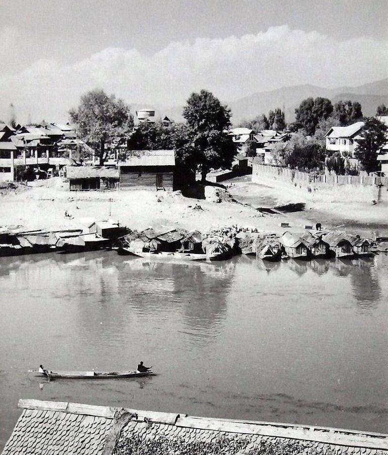
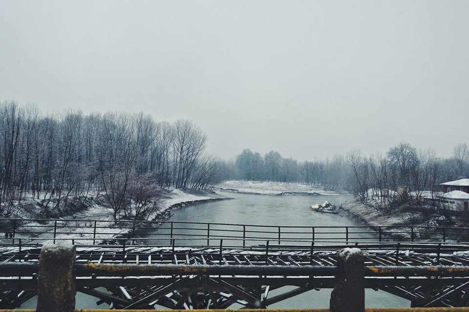
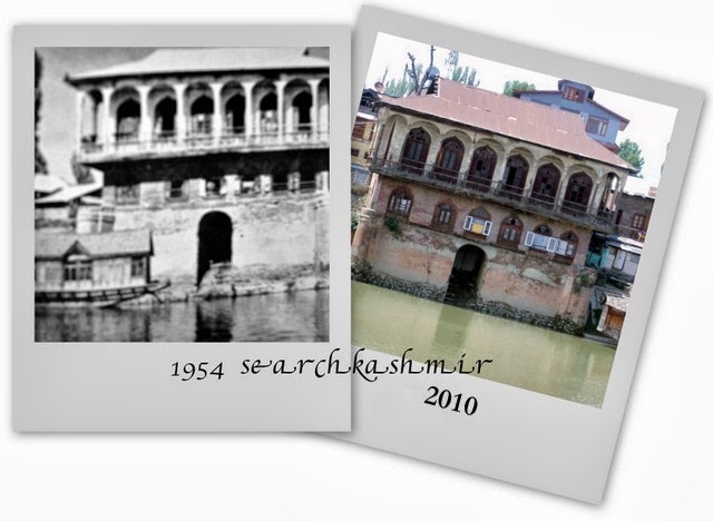
Vishav, in flood, has overflown her banks.

~ An old Kashmiri Ditty

New house over the old three feet base
Chattabal, 2008
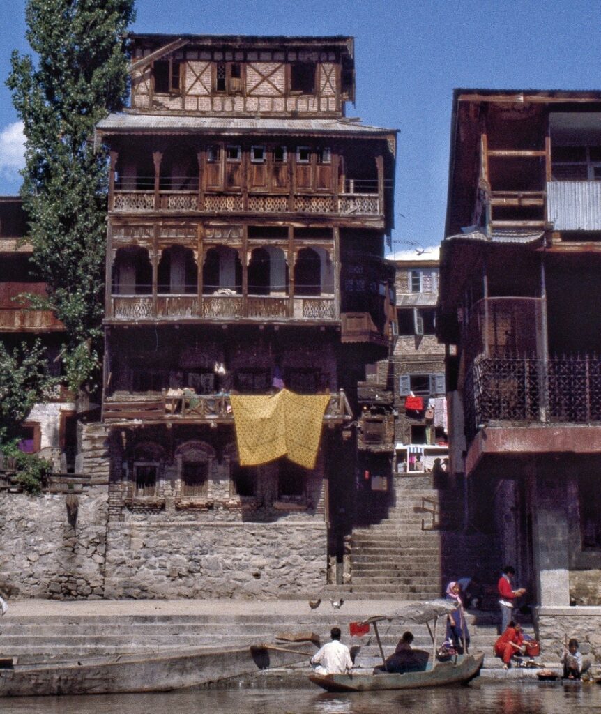
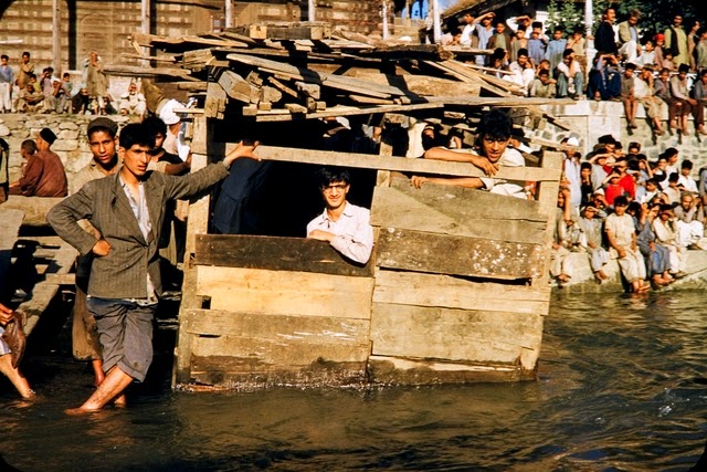
When I was a child, wherever I would spill a glass of water, the exclamation from my mother or grandmother would be, ‘Ye kus Sylaab!’ (What’s this flood!). The house I was born in Chattabal was near a river. The hundred year old wooden house was built a good three feet above the ground. As a child I never understood the real need for it. I was told it was for safety from the floods.  I would wonder: ‘What floods?’. I had seen the quite river. No way was that river ever going to reach our doorstep and then climb these three feet too. Then in autumn of 1988 (or was it 1989?),  I remember, one morning, on way to the house of the gourbai (milkmaid), walking to the small foot bridge over the river and finding planted at the start of it a red skull and bone signboard with ‘Danger’ written across it. The reading at Sangam wasn’t good. A flood warning had been issued in Kashmir.  I waited for water to rise. Would we be using boats in the house. Could I fish? I waited. The flood never arrived at the gate.

-0-

A list of all the major floods in Kashmir and the changes some of them brought. The date till year 1900 is mostly based on the list provided by Pandit Anand Kaul in his book ‘Geography of The Jammu and Kashmir State’ (1925)’ (scanned and uploaded here as part of searchkashmir free book project). The info. about era post 1900 till 1947 is updated using various accounts of European visitors and for more modern times using news reports, government reports and primarily ‘Flood Control, Drainage, and Reclamation in Kashmir Valley’ (1956) by H. L. Uppal and ‘Paradise in Peril: An Ecological Profile of the Kashmir Valley’ (1995).

[Update: Entries marked * are from Tarihk-e-Hassan of Pir Ghulam Hasan Khuihami who was the primary local resource for Walter Lawrence and for later writings by Anand Koul. Entries taken from ‘Historical Geography of Kashmir’ (1981) by S.Maqbul Ahmad and Raja Bano. It is interesting to note that Tarihk-e-Hassan was primarily based on work of Mula Ahmad, the court poet of Zain-ul-abdin. The surviving copy of Mula Ahmad’s ‘History of Kashmir’ was lost by Hassan in a boating accident.]
2082-2041 B.C. 
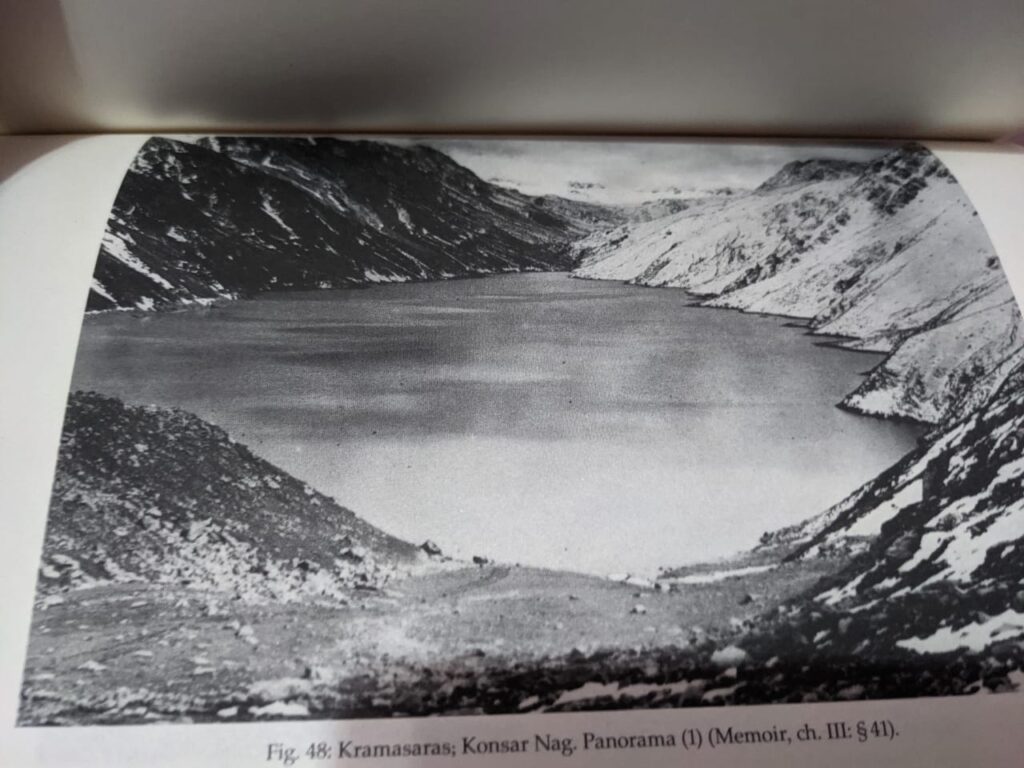
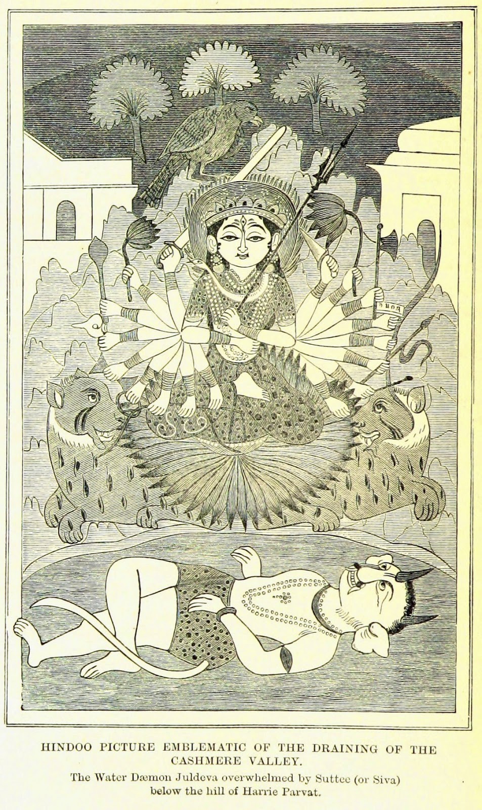
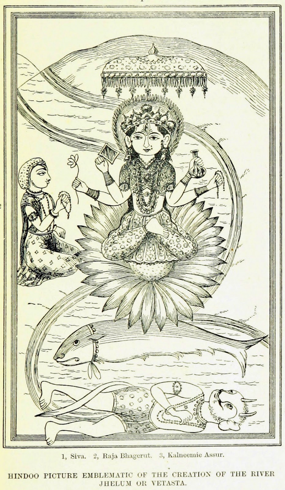
The one story about Wular from legends. In the time of Sundar Sena, a destructive earthquake occurred by which the earth in the middle of the city of Sandimatnagar was rift and water gushed out in a flood [from Ular Nag] and soon submerged the whole city. By the same earthquake a knoll of the hill at Baramulla near Khandanyar tumbled down which chocked the outlet of the river Jhelum and consequently the water rose high at once and drowned the whole city together with its king and inhabitants. This submerged city is now the site occupied by the Vular Lake.*

*  635 A.D.

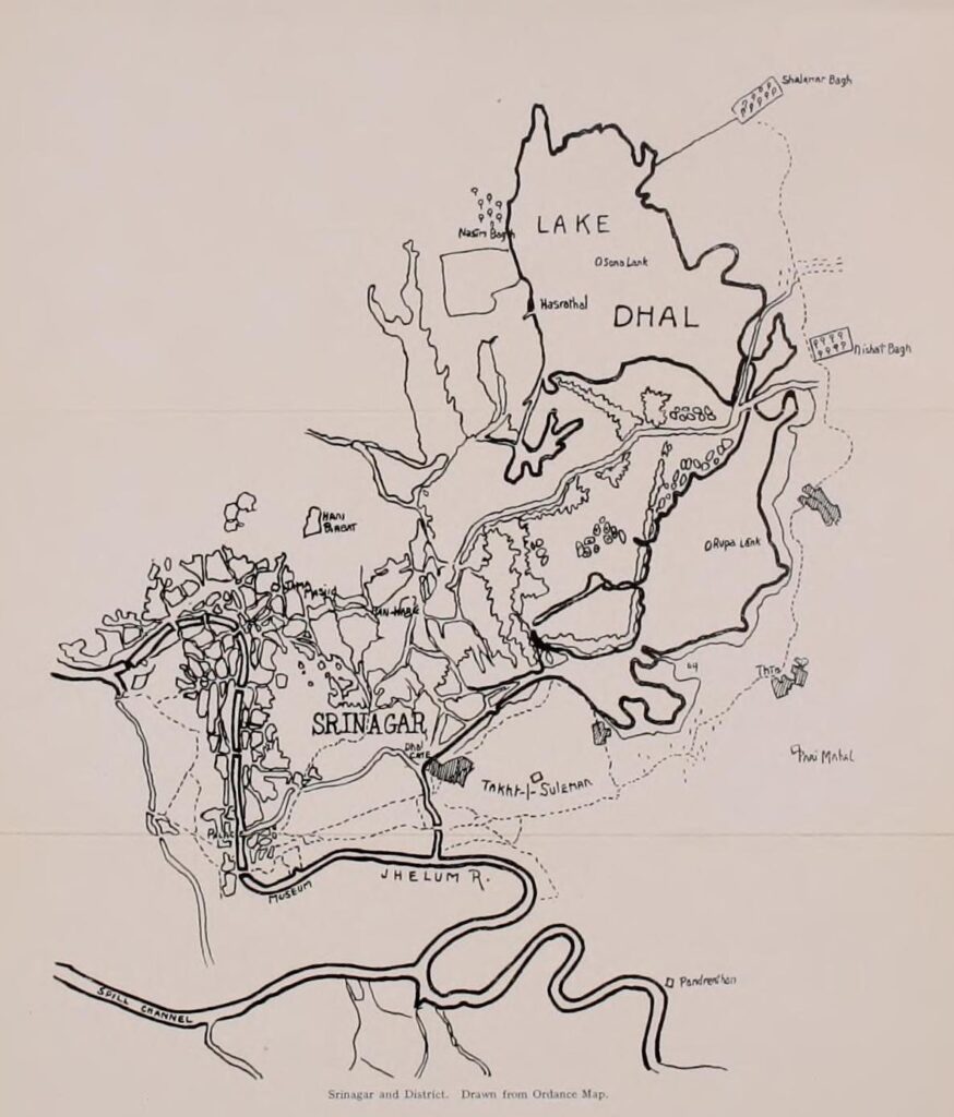
During the reign of Raja Durlab Duran, the city of Srinagar was drowned due to a heavy rainfall and the dam (Sadd) at Talan Marg built by Raja Parvaesen, were destroyed. As a result of Talan Marg being flooded, the Dal lake was formed.

724-761 A.D.

During the reign og Laltaditya due to a flood, all buildingd of the Raja in the town were destroyed. So, he rebuilt his palace in Litapur. 

855-882 A.D
During the time of Avantivarman, famine was caused by flood and then steps were taken to deepen the Jhelum near Khadanyar in order to accelerate the flow of the river. This measure had the effect of minimising the chances of flood as it was concluded that flooding has happened because of blocking of a river pass at Khadniyar.
917-8 A.D. 
During the time of King Partha, rive crop was destroyed by flood, the result being a great famine. Srinagar drowned as houses floated on the river as though they were bubbles. *
1122 A.D. 
During the time of Harsha, crops were swept away.
1379 A.D.
During the time of Sultan Shahabud-Din, 10000 houses were destroyed

[The above entry is by Anand Koul. And probably wrong on account of timeline [the Sulatan died in 1373]. Also, Rajatarangini of Jonaraja tells us:

There was flood in 1361. The town of Laxmi-Nagar was founded at Hari Parbat by Sultan Shahabud-Din to rehabilitate the people of the Srinagar city.It was named after his wife Laxmi. ]

1573 A.D. 
Ali Khan Chak’s time many houses and crops were swept away*
1662 A.D.
Houses destroyed during Ibrahim Khan’s rule. According to Hassan the year was 1682 A.D. and the reason was a severe storm in which houses whirled around on water like boats. At the time an earthquake is also supposed to have occurred.
1730 A.D.
Houses and crops destroyed during Nawazish Khan’s time due to heavy rains.*
1735 A.D.
Thousands of houses said to be destroyed during Dildiler Khan’s time. * After eight days of rain, flood water stayed in courtyards of houses as well as in the fields for a long time.
1746 A.D.
10,000 house and all the bridges on the Jhelum and also the crops swept away during time time of Afrasiab Khan.*
1770 A.D.
All bridges and many houses destroyed during Amir Khan Jawansher’s time.*
1787 A.D. 
During Juma Khan’s time, Dal Gate [*Qazi Zadeh] gave way and all the easter portion of the city of Srinagar was submerged.*
1787 A.D.
Crops destroyed during Abdullah Khan’s time*
1836 A.D. 
Bridges at Khanabal, Bijbihara. Pampor and Amira Kadal were swept away during the time of Col. Mian Singh.*
1841 A.D.
During the time of Shekh Gulam Mohiuddin, rain fell for seven days continually, Jhelum overflowed the Dal Bund [ Qazi Zadeh] and submerged the whole Khanyar and Rainawari. Six bridges from Fateh Kadal to Sumbal were swept away. *
[1844. great Gilgit valley flood ]

[*1882 A.D. 


 Sind-lar river flooded, changed course, water entered Anchar Lake extending the size of the lake three times. (Before this flooding, Anchar Lake was much smaller (probably of the present size)]

[‘John Bishop Memorial Hospital’ got washed away in devastating floods of 1892.~ Until the shadows flee away the story of C.E.Z.M.S. work in India and Ceylon (1912)]

21st July 1893
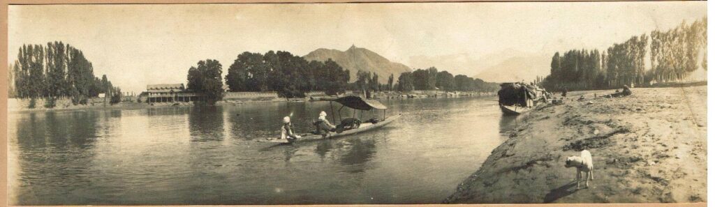
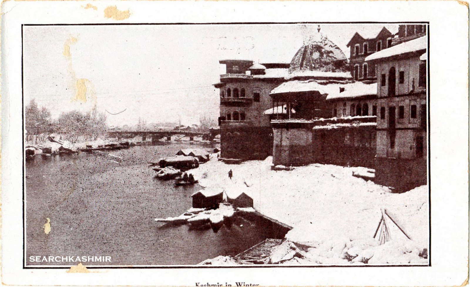
The first of the well documented case of flooding in Kashmir during the time of Maharaja Pratap Singh. It rained incessantly for 59 hours and the river became so swollen that miles of land on both banks were flooded. The water rose to the height of R.L. 5197.0. All the bridges except Amira Kadal, and many houses were destroyed. Loss of cattle and crops was immense and many people were drowned. A detailed account of this and previous flood was provided by Walter Lawrence in his ‘Valley of Kashmir’ (1895).

“In 1841, there was a major flood which caused much damage to the life and property in Srinagar. Some marks shown to me suggest that the flood of 1841 rose some nine feet higher on the Dal lake than it rose in 1893. But thanks to the strong embankments around Dal, the flood level in 1893 never rose on the lane to the level of the flood in Jhelum”


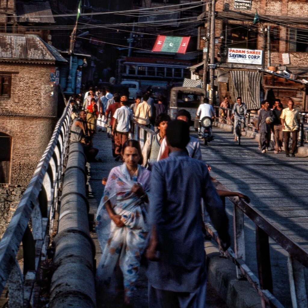
 It is interesting to note that New town area of Srinagar was formed in 1891, in the 1893 flood most of the old town of Srinagar was swept. After the flood of 1893, Jhelum bank was strengthened to protect Munshi Bagh, and the new ‘bund’ came up. This was the first of ‘Great Flood’ in recent history after which modern preventive measures were started.

Between 1895 and 1903, flood kept arriving.
1900 
The water was nine feet lower at Munshibagh than its predecessor. It is chiefly remembered for the breaches in the right bank above Shergrahi. 
1902
The flood of 1902 was lower than the previous one by 2’2 feet.
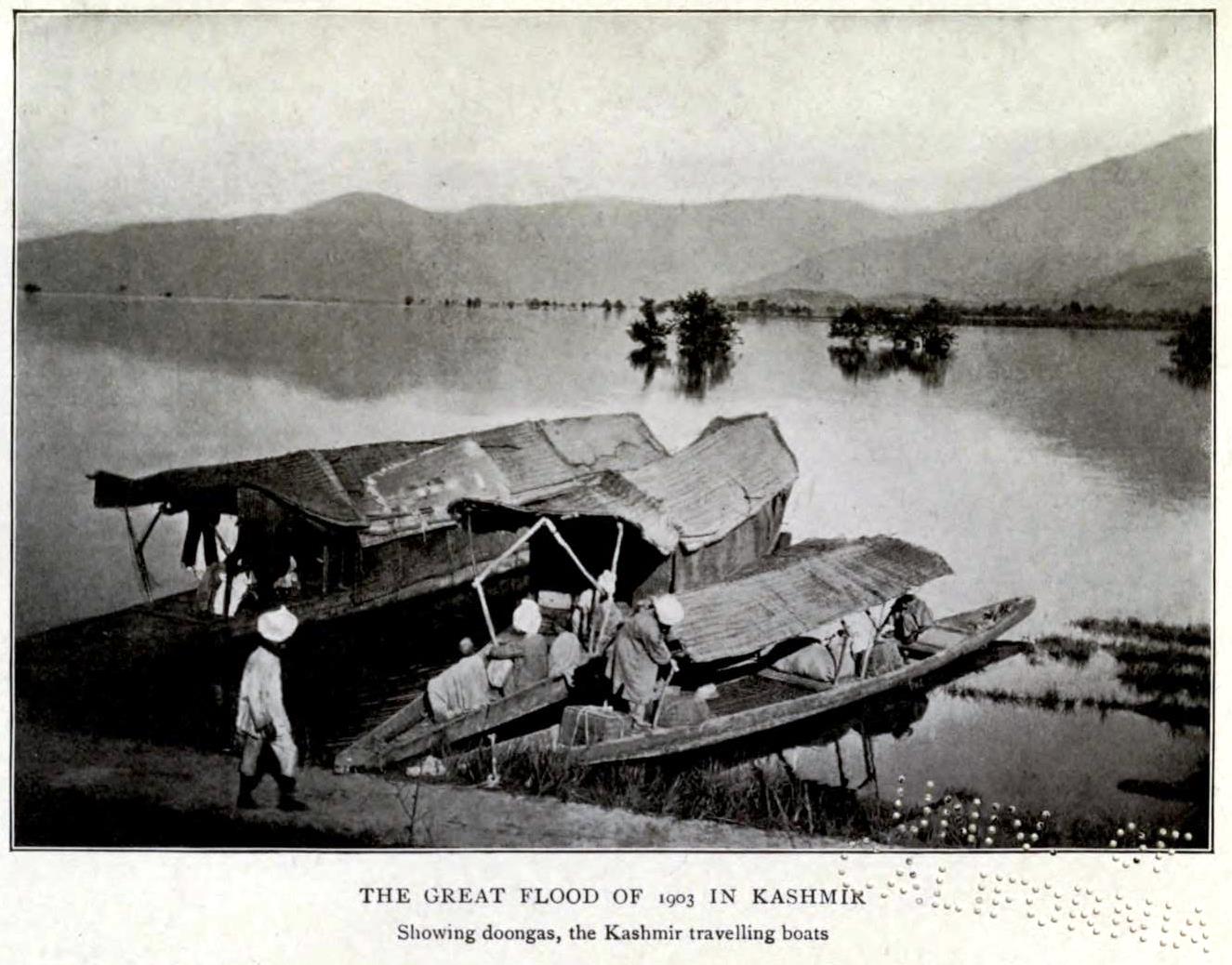
24th July 1903
The second of the great flooding in modern times. Five inches of rain fell between 11th and 17th July and eight inches from 21st to 23rd idem and the river rose to the maximum of R.L. 5200.37 on the 24th July at 2 P.M. The whole valley became one vast expanse of water and fearful loss of life and property and crops occurred. The damages caused to the roads and other Public works alone rose to over three lakhs of rupees.
V.C. Scott O’connor mentions that people claimed Dal Lake rose Ten feet in thirty minutes. Three thousand houses in and around Sringar collapsed, and over forty miles of roads were under water.

This was the flood that lead to the first proper scientific approach to control the floods in the valley using the help of British. In 1904, a spill channel was excavated above Srinagar through a swamp rejoining the river at some distance below the city and proved much helpful in protecting Srinagar. Dredging work started in 1907 from Baramulla unto Vular Lake using electricity. In around 1906, came the weir at Chattabal. The flood control work with British help continued for a couple of decades. A Kashmiri poet of that time named Hakim Habibullah went on to write a work titled ‘Sylab Nama’ based on this natural calamity of 1903.
The flood kept arriving at regular interval: 1905, 1909, 1912, 1918, 1926, 1928 (about 75 people lost lives), 1929, 1932, 1948. 
During the years 1900 and 1965, valley experienced about 15 major floods.
1950

Fifties started with flood. In 1950, water of Jhleum was flowing 10-15 feet over the banks in Srinagar. In all about 70 mile area of the valley was under water. In Jammu, about 12,000 houses collapsed.
In the fifties, the floods were witnessed in: 1950, 1951, 1953, 1954, 1956, 1957 and 1959. Of these, the floods in 1950, 1954, 1957 and 1959 were major. And among them the flood of 1957 and 1959 were two greatest ever in recent recorded times of Kashmir.
1957
Capacity of Jhelum river is 36,000 to 50,000 cusecs and flood situation is declared in Kashmir when the water discharge at Sangam in south Kashmir is above 24 thousand cusecs. 
In 1957 it was estimated roughly to be 90,000 cusecs to 1 lakh 20 thousand cusecs at Sangam while the flood capacity of Jhelum is 90,000 cusecs. That year Wular Lake rose from normal height of 5,172 meters to 5,184 meters.  It is said, “the area on the left bank of the Jhelum from Sangam to Srinagar, and on the right bank from Sangam to Barsoo, appeared one continues sheet of water, with the submerged village site sticking out as bench marks on the watery waste.” Human lives lost were at about 41 with 600 villages inundated. The damages was at about Rs 4.2 crores.
July, 1959
This flood is considered the most devastating in recent times. Jhelum was assumed to be at 80,000 cusecs to 100,000 against its normal capacity of 17,000 cusecs. The highest gauge touched at Sangam was 31.00 feets and the discharge through the river was about 50,000 cusecs.
About 82 people lost lives. Damage to public utility services was about Rs. 20 million, in addition to Rs. 15.6 million of damage to crops.
1960s started with Kashmir placing order for British shovels and two American dredgers (costing about $16, 800,00 or 8 Crore of the time) capable of dredging 750 cubic feet per hour. The floods continued in 1962, 1963, 1964, 1969 and 1972.
August 1973
About 20% of the population of the state impacted flooding about 40 villages. About seventy people dead, with 50 in Jammu province and about 21 of drowning in Kashmir. Damages amounted to Rs 12.18 crores. The Buddhist site at Harwan (the upper terrace) was buried under debris during this flood (it was finally cleared in 1978-80). 
Floods kept arriving at regular intervals
1976
1986
1988
14,700 hectares of land was under water, 1.66 lakh quintal of paddy crop costing Rs. 2.50 crore were damaged. Three hundred villages were affected and four hundred and fifty hours were washed away. Loss of irrigation and flood-control works totalled Rs 15.50 crore.
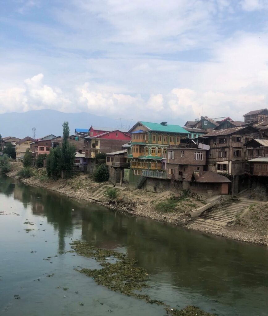
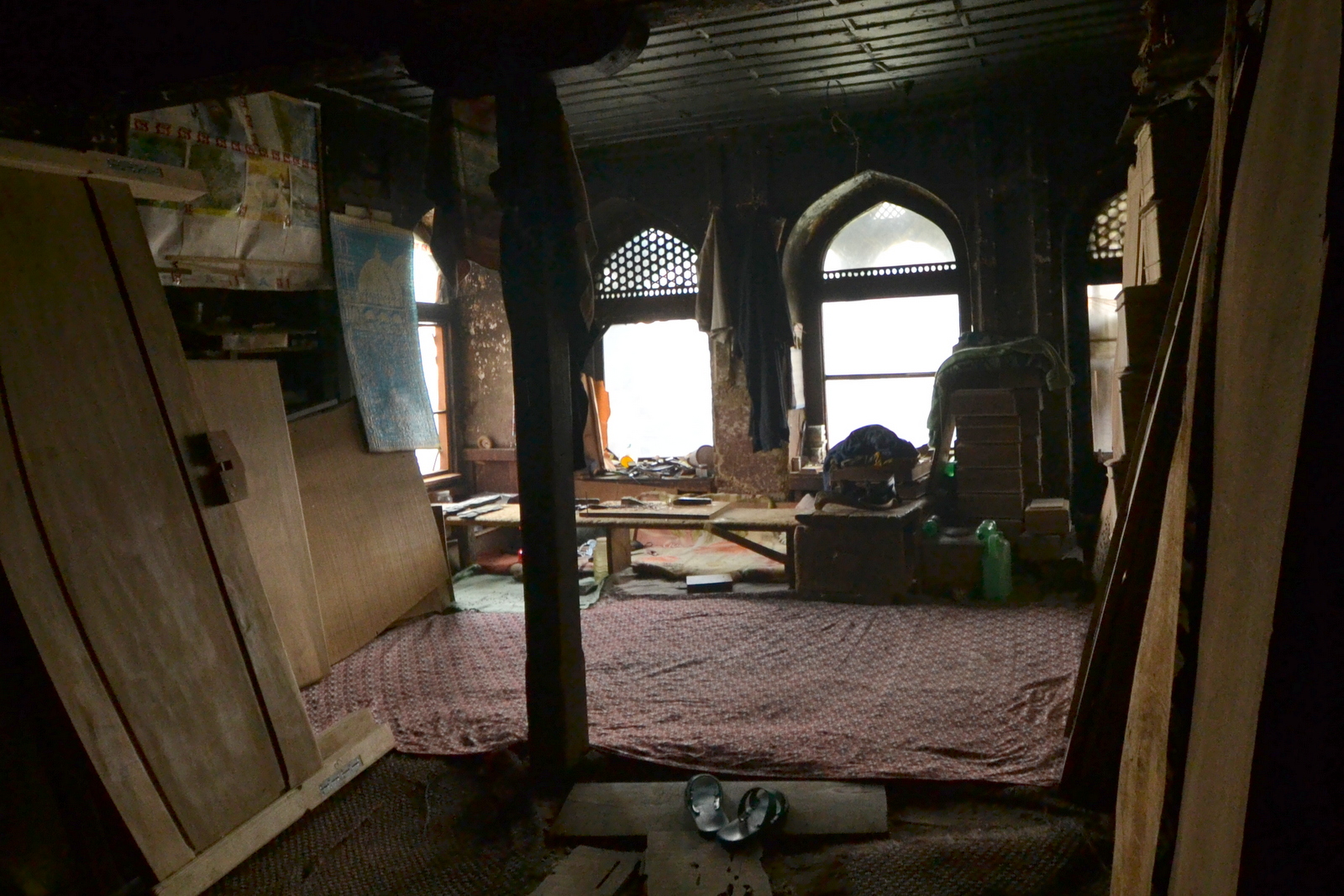
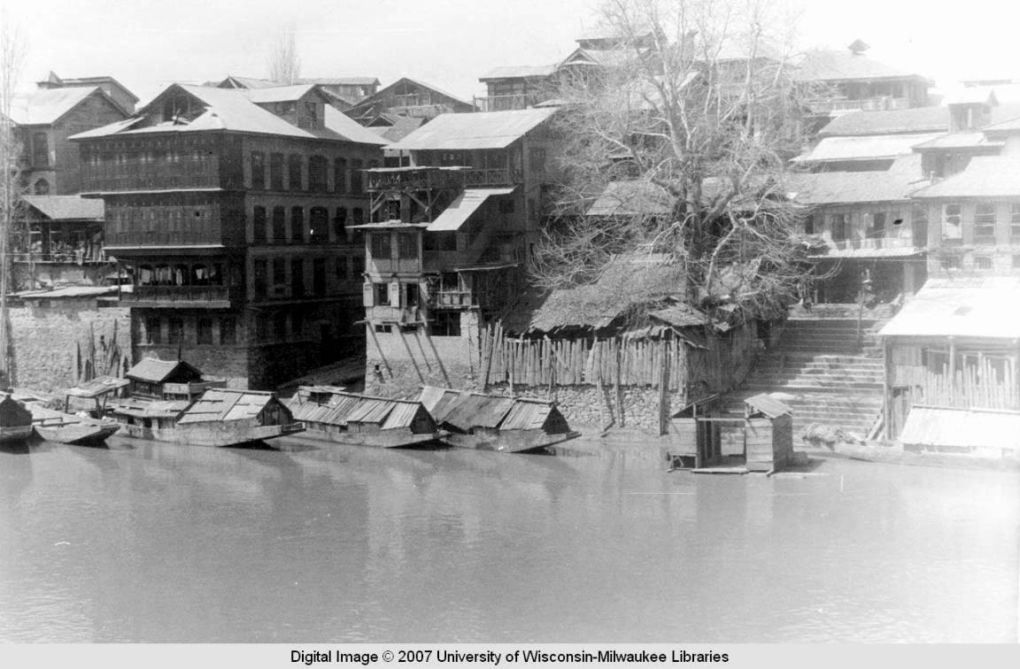
The possible reason for damage to the city from these recent floods remains the slitting of water bodies. “The 1891 census of the state mentions 34,000 boatmen using the Jhelum as the Kashmir Valley’s only highway. Today Jhelum is least fit to accommodate even an average sized cargo boat. So shallow are the waters that in the summer of 1987 one could wade through the river as it passed through Srinagar.”


September 1992
About 210 lives lost.
1995
August 1996
Happened while Amarnath Yatra was going on, about 160 dead.

2010

September, 2014


Triggered by merging of western disturbance and the monsoon over the entire three regions of the State. Heavy rain experienced in upper reaches of Kashmir on 2nd, 3rd and 4th. Upper-reaches of Pahalgam experience three massive cloudbursts.

On 3rd September, Gauge at Sangam reads 21 feet. Flood is normally declared when water is at 23 feet. Ram Munshi bagh reading is 12 feet. Danger mark is 18 feet. People worry about the rising water levels. Rains continue.

On Sept 07, 2014. Flood hits Srinagar city. Deaths in Jammu regions.


Gauge reading at around 1200 hrs in Srinagar:
Sangam = Gauge plate under water (last recorded gauge 33.65 ft).
Ram Munshibagh = Gauge plate under water (last recorded gauge 26.25 ft). 
Ashram = 17.58 ft

Conditions abate by September 10th. But almost entire Srinagar under water.

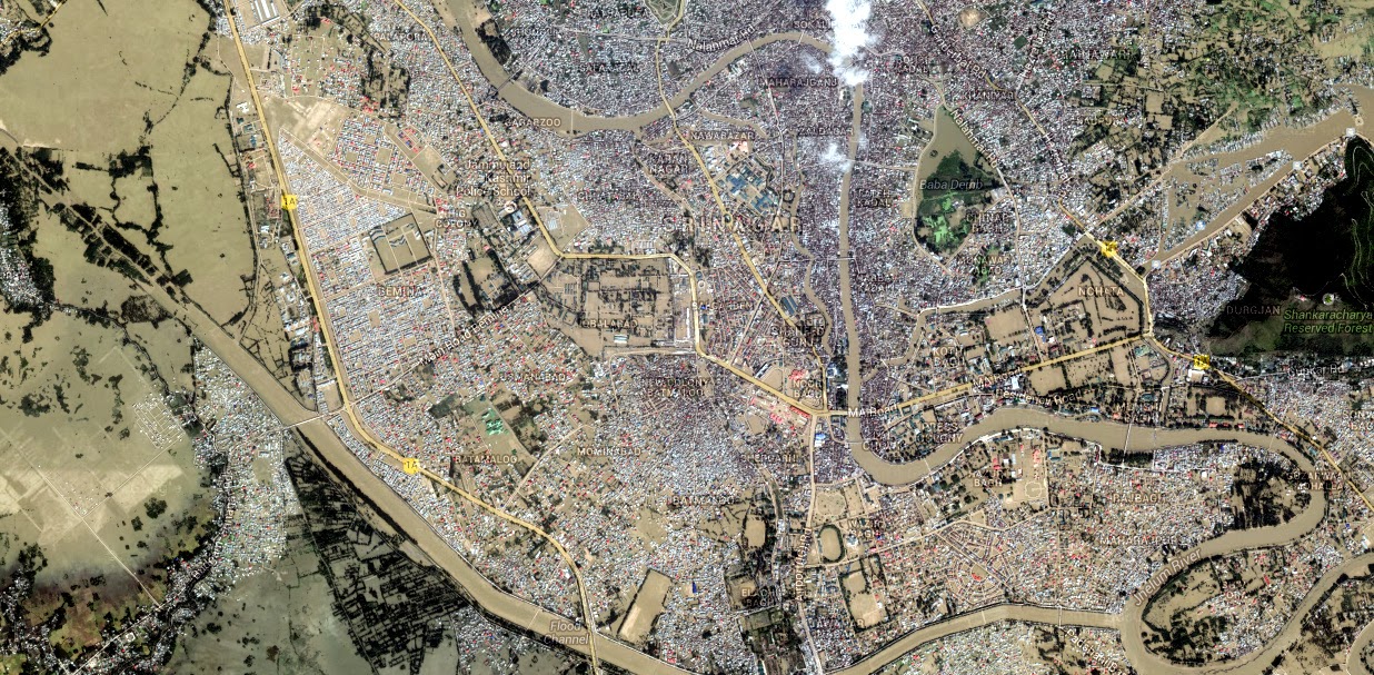
Satellite image of Srinagar as on 10th September

-0-

Related Post:

Flooding Superstitions

Paintings of Kashmiri Water Deities and Origins, 1882


Two rare Kashmiri painting collected by David J. F. Newall in 1850s and presented in his book ‘The Highlands of India’ (1882) and Preliminary Sketches in Cashmere; Or, Scenes in “Cuckoo-cloudland.” By (D.J.F. Newall.) [With Illustrations.] (1882).

“Hindoo Picture Emblematic of the Draining of the Cashmere Valley
The Water Demon Juldeva overwhelmed by Suttee (or Siva) below the hill of Harrie Parvat”
The only depiction of the deity that I have seen in which the bird is part of the scene

In the story, the goddess Sharika [Tripursundari] kill the demon Jalodbhava by taking the form of a Myna (Haer in Kashmir, hence the name of the hill. Identifiable in the painting) and dropping a pebble on the head of the demon (hence setting the precedent for stone throwing in Kashmir).

The stone depicting the goddess on Hari Parbat. 2008.

“Hindoo Picture emblematic of the creation of the river Jhelum or Vetasta.”
The only depiction of the river deity that I have seen

The story as collected by Newall and presented in ‘Notes on Pilgrimages in the Country of Cashmere’, Journal of the Asiatic Society of Bengal, Volume XXXV, Issue IV, 1867

I now come to the last pilgrimage of which I Have noted the details, and which may perhaps be almost more properly called a fabulous account of the river Vetusta, as I am not aware that it is at any time undertaken by the Hindus of Cashmere, and as I rather think that some of the places named are under waters of that river. I extract exactly as I find it in my notes.
“Fabulous account of the origin of the river Jhelum or Vetusta.”
“Mahadeo being here engaged in self-contemplation, Raja Bhagerut arrived, and prayed for a Nag or spring in which to bathe and be cleansed from his sins. A stream then issued from the head of the destroyed which, on arriving at Wamoo, was swallowed by a certain demon, rejoicing in the name of Kalneemie Assur. A second spring was in like hammer swallowed by the thirsty demon. Whereupon Raja Bhagerut descended from his place of prayer at Vetusta Khoond, and engaged the demon, whom, after a brisk encounter (described in the graphic language of the Sanskrit ring (sic in MS.) he is stated to have injured, but was unable to destroy or drive away. (Kalneemie Assur probably graduated in the Vedic art of self-defence!) In fact it seems a polite way of stating that the Raja got the worst of it, as the demon is stated to have given chase, and to have come as far as Hurnag (Virnag) in pursuit. At this however, the wrath of the destroyer was aroused. He encountered the demon, and slew him, got his head in chancery and finally grassed him. I have in my possession a picture of this event where Mahadeo is represented as literally sitting on his face! Lion (or Mahdeo) then commanded the spring to follow Bhagirat Raja, who, descending the valley, passed successively.
1. Kanibul
2. Sumbooderi Tirat
3. Deokieyar
4. Bejbeharie
5.Sungum
6. Shriya
7. Mullyar
8. Gunputyar
9. Soomyar
10. Baramoola, the residence of Raja Bhagerur, where the pilgrimage terminates.”

Newall had no knowledge of Sanskrit, in fact the story was narrated to him by his source in Persian reading from a Sanskrit Manuscript.

Kalanemi, a very popular demon from Vaishnav stories, a perennial enemy of Vishnu, even Kansa is said to be a incarnation of Kalanemi. The story of birth of Vitasta seems to draw upon the stories of birth of Ganga (the reference to Raja Bhaghirath) and slaying of Kalanemi by Vishnu/Shiva in multiple puranas.

The imagery of the demon was uniform in Kashmiri style irrespective of story from which culture was being drawn.

An illustration to the Shahnama (“Book of Kings”): Rustam and the White Div,
Kashmir, circa 1800 
Verinag.
Feb, 2014

From Newall’s writings it is clear that he had collected a lot more of such paintings but sadly only these two seem to have been published.

-0-

The painters
‘Group of Hindu artist’ from ‘Afoot Through the Kashmir Valleys’ (1901) by Marion Doughty.

-0-

Bala’yan Cha heng aasaan

Serious Union/Gambhira Sangam

Feb. 2014.
Overlooking the old bridge

Serious Union/Gambhira Sangam= Vitasta + (Vishav + Rembyar, Stein’s Gambhira). Gambhira Sangani of Rajatarangini. Sangam at Kakapora. Between Bijbehara and Avantipur.

Something about the bridge from updated Rājataraṅgiṇī:

“It may be noted that this crossing has a certain strategic impotence. On occasion of a rising in 1930 in parts of Jammu territory, sympathizers in the Kasmir valley took care to burn the wooden bridge by which the modern motor road from Srinagar to Banhal pass crosses here the river. It has been since replaced by an iron one duly guarded.” ~ Luther Obrock (ed.) Marc Aurel Stein – Illustrated Rājataraṅgiṇī (2013)


Bath-Houses along Vitasta

John Burke, 1868-69


By Geoffroy Millias.
from ‘Irene Petrie : Missionary to Kashmir’ (1903)

At Shah Hamadan
By Brian Brake, 1957

by Douglas Waugh (late 1950s, early 1960s)

From the book
“Tikkus’ tourist & shopping guide of Kashmir covering Jammu, Kashmir, Ladakh ” (1970) by Bharat Tikku.
2008

“In the upper part of the city the banks are lined with houseboats in which the visitors live. But lower down these banks, which are sometimes twenty and thirty feet high, have a very interesting and varied life at the water’s edge, where you find laundrymen and laundrywomen at intervals all the way along, and bathers, sometimes composed of groups of men, others of groups of women, and again men and women together. As a rule this bathing takes place at the foot of some of the wide stone steps that lead up from the water to the upper level of the bank, and frequently in the vicinity of a temple or mosque. There are also a number of small bath-houses, without roofs, and divided into very tiny little cabinets that are hardly large enough for a single person. These are indulged in by the more fortunate, or the better-to- do classes, who constitute but a very small percentage of the total bathing population.

This bathing, too, is a very interesting process to witness, especially the dressing, for, while the men are rather indifferent as to how much or how little clothing they may have on, the women are exceedingly modest and rarely, if ever, is there the least exposure of any portion of the body besides the arms, and head and feet. They go into the river with one dress on and when they have bathed they have not only washed their bodies but the garments they have been wearing, and when they come out they have on the bank, or steps, another garment which they put on, and so skillful are they in making this change that it is almost impossible to tell how it is done. One moment they are clad in the wet, clinging clothes which they have worn in the river, and the next by a rapid sleight- of-hand transformation they are dressed in dry garments of most pleasing hue.”
~ ‘Our summer in the vale of Kashmir’ (1915) by Frederick Ward Denys

-0-

Frozen Jhelum

Kashmir in Winter
[view of Sher Garhi Palace]
Early 20th century
via by Michael Thomas of Pipal Press
More postcards from the collection here


“The river Jhelum was frozen over in the winters of 1658, 1764, 1759, 1780, 1816, 1835, 9th December, 1879 and 1st February, 1895. The winter of 1759 A.D. got so much prolonged that the Jhelum was frozen over on as late as 31st March…”
‘Geography of The Jammu and Kashmir State’ (1925) by Pandit Anand Koul. 

Jehlam flows into Bay of Bengala


Goof-up from a time when East India Company had just arrived at Mughal courts:

Kyshmier [Kashmir]. The Cheefe Citty is called Sirinakar [Srinagar]. The Riuer of Bhat [Behat or Jehlam] passeth through it and findeth the Sea by Ganges or, some say, of it self in the North Part of the Bay of Bengala. It bordereth Cabul to the East Southerly. It is all Mountaines.

From the Appendix to ‘The embassy of Sir Thomas Roe to the court of the Great Mogul, 1615-1619, as narrated in his journal and correspondence’ (1899).

A note in the book does point out the obvious error in sending Vitasta eastwards and mentions that William Baffin’s map from 1619 of Mughal empire , based on Sir Thomas Roe’s account did get the direction of the river right.

William Baffin’s Map
[via: columb
ia.edu]

-0-

Facebook
YouTube
Instagram
RSS