Splendor of Ancient Kashmir in Alchi


In 9th century, Buddhism was in decline in trans-himalayan region due to persecution from Bon Tibetan rulers like Langdarma of Guge (A.D. 836 to 842). The faith was in decline until King Yeshe-Ö (A.D. 947-1024) came to the throne of the kingdom that consisted of the present Indian territories of Ladakh, Spiti and Kinnaur, and Guge and Purang in western Tibet.

To revive the faith, Yeshe-Ö sent 21 young men to viharas of Kashmir and other parts of India where Buddhism was still flourishing. They were to study and translate the texts of Mahayana Buddhism and bring them to west Tibet. Of these 21 men, only two survived the journey and returned home. One of them was Rinchen Zangpo who in 10th century is credited to have built over 100 monasteries all over Himalayan region from Ladakh to Sikkim. Of these building few survive, the best and the most famous remains Alchi about 10,500 feet above sea level in Ladakh, by the side of Indus.


At the entrance of Alchi a contemporary painting representing Lochen Rinchen Zangpo (958–1055) . He is said to have founded the Alchi monastery by planting a pipal tree here. Lochen means ‘the great translator’. 
Rinchen Zangpo was a student of Buddhist Bengali master named Atiśa (Born 980, Bikrampur, Bengal, Pala Empire (now in Bangladesh)). Zangpo is said to have spent quite sometime studying in Kashmir. His biography mentions that for building Alchi and other monasteries, Zangpo brought 32 artists from Kashmir. Thus, laying foundation for one of the oldest and the most unique monasteries of Ladakh. It is here, you can see scenes from ancient Kashmir – 900 year old glimpses left by those Kashmiri hands. Kalhana was to offer us such glimpses only some time later in 12th century. The best place to visualize his Rajatarangini is at Alchi rendered in a style mixing Indian, Kashmiri, Tibetan and central Asian artistic traditions.

Bodhisattva Avalokiteśvara in Sumtseg temple

The Kashmiri painters at Alchi have drawn these scenes around bodhisattva Avalokiteśvara in Sumtseg temple of Alchi. Avalokiteśvara, ‘the lord who looks down’, the buddha of compassion, is said to live on mythical mountain Potalaka which modern scholars say is in fact Pothigai hills of Western Ghats (Tamil Nadu/Kerala).

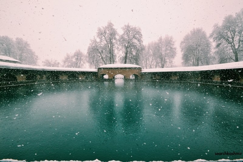
Site map of Alchi Chhoskhor
The monastery was abandoned in 16th century for some unknown reasons
It is now run by Likir Monastery, currently headed by the Dalai Lama’s younger brother, Tenzin Choegyal.

Although Ladakhi tradition places the monastery in 10th century and to Zangpo, inscriptions at the temple ascribe the monastery to a Tibetan noble called Kal-dan Shes-rab later in the 11th century. The various temples here are now dated to be between early 12th and early 13th centuries. A period of great religious and political upheaval for the entire region with the coming of Ghaznavid Attacks on the sub-continent, but miraculously, owning to its geographic location, left this place untouched.

Sumtseg/Sumtsek temple
made in stone and mud brick supported by wooden beams


Alchi temples are also the oldest surviving big wooden structures done by Kashmiris. 


Maiteya Buddha

Akshobhya Buddha

Bodhisattva

The upper floors are off limits for tourists

the caretaker monk
If you are a woman, there is a chance he will grab your hand and try to explain away the place.

Inside the temple:
Pattern drawn on the beams is now believed by scholars to have patterned on the design of Kashmiri textile, 
making it the only surviving sample of Kashmiri cloth design of medieval times. 
West niche of Sumtsek temple
Bodhisattva Avalokiteśvara
the most interesting part of Alchi complex
Avalokiteśvara’s painted clay dhoti

Scholars like British anthropologist David Snellgrove and German art historian Roger Goepper have suggested that the scenes depict ancient pilgrimage sites of Kashmir or famous sites of Kashmir known to the artists (depicts 13 places in all and a place). It is a map of Kashmir.

A Shiv Temple
And
the Riders

The figures in the painting look too Kashmiri, with typical nose, beards and half-closed eyes. But the over-all feel seems a bit Islamic.

Not just Trans-Himalayan and Indian subcontinent, 10th, 11th and 12 century Kashmir was also going through some major changes.

The Hindu Shahi Kings in Kabul were going to rise and then fall under Ghaznavid blade. Kashmir of Lalitaditya Muktapid ( 724- 761 A. D.) when Hinduism and Buddhism flourished together in Kashmir was past but its legacy in form of architecture was still alive (One of the oldest Kashmir text from the era, ‘Nilamata Purana’, mentions Buddha was one of the lords worthy of worship).

Queen Didda (979-1005 AD), grand-daughter of Bhimadeva, Shahi ruler of Kabul, arrived to rule Kashmir. Shivaie Abhinavgupta wrote the great work of Kashmir Shaivism, Tantrāloka. Mahmud Gaznavi couldn’t get Kashmir due to its remoteness. For the moment valley was safe from outsiders. But, wasn’t safe from insiders.

Kashmir was to see the reign of Harsha (ruled 1089-1111 AD),  a destroyer of Hindu and Buddhist temples. He had many ancient temples destroyed, had their golden statues melted for financial reasons. In fact, for his temple destroying ways, Kalhana calls Harsha a ‘Turushkas’. Apart his temple destroying ways, Kalhana (whose father was a minister for Harsha) in his Rajatarangini also remembers the King as a patron of arts and music. It is mentioned that under his rule new fashions of dress and ornaments from foreign were introduced. His ministers were always luxuriously dressed. In his army were employed Turk soldiers (foreign Muslims, in Rajatarangini any Muslim from Central Asia was a ‘Turk’). Can these be the riders seen in the paintings at Sumtsek?

Rajatarangini, mentions that the scale of Harsha’s temple destruction was immense, but some temples did survive. Among those saved was one at Parihaspora, left untouched as a favor to a singer named Kanaka. The year was 1097.

Parihaspora was the capital of Lalitaditya. Here he had built five large buildings viz.,(1) the temple of Mukta-keshva with a golden image of Vishnu, (2) the temple of Parihasa-keshava with a silver image of Vishnu.(3) the temple of Mahavaraha with its image of Vishnu clad in golden armour, (4) the temple of Govardhanadhara with a silver image and (5) Rajavihara with a large quadrangle having a large copper Buddha. At the site, was also a stupa built by Chankuna, Tokharian minister of Lalitaditya.

The site has earlier been plundered by S’amkaravarman (A.D. 883-902), son of Avantivarman. But, obviously some of it must have survived. The silver image of Vishnu Parihasa-keshava was carried away and broken up by King Harsha. Rajavihara was not touched. The site was finally destroyed by Sikandar But-Shikan (A.D. 1394-1416). However, even up to the year 1727 A.D. the Paraspur plateau showed architectural fragments of great size, which were carried away as building materials.

Caitya of Cankuna which housed Brhad Buddha
1915, Parihaspora

The scholars now suggest that these Buddhist sites of Parihaspora can be seen depicted in the paintings on the west niche of Sumtsek temple.

west niche of Sumtsek temple.

representation of Lalitaditya chaitya at Parihaspora
Stupa built by Cankuna at Parihaspora
In the center
Green Tara in varada mudra
Born of Avalokiteśvara’s tear
protects from ‘unfortunate circumstances’
Style in which her eyes are drawn can be seen in Ellora murals (8th Century), Aurangabad, Maharastra

Manjushri
Right wall
Dhoti depicting scenes from life of Shakyamuni
Mahakala
Lotsa Temple 
Mahakaal Inside
Gate of Manjushri temple

Red Manjushri Inside
Bodhisattva of wisdom
Saraswati of Hindus,
the goddess of Kashmir

Outside the temple, there are some monk cells meant for meditation.
The inside of the monk cells tell another interesting tale.

the designs and paintings
inside the monk cell

Notice the flying apsara…now see this:

Photograph of the Meruvardhanaswami temple at Pandrethan near Srinagar, taken in 1868 by John Burke. Pandrethan, now mostly in ruins, is one of Kashmir’s historic capitals, said by Kalhana in his poetical account of Kashmiri history called Rajatarangini to have been founded by king Pravarsena in the 6th century AD.

The ceiling of the temple:

Copy of Pandrethan ceiling prepared by one R.T. Burney was presented by W.G. Cowie in his 1865 paper ‘Notes on some of the Temples of Kashmir, especially those not described by General A. Cunninghan’ (Journal of The Asiatiic Society of Bengal Volume 35, Part 1. 1866)

The design on the ceiling was first copied by Alexander Cunningham in around 1848 after a tip-off by Lord John Elphinstone. When Cunningham visited the temple, there was evidence that one time the ornamentation, the designs and the figures of the temple must have been profusely plastered over to cover its naked idol beauty. [for details read: Ceiling of Pandrethan]

By 13th century, the Buddhist Kashmiri Pandits in Ilkhanate court where heading back to Kashmir as Iran became Islamic. But, by the end of 14th century, Kashmir also became Islamic. The famous Bodh vihara of Nalanda in Bihar was destroyed by Muhammad Khilji. It’s last head a Kashmiri named Shakyashri Bhadra (1127­-1225) headed for Tibet and then retired to Kashmir.

Later Rajataranginis tell us that temples with beautifully painted walls were found in Kashmir till Akbar arrived in 16th century. The area around Hari Parbat in Srinagar was full of such temples. But, these got lost or destroyed and none remain. Around 16th century Alchi monastery was abandoned for unknown reasons. The stories on its walls remained etched and untouched for centuries. A little time capsule, storing the glory of ancient Kashmir and its artists.
-0-

References and further reads:
Mural paintings of Alchi by Dr. Monisha Ahmed

Glimpses of the Lost World of Alchi By Jeremy Kahn

Here hear the battle of Basgo

View of plans of Basgo (Bazgu) village with Zangla castle at top of a hill, about 4 miles further of Nimo, about 42 kilometer west of Leh.

Here was fought the battle of Basgo that ended with Ladakh coming under to sphere of Mughal influence.

Zangla Castle

In the middle of 17th century, Tibet was under the control of Mongol Gushi Khan who supported the 5th Dalai Lama to take control of the region that was seeing quarrels between different sects of Buddhism. This is the Dalai (meaning ‘Ocean’ in Mongolian) who built Potala (Skrt. Potalaka meaning ‘celestial residence’) in Lhasa.

Ladakh at the time was under a new Dynasty, Namgyal who had defeated the king of Leh and moved the capital to Basgo. In a dispute between Tibet and Bhutan, Namgyals of Ladakh, given the head of their sect was based in Bhutan, decided to support Bhutan. In return, in the Dalai Lama of Tibet sent Mongol and Tibetan forces on an expedition to Ladakh under one warrior monk Lama Sang (Ganden Tshewangpel Sangpo of Ganden (Skrt. Tushita)) monastery). Tibetans forces also had the support of Kehari Singh (1639-1696) of Bushar state in upper Satluj Valley as he wanted to recover some part of Kinnaur area which had been earlier claimed by Namgyas. 
When Gyalpo Delek Namgyal (1640(5)-1680 A.D) of Ladakh found Tibetan-Mongols on his heel, from Basgo he wrote for help to Kashmir. Kashmir at the time was under Mughal governor Ibrahim Khan (reign: 1678-1885) son of famous Kurdish administrator Ali Mardan Khan. Already, during the time of Shah Jahan, Namgyals and their territorial ambitions in Trans-Himalayas were not unnoticed by the Mughal court. But, Namgyals on being notified, did tender submission to Mughal court. Now, that Namgyals needed help, they looked to Mughals. 
Ibrahim Khan forwarded the request to Mugal Emperor Aurangzeb at Aurangabad (August Hermann Francke mistakenly mentions ‘bigot’ Shah Jahan). Mughal historian Mir Izzet Ullah (1812) mentions an army of six lakh men from Kashmir was sent and lead by Ibrahim Khan’s son Fidai Khan (Alexander Cunningham pegs the number at a more believable 6000, Francke mistakenly gives the name as Fateh Khan). In return for this help, Delek was to become Muslim and promise to give Kashmir monopoly over the pashmina trade. 
Mughal crossed the Indus at Khalatsi (Khalatse) on two wooden bridges and marched to Bargu village. Bidhi Singh of Kullu Kingdom  (Lahul and Kullu tributary were tributary of Ladakh since AD 1125-50 ) supported Mughals but plundered Zanskar valley nevertheless when he entered it. 
The Mongols had taken position on the plain of Jargyal between Bazgu and Nemo. In the battle that ensured, the Tibet-Mongol were defeated and chased till Spituk. 

After the war, Ladakhi source do not mention the conversion of Namgyal to Islam, but Mughal sources do. As was the norm of the time, Fidai Khan took some of the royal family members to Kashmir as ‘hostages’ while Delek Namgyal changed his name to Akbat Mahmud Khan.

However, after the Mughals returned to Kashmir, the Mongols again came in 1684 and the king of Ladakh had to submit and pay yearly tribute to Tibet. Dalai Lama wasn’t pleased with the interference of foreigners in Himalayas. A peace treaty was signed between Tibet and Ladakh which ensured Tibet will never attack Ladakh and among other things ensured Kashmiri Pashmina traders will only be allowed till Spituk.
However, after the battle of Basgo, Ladakh continued to remain in sphere of Mughals, then Durranis, Sikhs and the Dogras.
-0-
*

Based on info. in ‘Buddhist Western Himalaya: A politico-religious history’ by O.C. Handa. According to the author, the exact year of the event is much disputed and is given as 1650 by Francke, 1680 by Hutchison and Vogel and 1687 by Cunningham. This was also the time when first mosque was erected in Leh in 1699.

-0-

The Zangla castle was where stayed the famous Hungarian Alexander Csoma de Kőrös (1784-1842) and brought out the first Tibetan-English dictionary and grammar book. The castle was renovated by a Hungarian team in around 2006.

-0-

Sher Garhi Palace as it Was

Last month received an email from INTACH (Srinagar), they will be using the images shared by SearchKashmir to help with the renovation of Sher Garhi Palace. Here are the images and some elementary back info. about the place.


Located on the left bank of River Jhelum near the Budshah Bridge. Built originally by Afghan governor Ameer Jawan Sher Qizilbash in around 1772. It is said the stones for the palace came from Pathar Masjid. It was built on a site where King Ananta had built his Royal Palace in 1062-63. Later it became palace of Dogras who added a Dogra art touch to it. Sometime before 1900, the palace was again renovated in faux Greco-Roman style with great Grecian columns. A major portion was destroyed in fire, I believe, in late 1970s. This building was the “Old Secretariat”. It was used as an office building in 1980s. A description of the palace and the adjoining buildings can be found in “The Happy Valley: Sketches of Kashmir & the Kashmiris (1879) by William Wakefield”.

Pursuing our course down the river the sides of which in former days were em- banked from the first to the last bridge, by an embankment composed of large blocks of limestone, of which at present the ruined remains are all that is left we soon come to a large building, the Sher Garhi, the city fort and palace. Situated on the left bank, it presents to the river, which flows along its eastern side, a long loop- holed wall, with bastions rising between twenty and thirty feet above the general level of the water, surmounted by roomy, but lightly-built, houses. Its southern and western sides are protected by a wide ditch ; the Kut-i-Kul canal bounds it on the north, and in its interior are grouped a number of dwelling- houses for the officials of the court, government offices, and barracks. On its wall, facing the river, and perched upon one of the bastions, is a large double-storied house, the abode of the Dewan or Prime Minister, and just below his residence is a long lofty building, the government treasury, containing shawls, ‘pushmeena,’ coin, and other valuable property. A curious-looking wooden building comes next, the Rang Mahal or ‘audience hall,’ a part of the royal residence, which is just below it, styled the Baradarri, and which is unquestionably the most important modern structure in Srinagar. It is a large irregular building of a peculiar style, for while partly of native architecture, one portion, with a large projecting bow, partakes somewhat of an European character. A flight of wide stone steps leads up from the water’s edge at the angle of this building, and conducts into the palace. Adjoining is the temple frequented by the ruler and family, called the Maharaj-ke-Mandir, the domed roof of which is covered with thin plates of pure gold, which glitters in the sunlight, causing it to be plainly perceptible a long distance away. To reach the interior of the palace, one ascends by the before -mentioned steps, which at all times of the day appear thronged with people, some waiting to prefer petitions to the sovereign or his ministers as they descend to their boats, others to obtain a hearing or justice, which is here administered in open court daily by the governor. To the more private portion of the palace they have no access ; for, guarding the gateway at the top of the stairs which leads directly into the royal abode, stands a sentry, a warrior belonging to the Kashmir, army, and near by is the guard-room, what we should call in our service the main-guard.

View of the Place before the last renovation
Probably by Samuel Bourne
in around 1860s

Sher Garhi Palace, the Summer place of 19th-century Dogra ruler, Pratap Singh. From ‘The Romantic East: Burma, Assam, & Kashmir’ by Walter Del Mar (1906

Sher Garhi Palace. From Dutch travelogue ‘De zomer in Kaschmir : De Aarde en haar Volken’ (Summer in Kashmir: ‘The Land and its Peoples) by F. Michel (1907)

From ‘The road to Shalimar’ by Carveth Wells, 1952.

view of Sher Garhi Palace in winter.
Postcard. Early 20th century. [courtesy: Micheal Thomas]

from ‘Our summer in the vale of Kashmir’ (1915) by Frederick Ward Denys.

From ‘Kashmir: Its New Silk Industry’ by Sir Thomas Wardle (1904)

Illustrated Weekly of London. 1921.

Postcard. 1920s.
[via: ebay]

From National Geographic. 1921.
-0-

Complete Guide to Nur Jahan’s Pathar Masjid in Srinagar

Same pattern inside the pavilion at Shalimar Garden built in 1619 on order of Jahangir


In 1623, Noor Jahan built a Masjid in Srinagar on the left bank of Jhelum near Zaina Kadal opposite Shah Hamdan mosque.

Kashmiri had a belief that Noor Jahan belonged to the valley. Godfrey Thomas Vigne, in 1835, writes:

“Nur Jehan Begum (the light of the world), the Nur Muhul (the light of the palace) of Lallah Rookh, is the most renowned name in the valley, that of her august consort, Jehan Gir, not excepted. In spite of the more authentic story of her birth which is to be found in Ferishta, the Kashmirians would have us believe that she was a native of the valley: a daughter of the Malek of Chodra, a large ruined village in the centre of the centre of the southern side of the valley, and situated on the Dud Gunga (milk river). The only fact that that I heard that I heard of, that could be any possibility be brought forward in support of this assertion is, that near Chodra there are some ruins, said to be those of a house that once belonged to her; but in which there is nothing in any way remarkable. I have already oticed the palaced at Vernag and Shahbad, which were built by here or her husband. The Musjid, or new mosque, in the city, was built by her, and is, in fact, the only edifice of the kind that can vie in general aspect and finish with the splendour of the Moti Musjid, or the pearl mosque, at Agra. A handsome flight of stone steps leads from river to the door of the courtyard, which surrounds it. The interior of the building is about sixty-four yards in length, and of a proportionate width, the roof being supported by two rows of massive square piers, running through the entire length of the building, the circular compartments between them being handsomely ribbed and vaulted. When I was in Kashmir it was used as a granary or storehouse for rice.”

Unlike other Masjids in Kashmir that were made of wood, this, this masjid was made of stone or Pathar, and hence came to be known as Pathar Masjid. And unlike the native Kashmiri mosques, it didn’t have a pyramidical dome at top.

The story goes that on completion of the Mosque, a Mulla asked Nur Jahan how much did it cost her. It is said that in her response the Shia Empress of India pointed to her shoe or Jooti. Mulla in response is said to have decreed the Masjiid unfit for praying. So goes the story of a building that in Sikh era was used as a granary. It is said the mosque originally had a dome that was demolished by a Sikh era governor.  

A description of the mosque is given by Ram Chandra Kak in his ‘Ancient Monuments of Kashmir’ (1933):

The half-attached “bedpost” columns in the two outer angles of the jambs of the entrance are noteworthy. The plinth, which is now mostly underground, is surmounted by a lotus-leaf coping.

The frieze between the projecting cornice and the eaves is decorated with a series of large lotus leaves, carved in relief, some of which have been pierced, and thus made to serve the purpose of ventilation apertures. A flight of steps in each jamb of the entrance gives access to the roof, which is, as usual in Kashmir, sloping, except in the centre, where there was originally a dome which was later dismantled by the Sikhs. The roof consists of twenty-seven domes, the central one of which is the largest. The domes are mostly ribbed inside, though there are some which are flat or waggon-vaulted.

The roof is supported internally on eighteen extraordinarily massive square columns having projections on two sides. The lower portion of the columns is built of stone and the upper of brick covered by a thick coat of buff-coloured lime plaster.


The enclosure wall is built of brick masonry, with a coat of lime plaster, adorned by a range of shallow arched niches.

The mosque is said to have been built upon an ancient Buddha vihara. A mosque first came up here during Fateh Khan’s rule (1510-1517). It was a sunni mosque. In 1623, Nur Jahan, rebuilt it as a Shia mosque. It is said the stones for the mosque came from ancient stairway that linked Shankaracharya temple to river Jehlum near the present day Durga Nag temple.

In around 1819, Maharaja of Punjab, Ranjit Singh, send his best military general (Akali) Phula Singh to take on Afghans in Kashmir. Phula Singh defeated Jabbar Khan and then he went around triumphantly rearranging Kashmir, again. Pathar Masjid was taken over by the newly established government. A toup (tank) was placed at Pathar Masjid so that the shrine of Shah Hamada across the river could be blown up. Pandit Birbal Dhar who is said to have invited Sikhs into Kashmir, intervened to save the shrine. 
The bank inside the mosque is still used for some kind of storage.

-0-

Complete Guide to Naseem Bagh


On west bank of Dal Lake, in 1635, on order of Shahjahan work on a new garden was started. It is said that on the same site, sometime after 1586, Akbar had laid out a garden.

In summer of 1635, when Sun entered the Zodiac of Aries, northern vernal equinox, March 20-21, twelve hundred saplings of chinar were planted all at the same time. Laid out in classic ‘Char Chinar’ pattern, four chinars in four corners of a rectangular piece of land, so that a person in centre would be under shade at all hours of the day. The saplings were fed water and milk. A canal from Zukrah canal (canal now non-existent, near Batpora) was dug and brought in to water velvety green grass. A boundary wall was raised and fountains planted (both disappeared during Afghan time). This Mughal garden was named Nasim Bagh or the Garden of Breeze, for the gently breeze that blew though it.

Persian chronograph for the garden read:
Dar jahan chu ba hukm-i-Shah-i-Jahan,
Dauhae tazah az na’im amad,
Kard gulgasht-i-an chu Shah-i-Jahan
Bulbul az shakha gul kalim amad;
Guft tarikha dauhae shahi
Az bihishte Adan Nasim amad
When in this land by order of Shah Jahan
A fresh garden came into existence out of magnificence.
When Shah Jahan roamed therein
Bulbul spoke from a blossomed branch
Said the date of the royal garden.
Local lore recommended visiting the garden in mornings when gentle Nasim would blow through it. 
The Persian saying about gardens of Kashmir used to be:

Subha dar Bagha Nashat o Sham dar Bagha Nasim,
Shalamar o lala-zar o sair-i-Kashmir ast u bas

Morning at Nashat Bagh and evening at the Nasim Bagh,
Shalamar, and tulip fields, – these are the places of
excursion in Kashmir and none else.

However, Godfrey Thomas Vigne,  who visited Kashmir in 1835, was told by locals to visit the garden in morning. 
I visited the garden in morning. I wonder if people still know when exactly Nasim blows.
In 1950s, during the time of Bakshi Ghulam Mohammad, this garden was handled over by the Dogra royal family to the civil administration for use as campus of a University. Naseem Bagh is now the beautiful campus of Kashmir University.
  
Autumn, 2014

Naseem Bagh
1875
[via: Japan Archive]
It was a popular camping site for the British.
Hari Parbat from Naseem Bagh
1890s
[via: George Eastman House Photography Collections]

Nasim Bagh by Ralph Stewart
1913
[via: pahar.in]

-0-

Historical account based on ‘Tarikh-i- Hasan’ of Moulvi Ghulam Hasan Shah (1832-1898). And translations provided by Pandit Anand Koul in 1920s.

Complete Guide to Buniyar Temple

Buniyar Temple, about two miles above Rampur,  situated along the Baramula-Uri road on the bank of the Vitasta, is often described as the “best preserved” specimen of Kashmiri architecture. Although unlike most Kashmiri temples which are made of limestone, this one (beside the one at Wangat) is made of granite.

This is the story of the temple at Bhaniyar/Buniar/Bhavaniyar/Bunair/Boniar/Boniyar/Buniyar.


On my way back from Uri, I decided to check the ancient temple whose roof is visible from the road. A military man walked me from the main road, past the security gate and into the military camp which now surrounds the temple. On way to the temple, the man, someone from mainlands, claimed the temple was build by ‘Pandavas’. When I told him that I am ethnically Kashmiri Pandit, the man happily said that it all belongs to me. 
In 1868, when Henry Hardy Cole arrived at the temple along with photographer John Burke for his ‘Archaeological Survey of India report, ‘Illustrations of Ancient Buildings in Kashmir’ (1869), a local Hindu Fakir who lived in the temple told him that the temple was build by ‘Pandus’. 
The temple had recently been excavated on the orders of Maharaja Ranbir Singh. Before that, the temple had been claimed by mountain and the trees, which might explain why it survived vandalisation and remained untouched for a long time.
Burke’s Photograph
[via British Museum]

The ruins of this temple had earlier been noticed by Karl Alexander A. Hügel  (1835) and G.T. Vigne (1837). Hügel mistakenly described it as a well preserved Buddhist temple, while Vigne called it a Hindu ruin on the road. 

An attempt to study the temple was first made by Alexander Cunningham in November 1847. He noticed that the Pandits called the place ‘Bhawaniyar’. And assumed it to be a ‘Bhawani’ temple. Cunningham couldn’t examine the temple properly as it was half-buried under snow at the time. Using a telescope he tried to see beyond the thick foliage if the inner wall of the temple had a colonnade.

First proper detailed note of the temple came in 1865 when that summer W.G. Cowie visited the temple that had been recently excavated revealing 13 sq.ft. interior), walls supported on a basement of 4 ft.sq, a cloistered quadrangle measuring 145’x120′. The findings were given in ‘Notes on Some of the Temples of Kashmir’  (Journal of the Asiatic Society of Bengal > Volume XXXV, Issue II, 1867). Te local Pandits told him that the temple was built by one Bonadutt, hence the name of the place. The brother of this man had built a temple at Venapora beyond Sopor. About the granite used in the temple he wrote:

“The material of which the buildings are constructed, is a pale, coarse granite, of which there seems to be no quarry within reach on the left bank of the Jhelum. This circumstance is remarkable, considering the enormous size and weight of some of the stones employed. Mr. Drew, a geologist in the service of H, H. the Maharajah, thinks that the blocks of granite must have been carried down some of the valleys on the opposite side into the river bed, whence they were brought for the construction of the temple.”

He also suggests that the central temple was probably surrounded by water (just like Cunningham had suggested for Martand) as he found two old wells also near the temple. He also noticed that near upper base of the temple, is the spout of a channel which carried off the washings of the image. He wrote it looked like a snake or some similar animal.

Later some addition notes were added by James Fergusson in around 1876. He noticed that the colonnade was Gandhara inspired. 

Final clear description about the temple was given by R.C. Kak in Ancient Monuments in Kashmir (1933):


The gateway is a double-chambered structure faced on each open side by a trefoil arch surmounted by a steep pediment. The lintels of the closed arches are supported on pairs of columns which were originally fluted, though the weather has now left no trace of flutes. They have a double capital, the upper one being voluted on all four sides. The walls are externally surmounted by a cornice of kirti- mukhas, alternating with miniature trefoiled niches. Upon this rests the first course of the pyramidal roof. 

The flights of steps-on the eastern and western sides respectively afford entrance to and exit from the entrance chamber. The one on the roadside is buried underground, but the inner stair has been excavated. It consists of seven steps flanked by sloping rails and upright side walls. Between this stair and the temple is a small stone platform which formed the lowermost course of the stepped base of a column (most probably a Garudadhvaja). 

The priest in charge of the temple has now placed in it a small stele of very crude workmanship and late date, which he has painted with vermilion. Another similar stele, still standing in the position in which it was found, is seen in front of the temple stair.
The temple itself stands on a double base, which is in every respect similar to other structures of its kind in Kashmir. A lofty trefoil arch, standing upon advanced pilasters and enclosing a rectangular entrance originally surmounted by an ornamental trefoil and steep pediment, gives access to the sanctum. The jambs of the entrance are adorned with half-engaged columns. The interior is a square of 14 feet. The pedestal of the image is placed on a broad platform. The original image, which seems to have been of Vishnu, is now replaced by small Siva-lingas originally brought from the bed of the river Narbada. The walls are covered with a coat of modern whitewash. The string course from which the ceiling springs is still visible, but the ceiling itself which Bishop Cowie saw in 1865 and described as domical, has since either fallen down or been removed. It was, no doubt, similar to the ceilings of the larger temples at Wangath.

Externally the only decorations are the trefoils of the recesses, their pediments, and the cornice of kirtimukhas and miniature trefoils from which the roof sprang.
The quadrangle measures 145′ by 119 1/2′, and consists of fifty- three cells and the gateway. They are rectangular, 7′ long by 4′ broad. Each cell has a single trefoiled entrance enclosed in a high- pitched pediment resting on half-engaged columns. These ranges of cells are preceded by a noble colonnade which stands on a base similar to that of the temple. A transverse beam connects the capitals of the columns with the roof of the cells. Over these beams rises the entablature, only one course of which, namely the frieze of miniature trefoils, is extant.

In the centre of each range of cells, except, perhaps, the one in which the gateway stands, is an apartment of larger dimensions preceded by a pair of taller columns which are advanced about 4′ from the rest of the peristyle.

The top course of the cells is also decorated in the same way as the frieze above.
On the south side, projecting from the cornice of the upper base of the temple, is the spout of the channel which carried off the washings of the image. It seems to have been shaped originally into a makara, or crocodile’s head. Immediately below it is a huge water trough carved out of a single block of stone.

The rain-water in the courtyard is carried off by a drain which runs under the south-eastern corner of the peristyle. 

In cell No. 11 of the north range, beginning the reckoning from the corner nearest the gateway, is the side entrance, which was then, as now, closed with a wooden door. The monotony of the external face of the western wall is partially relieved by rows of small square projections. In its two corners are two cells opening outwards.
Immediately outside the side-door mentioned above is a square structure built of plain blocks of stone. The middle portion of each of its four walls has fallen down, and the gaps have been filled in with small chips of stone built in mud. It is difficult to surmise what was its original purpose.

The temple is now often described as Vishnu temple dating back to 8th-12 century A.D. 
In 1947 war, some Dogra soldiers were holed up in the temple and attacked by the raiders. The place is now a military camp with the temple getting reshaped by aesthetics of military men. 
-0-


Photograph from ‘Our summer in the vale of Kashmir’ (1915) by Frederick Ward Denys.

This is now worshipped as Shiv Ling

A postcard from 1920s. 

Sketch of Colonnade from
‘Notes on some of the temples of Kashmir, W.G. Cowie, 1865

The walls of the colonnade now have crude murals  of Hindu deities.

Ground Plan of Buniar Temple

Inside the colonnade are now placed these interesting ancient sculptured stones (again crudely painted over). [Some of them are Hero stones or Sati Stones]

The above image is the only one I could clearly identify. This is Chamunda, yogini of death, destruction and decay.

The snake/crocodile


-0-

Kashmira Tilotamma

Based on the 11th and 12th sarga of Kāśmīrakamahākaviśrījayānakaviracitaṃ Pr̥thvīrājavijayamahākāvyam.

Prithviraja Vijaya Mahakavya was written by Kashmiri poet Jayanaka between 1193-1200 A.D in Ajmer at the royal court of Prithviraj Chauhan III. It was an epic eulogy to the Chauhan, and along with Rajput history, it gives the description of early battles between forces of Prithviraj and Muhammad Ghori.

The only known manuscript  of the poem (missing some sections) was found in around 1875 in Kashmir in Sarda script by Georg Bühler. It was a commentary on the work by Jonaraja, who is famous for having written Dvitiya Rajatarangini (second Rajatarangini), covering  the period from 1150 A.D. to 1459 A.D.

In 11th sarga, Prithviraj is told the story of destruction of asuras Sunda and Upasunda. He hears about defeat of Ghori’s forces in Gujarat. He retires to his picture gallery, browses through his illustrated books and is aroused by image of apsara Tilotamma, the one made from the ‘finest bits’, the cause of destruction of Sunda and Upasunda. He over hears someone recite a verse, ‘…everything comes to him who strives to get it.’

In 12 sarga, the reciter is introduced:  Jayanaka, from the fine land of Sharda – Kashmira Mandala. A man knowing six languages, great-grandson of a brother of Sivaratha, a minister of King Uchchala of Kashmir (1101-1111 A.D.).

Then the epic abruptly ends.

-0-

Complete Guide to Sugandhesa Temple, Pattan

Kalhana tells us that King Avantivarman (AD 855 – 883 AD), the first king of the Utpala dynasty had a foul mouthed son who didn’t have taste for high poetry. He tells us S’amkaravarman (Shankaravarman, A.D. 883-902), son and successor of Avantivarman founded a new town called S’ankarapurapattana and built two temples at the place dedicated to Shiva. The new king named one of the temples after his wife Sugandha as Sugandhesa. After early death of her two boy kings, Sugandha too got to rule Kashmir from 904 to 906 A.D. 


Kalhana mentions that just like a bad poet steals material from other poets, a bad King, plunders other cities. S’amkaravarman plundered the nearby Buddhist site of Parihaspora to build his new town. The stone of the temple came after the ruin of Parihaspora, that happened just around 150 years after it was founded by Lalitaditya (697-734 A.D). According to Pandit Kalhana, it was the evil deeds of the King that lead people to forget the real name of this town and instead have them call it simply as Pattan [Stein, ‘the town’. Cunningham, pandits wrote it as ‘Paathan’, ‘the path’ as it falls on the important route to Varahmula]. Kalhana mentions that the fame of the town rested not on the temples but “what gave fame to that town was only what is still to be found at Pattana, — manufacture of woollen cloths, trade in cattle, and the like.”
In 1847, the two temples at Pattan were identified by Alexander Cunningham (1814-93) as the ones mentioned in Rajatarangini. Based on the fact that one of the temples was smaller and less decorate that the other, he marked it as Sugandhesa temple.
-0-
16th November, 2014
At a distance of about 25 kilomoters from Srinagar, this is the first major historical monument that one runs into while on way to Baramulla on national highway NH1-A. 

Sugandhesa Temple, 1868.
Photograph by John Burke for Henry Hardy Cole’s Archaeological Survey of India report, ‘Illustrations of Ancient Buildings in Kashmir’ (1869).
Ram Chandra Kak in his ‘Ancient Monuments of Kashmir’ (1933) provides the basic description of the structure:

The shrine is 12′ 7″ square and has, as usual, a portico in front. It is open on one side only, and has trefoiled niches externally on the other sides. These niches contained images. The temple stands on a double base, but it seems probable from the flank walls of the lower stair and the frieze of the lower base, in which the panels intended for sculpture decoration have been merely blocked out, but not carved, that the temple was never completed.
The entrance to the courtyard is in the middle of the eastern wall of the peristyle, and consists, as usual, of two chambers with a partition wall and a doorway in the middle.
Among the architectural fragments lying loose on the site, the most noteworthy are (a) two fragments of fluted columns with their capitals, (b) two bracket capitals with voluted ends and carved figures of atlantes supporting the frieze above, (c) a huge stone belonging to the cornice of the temple, bearing rows of kirtimukhas (grinning lions’ heads) and rosettes, and (d) a stone probably belonging to the partition wall of the entrance, having (1) two small trefoiled niches in which stand female figures wearing long garlands and (2) below them two rectangular niches, in one of which is an atlant seated between two lions facing the spectator, and in the other are two human-headed birds.
The cornice of the base of the peristyle is similar to that of the Avantisvami temple. The cells were preceded by a row of fluted columns, bases of some of which are in situ while those of others are scattered about in the courtyard.
The attention of the visitor is called to the slots in the lower stones of the jambs of the cells. These are mortices for iron clamps which held pairs of stones together. Pieces of much-corroded iron are still extant in some of the mortices.

Cunningham noticed an interesting fact that while the temple of Awantiswamin at Avantipur had lost its central structure and yet retained its wall. At Sugandhesa the central structure was intact while the walls were lost. A recent study of stones at Sugandhesa suggests, “collapse in the tenth or eleventh century, and significant damage in 1885, with at least one intervening earthquake possibly in the seventieth century.” [link]

Another place. Same treatment.

In 1847, Cunningham noticed that the chambers of the temple measuring about 6 feet by 4 feet, once must have contained linga: for he found the pedestals of three of those emblems, which had been converted into Muslim tombs within fifty paces of the temple. [‘An Essay on the Arian Order of Architecture, as exhibited in the Temples of Kashmir’ (1848), link to book]

All this essentially means, this Muslim shrine at the temple would now be more that 150 years old. Just as old as Parihaspora was when Sugandhesa Temple and the town of Pattan came up.

Traditional Kashmir morning tea outing 

by John Burke

Little Uruja and the temple

1913. Arch. Survey of India.
[source of old images: Universiteit Leiden, Netherlands]
Sugandhesa in ‘Our summer in the vale of Kashmir’ (1915) by Frederick Ward Denys.
Probably  
by Col. H.H. Hart.

-0-

Why is Madin Sahib locked?


On way to the place I was narrated the old tale. Somewhere in 1980s, news spread in Srinagar that a miracle had been witnessed at the shrine of Madeen Sahib. People were saying a lot of things. It was heard that the mausoleum’s outer wall was dripping blood. Shias as well as Sunnis started gathering at the place. They did see something. Some said, the spot on the wall seemed liked someone had focused the beam from a laser pointer, a device which were in vogue back then as a source of amusement and harassment. Soon the rioting and violence started. When the violence was over, the mausoleum had been shut for public access.

Near But Kadal in Zadibal, Srinagar, is a 15th century monument known as ‘Madin Sahib’ named after the tomb and mosque of Sayyid Muhammad Madani who came to India with Timur in 1398 and moved to Kashmir during the reign of Sultan Sikandar Butshikan (1389–1413 CE). The monument comprises of a Mosque and a Tomb, with the mosque dating back to around 1444 which first came up during the reign of Zain-ul-Abidin, incorporating elements, pillar and base, from an older Hindu monument.

In 1905, archaeological surveyor W. H. Nicholls (1865-1949), during his pioneering study of Muslim architecture in Kashmir, was the first to notice the uniqueness of the art of this building among all the Muslim monuments in India. The mosque had glazed tiles of a kind unlike any other building in India and some tiles was painted a mystical beast not seen anywhere on any other mosque in India. [Read: Beast at Madin Sahib]

Madin Sahib 1905. From the report by Nicholls for ‘Archaeological Survey of India Report 1906-7’

Although the architecture and its beauty was documented only in 1905, the place Zadibal is in fact mentioned in one of the earliest western travelogues. Godfrey Thomas Vigne who visited Kashmir in 1835, mentioned in his book ‘Travels in Kashmir, Ladak, Iskardo, the Countries Adjoining the Mountain-Course of the Indus, and the Himalaya, north of the Panjab with Map’ (1844), that Zadibal witnessed rioting in the year 1830 when the place was inhabited by Persian traders. The trigger was Muharram procession (something still now allowed in Srinagar. And the note by Englishman Vigne places the blame on Shias. A piece of writing that still can be used to incite violence). In the aftermath of the rioting, the Persians who were mainly into Shawl trade and numbered about 200-300, left Kashmir for Iran.

The place again witnessed rioting in 1872. In 1870, the Franco-Prussian war between France and Germany lead to the decline in Shawl business. The Shia of Srinagar were primarily into paper mache and shawl business. In fact, one of the richest man in the city back then was a Shia named Mirza Muhammad Ali.  The Shias in Kashmir follow either of the two influential families, Moulvi or Aga. Most also falling into two contrasting income brackets: rich and poor. It in not hard to follow that in this part of the world, economic disturbances eventually lead to sectarian and religious violence . All it needs is a trigger. Shia at the time were about 6000 in the city and for every 1 Shia there were 10 Sunnis. On 19th September 1872, on the Urs (death anniversary) of Madin Sahib, Sunnis gathered at the place, and so did Shias. Claims over the right to own the place were exchanged. Soon, a wave of violence was unleashed that lasted about three days. In the madness, the ancient monument was damaged in fire that raged all over Zadibal.  In fact much of Srinagar was in flames. 

The violence of 1872 is recorded in report published in a Munich based paper, where it is titled ‘The Grauel in Kajhmir’ (The horror in Kashmir). In an interesting observation, the report also mentions that Shia women and children were given refuge in Pandit households.  [Read: Allgemeine Zeitung Munich]

Madin Shib in around 1979. Before renovation that started in 1983.
Raghubir Singh.

More than hundred years later, in 1983, just when the work on renovation of the shrine had started, the place again suffered rioting. June 1983 was going to be the year for state assembly election.  It in not hard to follow that in this part of the world, political rivalries eventually lead to sectarian and religious violence. Zadibal, the Shia majority area was considered a stronghold of Congress I, the party headed by Pandit Indira Gandhi. The violence started around June 14th, and after raging for around three days, left around 700 injured and many shops and houses, and a mosque – burnt. [News Report]

Madin Sahib in 1983 when the renovation started.
 Prataap Patrose, Aga Khan Visual Archive, MIT

source

A more lasting impact of the riot was that the Astaan of Madin Sahib went behind locks, out of bound of common man who might be just interested in art and architecture. And it has been like that ever since.
-0-
The light was falling fast. Bilal climbed atop the high iron railing that now forms an ugly fence around the monument and asked me to follow him.  Across the monument, sitting on the window was an old man enjoying the last hours of the day. There was hardly anyone of the street. We could have climbed in. If I didn’t know the history of the place, I would have climbed on and broken into the monument. Knowledge of history and not just history, creates our sense of boundaries. I told him I can’t climb over the wall. In addition, there was one more major concern, I didn’t want to impale my precious organ just trying to get into an ancient forgotten monument.

Just then a young guy walking along stopped and asked what were we doing. Bilal explained. The guy said there was no need to climb, there were men inside the shrine on guard duty. To get in, all we had to do was knock on the iron padlocks. Bilal asked the man why the placed was locked. The man didn’t know. Bilal asked him where was he from. He was a local of the area. In Kashmir such questions aren’t asked directly. If you are Sunni, you don’t ask the other person directly if he is Shia.

We banged on the railing. But there was no response. The guards were probably watching television somewhere inside. Finally, after about half an hour of knocking, two men appeared sleep walking from behind the shrine. As they approached, Bilal in an insidious tone asked me to keep my mouth shut and just follow his lead. Bilal had a stratagem up his sleeves for getting me in. The conversation that followed is one of the weirdest and most comic I have had in Kashmir.

The men asked Bilal about nature of the visit. Bilal’s explanation, ‘This here with me is a Sahib who has come from very far to see the monument.’

One of the men asked, ‘Where has he come from?’

‘He has come all the way from Germany.’

A hysterical laugh almost escaped from my throat, a smile that on reaching my lips converted into an awkward smile.

The man stared at me.

‘Germany?’

‘Yes, from Germany. To write a book. Like the angreez do.’

I tried to look as German as I could and hide what I thought my obvious Kashmiriness. My smile disappeared and I looked glum and serious, like a man ashamed of past. That should have done it. But the next query from the man foiled Bilal’s plot and had me stumped.

‘Is he a Christian or a Jew?’

I burst out laughing when I heard the question. I exclaimed, ‘But, I was a local’.

The man looking terribly confused and turing to Bilal asked, ‘You said he is foreign.’

In a last-ditch attempt, Bilal tried to explain it away, ‘He is foreign. But living here. Like lot of angreez do. Please let us in. Just for five minutes.’

Stratagem fell apart.

‘You need to get written permission from the trust that runs this place.’

The plot was obviously flawed from the beginning. Even Bilal with his copper hair had a higher chance for passing off as a German.  But apparently, this is the most obvious method that tourists try at this place to get inside. I was told you had a higher chance of getting in if you are not a Kashmiri. You may get in if you are foreigner, or even if you are from some other part of India, but not if you are from Kashmir.

I looked at the iron railings more carefully. Some of them had their lower ends bent to create sort of a holes in the wall. The holes had obviously been made by random tourists so one could stick a camera lens in and get a clear shot of the shrine. Walls that history creates is often accompanied by holes that people create to subvert the walls

I too took my camera, stuck it into one of the holes and let it see Madin Sahib as it is.

-0-

15th November, 2014

-0-

Sylabnama: Great Floods of Kashmir

The Great Folld of 1903 in Kashmir

buji aki dop yi kya didi gom
kasabay osum su kot didi gom
su ha didi nyunay gura aban
zor kor veshive sahlaban

Said an old granny in a wild flurry,
“Oh, woe is me! Oh, woe is me!
O’ where’s my headgear?”


“O granny dear, O granny dear,
The yellow flood has carried it off.”
Vishav, in flood, has overflown her banks.

~ An old Kashmiri Ditty

New house over the old three feet base
Chattabal, 2008
When I was a child, wherever I would spill a glass of water, the exclamation from my mother or grandmother would be, ‘Ye kus Sylaab!’ (What’s this flood!). The house I was born in Chattabal was near a river. The hundred year old wooden house was built a good three feet above the ground. As a child I never understood the real need for it. I was told it was for safety from the floods.  I would wonder: ‘What floods?’. I had seen the quite river. No way was that river ever going to reach our doorstep and then climb these three feet too. Then in autumn of 1988 (or was it 1989?),  I remember, one morning, on way to the house of the gourbai (milkmaid), walking to the small foot bridge over the river and finding planted at the start of it a red skull and bone signboard with ‘Danger’ written across it. The reading at Sangam wasn’t good. A flood warning had been issued in Kashmir.  I waited for water to rise. Would we be using boats in the house. Could I fish? I waited. The flood never arrived at the gate.

-0-

A list of all the major floods in Kashmir and the changes some of them brought. The date till year 1900 is mostly based on the list provided by Pandit Anand Kaul in his book ‘Geography of The Jammu and Kashmir State’ (1925)’ (scanned and uploaded here as part of searchkashmir free book project). The info. about era post 1900 till 1947 is updated using various accounts of European visitors and for more modern times using news reports, government reports and primarily ‘Flood Control, Drainage, and Reclamation in Kashmir Valley’ (1956) by H. L. Uppal and ‘Paradise in Peril: An Ecological Profile of the Kashmir Valley’ (1995).

[Update: Entries marked * are from Tarihk-e-Hassan of Pir Ghulam Hasan Khuihami who was the primary local resource for Walter Lawrence and for later writings by Anand Koul. Entries taken from ‘Historical Geography of Kashmir’ (1981) by S.Maqbul Ahmad and Raja Bano. It is interesting to note that Tarihk-e-Hassan was primarily based on work of Mula Ahmad, the court poet of Zain-ul-abdin. The surviving copy of Mula Ahmad’s ‘History of Kashmir’ was lost by Hassan in a boating accident.]
2082-2041 B.C. 
The one story about Wular from legends. In the time of Sundar Sena, a destructive earthquake occurred by which the earth in the middle of the city of Sandimatnagar was rift and water gushed out in a flood [from Ular Nag] and soon submerged the whole city. By the same earthquake a knoll of the hill at Baramulla near Khandanyar tumbled down which chocked the outlet of the river Jhelum and consequently the water rose high at once and drowned the whole city together with its king and inhabitants. This submerged city is now the site occupied by the Vular Lake.*

*  635 A.D.

During the reign of Raja Durlab Duran, the city of Srinagar was drowned due to a heavy rainfall and the dam (Sadd) at Talan Marg built by Raja Parvaesen, were destroyed. As a result of Talan Marg being flooded, the Dal lake was formed.

724-761 A.D.

During the reign og Laltaditya due to a flood, all buildingd of the Raja in the town were destroyed. So, he rebuilt his palace in Litapur. 

855-882 A.D
During the time of Avantivarman, famine was caused by flood and then steps were taken to deepen the Jhelum near Khadanyar in order to accelerate the flow of the river. This measure had the effect of minimising the chances of flood as it was concluded that flooding has happened because of blocking of a river pass at Khadniyar.
917-8 A.D. 
During the time of King Partha, rive crop was destroyed by flood, the result being a great famine. Srinagar drowned as houses floated on the river as though they were bubbles. *
1122 A.D. 
During the time of Harsha, crops were swept away.
1379 A.D.
During the time of Sultan Shahabud-Din, 10000 houses were destroyed

[The above entry is by Anand Koul. And probably wrong on account of timeline [the Sulatan died in 1373]. Also, Rajatarangini of Jonaraja tells us:

There was flood in 1361. The town of Laxmi-Nagar was founded at Hari Parbat by Sultan Shahabud-Din to rehabilitate the people of the Srinagar city.It was named after his wife Laxmi. ]

1573 A.D. 
Ali Khan Chak’s time many houses and crops were swept away*
1662 A.D.
Houses destroyed during Ibrahim Khan’s rule. According to Hassan the year was 1682 A.D. and the reason was a severe storm in which houses whirled around on water like boats. At the time an earthquake is also supposed to have occurred.
1730 A.D.
Houses and crops destroyed during Nawazish Khan’s time due to heavy rains.*
1735 A.D.
Thousands of houses said to be destroyed during Dildiler Khan’s time. * After eight days of rain, flood water stayed in courtyards of houses as well as in the fields for a long time.
1746 A.D.
10,000 house and all the bridges on the Jhelum and also the crops swept away during time time of Afrasiab Khan.*
1770 A.D.
All bridges and many houses destroyed during Amir Khan Jawansher’s time.*
1787 A.D. 
During Juma Khan’s time, Dal Gate [*Qazi Zadeh] gave way and all the easter portion of the city of Srinagar was submerged.*
1787 A.D.
Crops destroyed during Abdullah Khan’s time*
1836 A.D. 
Bridges at Khanabal, Bijbihara. Pampor and Amira Kadal were swept away during the time of Col. Mian Singh.*
1841 A.D.
During the time of Shekh Gulam Mohiuddin, rain fell for seven days continually, Jhelum overflowed the Dal Bund [ Qazi Zadeh] and submerged the whole Khanyar and Rainawari. Six bridges from Fateh Kadal to Sumbal were swept away. *
[1844. great Gilgit valley flood ]

[*1882 A.D. 


 Sind-lar river flooded, changed course, water entered Anchar Lake extending the size of the lake three times. (Before this flooding, Anchar Lake was much smaller (probably of the present size)]

[‘John Bishop Memorial Hospital’ got washed away in devastating floods of 1892.~ Until the shadows flee away the story of C.E.Z.M.S. work in India and Ceylon (1912)]

21st July 1893
The first of the well documented case of flooding in Kashmir during the time of Maharaja Pratap Singh. It rained incessantly for 59 hours and the river became so swollen that miles of land on both banks were flooded. The water rose to the height of R.L. 5197.0. All the bridges except Amira Kadal, and many houses were destroyed. Loss of cattle and crops was immense and many people were drowned. A detailed account of this and previous flood was provided by Walter Lawrence in his ‘Valley of Kashmir’ (1895).

“In 1841, there was a major flood which caused much damage to the life and property in Srinagar. Some marks shown to me suggest that the flood of 1841 rose some nine feet higher on the Dal lake than it rose in 1893. But thanks to the strong embankments around Dal, the flood level in 1893 never rose on the lane to the level of the flood in Jhelum”


 It is interesting to note that New town area of Srinagar was formed in 1891, in the 1893 flood most of the old town of Srinagar was swept. After the flood of 1893, Jhelum bank was strengthened to protect Munshi Bagh, and the new ‘bund’ came up. This was the first of ‘Great Flood’ in recent history after which modern preventive measures were started.

Between 1895 and 1903, flood kept arriving.
1900 
The water was nine feet lower at Munshibagh than its predecessor. It is chiefly remembered for the breaches in the right bank above Shergrahi. 
1902
The flood of 1902 was lower than the previous one by 2’2 feet.
24th July 1903
The second of the great flooding in modern times. Five inches of rain fell between 11th and 17th July and eight inches from 21st to 23rd idem and the river rose to the maximum of R.L. 5200.37 on the 24th July at 2 P.M. The whole valley became one vast expanse of water and fearful loss of life and property and crops occurred. The damages caused to the roads and other Public works alone rose to over three lakhs of rupees.
V.C. Scott O’connor mentions that people claimed Dal Lake rose Ten feet in thirty minutes. Three thousand houses in and around Sringar collapsed, and over forty miles of roads were under water.

This was the flood that lead to the first proper scientific approach to control the floods in the valley using the help of British. In 1904, a spill channel was excavated above Srinagar through a swamp rejoining the river at some distance below the city and proved much helpful in protecting Srinagar. Dredging work started in 1907 from Baramulla unto Vular Lake using electricity. In around 1906, came the weir at Chattabal. The flood control work with British help continued for a couple of decades. A Kashmiri poet of that time named Hakim Habibullah went on to write a work titled ‘Sylab Nama’ based on this natural calamity of 1903.
The flood kept arriving at regular interval: 1905, 1909, 1912, 1918, 1926, 1928 (about 75 people lost lives), 1929, 1932, 1948. 
During the years 1900 and 1965, valley experienced about 15 major floods.
1950

Fifties started with flood. In 1950, water of Jhleum was flowing 10-15 feet over the banks in Srinagar. In all about 70 mile area of the valley was under water. In Jammu, about 12,000 houses collapsed.
In the fifties, the floods were witnessed in: 1950, 1951, 1953, 1954, 1956, 1957 and 1959. Of these, the floods in 1950, 1954, 1957 and 1959 were major. And among them the flood of 1957 and 1959 were two greatest ever in recent recorded times of Kashmir.
1957
Capacity of Jhelum river is 36,000 to 50,000 cusecs and flood situation is declared in Kashmir when the water discharge at Sangam in south Kashmir is above 24 thousand cusecs. 
In 1957 it was estimated roughly to be 90,000 cusecs to 1 lakh 20 thousand cusecs at Sangam while the flood capacity of Jhelum is 90,000 cusecs. That year Wular Lake rose from normal height of 5,172 meters to 5,184 meters.  It is said, “the area on the left bank of the Jhelum from Sangam to Srinagar, and on the right bank from Sangam to Barsoo, appeared one continues sheet of water, with the submerged village site sticking out as bench marks on the watery waste.” Human lives lost were at about 41 with 600 villages inundated. The damages was at about Rs 4.2 crores.
July, 1959
This flood is considered the most devastating in recent times. Jhelum was assumed to be at 80,000 cusecs to 100,000 against its normal capacity of 17,000 cusecs. The highest gauge touched at Sangam was 31.00 feets and the discharge through the river was about 50,000 cusecs.
About 82 people lost lives. Damage to public utility services was about Rs. 20 million, in addition to Rs. 15.6 million of damage to crops.
1960s started with Kashmir placing order for British shovels and two American dredgers (costing about $16, 800,00 or 8 Crore of the time) capable of dredging 750 cubic feet per hour. The floods continued in 1962, 1963, 1964, 1969 and 1972.
August 1973
About 20% of the population of the state impacted flooding about 40 villages. About seventy people dead, with 50 in Jammu province and about 21 of drowning in Kashmir. Damages amounted to Rs 12.18 crores. The Buddhist site at Harwan (the upper terrace) was buried under debris during this flood (it was finally cleared in 1978-80). 
Floods kept arriving at regular intervals
1976
1986
1988
14,700 hectares of land was under water, 1.66 lakh quintal of paddy crop costing Rs. 2.50 crore were damaged. Three hundred villages were affected and four hundred and fifty hours were washed away. Loss of irrigation and flood-control works totalled Rs 15.50 crore.
The possible reason for damage to the city from these recent floods remains the slitting of water bodies. “The 1891 census of the state mentions 34,000 boatmen using the Jhelum as the Kashmir Valley’s only highway. Today Jhelum is least fit to accommodate even an average sized cargo boat. So shallow are the waters that in the summer of 1987 one could wade through the river as it passed through Srinagar.”


September 1992
About 210 lives lost.
1995
August 1996
Happened while Amarnath Yatra was going on, about 160 dead.

2010

September, 2014


Triggered by merging of western disturbance and the monsoon over the entire three regions of the State. Heavy rain experienced in upper reaches of Kashmir on 2nd, 3rd and 4th. Upper-reaches of Pahalgam experience three massive cloudbursts.

On 3rd September, Gauge at Sangam reads 21 feet. Flood is normally declared when water is at 23 feet. Ram Munshi bagh reading is 12 feet. Danger mark is 18 feet. People worry about the rising water levels. Rains continue.

On Sept 07, 2014. Flood hits Srinagar city. Deaths in Jammu regions.


Gauge reading at around 1200 hrs in Srinagar:
Sangam = Gauge plate under water (last recorded gauge 33.65 ft).
Ram Munshibagh = Gauge plate under water (last recorded gauge 26.25 ft). 
Ashram = 17.58 ft

Conditions abate by September 10th. But almost entire Srinagar under water.

Satellite image of Srinagar as on 10th September

-0-

Related Post:

Flooding Superstitions

Facebook
YouTube
Instagram
RSS